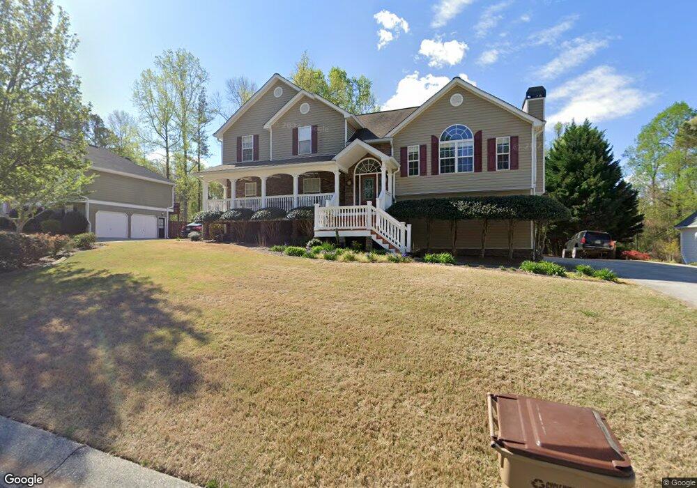
220 Sable Trace Dr Acworth, GA 30102
Oak Grove NeighborhoodEstimated Value: $421,000 - $454,182
3
Beds
3
Baths
2,308
Sq Ft
$190/Sq Ft
Est. Value
About This Home
This home is located at 220 Sable Trace Dr, Acworth, GA 30102 and is currently estimated at $437,591, approximately $189 per square foot. 220 Sable Trace Dr is a home located in Cherokee County with nearby schools including Oak Grove Elementary School, E. T. Booth Middle School, and Etowah High School.
Ownership History
Date
Name
Owned For
Owner Type
Purchase Details
Closed on
Jun 1, 2001
Sold by
Fowler Roy J
Bought by
Ried Eric C and Ried Tara L
Current Estimated Value
Home Financials for this Owner
Home Financials are based on the most recent Mortgage that was taken out on this home.
Original Mortgage
$174,900
Outstanding Balance
$65,051
Interest Rate
7.14%
Mortgage Type
New Conventional
Estimated Equity
$372,540
Create a Home Valuation Report for This Property
The Home Valuation Report is an in-depth analysis detailing your home's value as well as a comparison with similar homes in the area
Home Values in the Area
Average Home Value in this Area
Purchase History
| Date | Buyer | Sale Price | Title Company |
|---|---|---|---|
| Ried Eric C | $174,900 | -- |
Source: Public Records
Mortgage History
| Date | Status | Borrower | Loan Amount |
|---|---|---|---|
| Open | Ried Eric C | $174,900 |
Source: Public Records
Tax History
| Year | Tax Paid | Tax Assessment Tax Assessment Total Assessment is a certain percentage of the fair market value that is determined by local assessors to be the total taxable value of land and additions on the property. | Land | Improvement |
|---|---|---|---|---|
| 2025 | $3,879 | $166,856 | $34,000 | $132,856 |
| 2024 | $3,922 | $168,176 | $34,000 | $134,176 |
| 2023 | $3,292 | $160,960 | $34,000 | $126,960 |
| 2022 | $3,201 | $134,160 | $32,000 | $102,160 |
| 2021 | $2,905 | $109,920 | $24,000 | $85,920 |
| 2020 | $2,741 | $102,760 | $22,000 | $80,760 |
| 2019 | $2,636 | $98,200 | $22,000 | $76,200 |
| 2018 | $2,418 | $88,280 | $19,200 | $69,080 |
| 2017 | $2,411 | $218,000 | $19,200 | $68,000 |
| 2016 | $2,137 | $189,300 | $19,200 | $56,520 |
| 2015 | $1,916 | $168,700 | $15,200 | $52,280 |
| 2014 | $1,874 | $164,800 | $13,000 | $52,920 |
Source: Public Records
Map
Nearby Homes
- 585 Lee Dr
- 6390 Woodstock Rd
- 1856 W Elmwood Dr
- 5753 Oak Grove Dr
- 204 Queensbury Ct
- 127 Sable Valley Dr
- 307 Queensbury Walk
- 1030 Queensbury Run Unit 1
- 252 Oak Grove Way
- 423 Royal Oak Dr
- 200 Sable Ridge Way
- 422 Royal Oak Dr
- 159 Oak Grove Place
- 1037 Queensbury Run
- 2023 Abbott Landing
- 736 Coventry Cove Way
- 3106 Cambridge Mill St
- 740 Coventry Cove Way
- 744 Coventry Cove Way
- 748 Coventry Cove Way
- 218 Sable Trace Dr
- 222 Sable Trace Dr
- 224 Sable Trace Dr
- 216 Sable Trace Dr
- 209 Sable Trace Dr
- 211 Sable Trace Dr
- 301 Sable Trace Ct Unit 25
- 301 Sable Trace Ct
- 226 Sable Trace Dr
- 214 Sable Trace Dr
- 207 Sable Trace Dr
- 212 Sable Trace Dr
- 300 Sable Trace Pass
- 228 Sable Trace Dr
- 210 Sable Trace Dr
- 215 Sable Trace Dr
- 205 Sable Trace Dr Unit 21
- 205 Sable Trace Dr
- 303 Sable Trace Ct
- 217 Sable Trace Dr
Your Personal Tour Guide
Ask me questions while you tour the home.