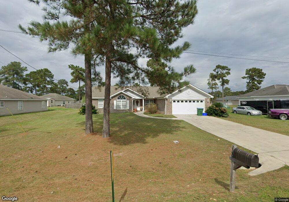
220 Slash Cir Midway, FL 32343
Estimated Value: $257,000 - $338,000
3
Beds
2
Baths
1,662
Sq Ft
$172/Sq Ft
Est. Value
About This Home
This home is located at 220 Slash Cir, Midway, FL 32343 and is currently estimated at $285,690, approximately $171 per square foot. 220 Slash Cir is a home located in Gadsden County.
Ownership History
Date
Name
Owned For
Owner Type
Purchase Details
Closed on
Dec 3, 2010
Sold by
Watkins Bernita
Bought by
Harris Janice
Current Estimated Value
Home Financials for this Owner
Home Financials are based on the most recent Mortgage that was taken out on this home.
Original Mortgage
$130,000
Outstanding Balance
$86,091
Interest Rate
4.42%
Mortgage Type
New Conventional
Estimated Equity
$199,599
Purchase Details
Closed on
Dec 28, 2006
Sold by
Golden Green Builders Inc
Bought by
Watkins Bernita
Home Financials for this Owner
Home Financials are based on the most recent Mortgage that was taken out on this home.
Original Mortgage
$75,000
Interest Rate
6.1%
Mortgage Type
Unknown
Create a Home Valuation Report for This Property
The Home Valuation Report is an in-depth analysis detailing your home's value as well as a comparison with similar homes in the area
Home Values in the Area
Average Home Value in this Area
Purchase History
| Date | Buyer | Sale Price | Title Company |
|---|---|---|---|
| Harris Janice | $130,000 | None Available | |
| Watkins Bernita | $165,000 | Attorney |
Source: Public Records
Mortgage History
| Date | Status | Borrower | Loan Amount |
|---|---|---|---|
| Open | Harris Janice | $130,000 | |
| Previous Owner | Watkins Bernita | $75,000 |
Source: Public Records
Tax History
| Year | Tax Paid | Tax Assessment Tax Assessment Total Assessment is a certain percentage of the fair market value that is determined by local assessors to be the total taxable value of land and additions on the property. | Land | Improvement |
|---|---|---|---|---|
| 2025 | $1,837 | $140,535 | -- | -- |
| 2024 | $1,771 | $136,575 | -- | -- |
| 2023 | $1,720 | $132,598 | $0 | $0 |
| 2022 | $1,651 | $128,736 | $0 | $0 |
| 2021 | $1,616 | $124,987 | $0 | $0 |
| 2020 | $1,580 | $123,262 | $0 | $0 |
| 2019 | $1,556 | $120,491 | $0 | $0 |
| 2018 | $1,555 | $118,244 | $0 | $0 |
| 2017 | $1,511 | $115,812 | $0 | $0 |
| 2016 | $1,484 | $113,430 | $0 | $0 |
| 2015 | $1,469 | $112,642 | $0 | $0 |
| 2014 | $1,429 | $111,748 | $0 | $0 |
Source: Public Records
Map
Nearby Homes
- 604 Rustling Pines Blvd
- 6 Slash Ln
- 545 Slash Cir
- 122 Loblolly Cir
- 305 Delores Madison Dr
- 34 Frank Run
- 396 Sand Pine Cir
- 17 Pine Bark Ln
- 25 Pine Bark Ln
- 668 M l King Blvd
- 359 Mae Cato Dr
- 407 Mae Cato Dr
- 31 Stevens Dr
- 0 Central Rd Unit 381525
- 8873 High Bridge Rd
- 8877 High Bridge Rd
- 380 Sumpter Ridge Dr
- 325 Mine Rd
- 00 Blue Star Hwy
- 10 Yvonne Ct
- 200 Slash Cir
- 240 Slash Cir
- 151 Slash Ln
- 133 Slash Ln
- 180 Slash Cir Unit 1
- 180 Slash Cir
- 169 Slash Ln
- 280 Slash Cir
- 115 Slash Ln
- 205 Slash Cir
- 221 Slash Cir Unit ~
- 221 Slash Cir
- 235 Slash Cir
- 185 Slash Cir
- 187 Slash Ln
- 275 Slash Cir
- 160 Slash Cir Unit 1
- 160 Slash Cir
- 300 Slash Cir
- 99 Slash Ln Unit 1
Your Personal Tour Guide
Ask me questions while you tour the home.