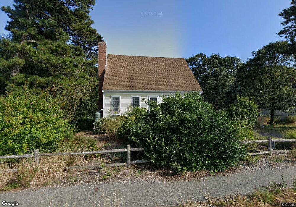
220 Swan River Rd West Dennis, MA 02670
West Dennis NeighborhoodEstimated Value: $660,000 - $800,000
3
Beds
2
Baths
1,501
Sq Ft
$478/Sq Ft
Est. Value
About This Home
This home is located at 220 Swan River Rd, West Dennis, MA 02670 and is currently estimated at $717,269, approximately $477 per square foot. 220 Swan River Rd is a home located in Barnstable County with nearby schools including Dennis-Yarmouth Regional High School and St. Pius X. School.
Ownership History
Date
Name
Owned For
Owner Type
Purchase Details
Closed on
May 12, 2004
Sold by
Williams John David and Driscoll Mary A
Bought by
Driscoll Cornelius J and Williams John David
Current Estimated Value
Purchase Details
Closed on
Feb 14, 2003
Sold by
Griswold Kenneth F
Bought by
Williams John David and Driscoll Mary A
Home Financials for this Owner
Home Financials are based on the most recent Mortgage that was taken out on this home.
Original Mortgage
$284,800
Interest Rate
5.88%
Mortgage Type
Purchase Money Mortgage
Purchase Details
Closed on
Jul 28, 1995
Sold by
Oconnor James J and Oconnor Joan M
Bought by
Griswold Kenneth P
Home Financials for this Owner
Home Financials are based on the most recent Mortgage that was taken out on this home.
Original Mortgage
$127,301
Interest Rate
7.56%
Mortgage Type
Purchase Money Mortgage
Create a Home Valuation Report for This Property
The Home Valuation Report is an in-depth analysis detailing your home's value as well as a comparison with similar homes in the area
Home Values in the Area
Average Home Value in this Area
Purchase History
| Date | Buyer | Sale Price | Title Company |
|---|---|---|---|
| Driscoll Cornelius J | $113,000 | -- | |
| Williams John David | $356,000 | -- | |
| Griswold Kenneth P | $134,000 | -- |
Source: Public Records
Mortgage History
| Date | Status | Borrower | Loan Amount |
|---|---|---|---|
| Previous Owner | Williams John David | $284,800 | |
| Previous Owner | Griswold Kenneth P | $127,301 |
Source: Public Records
Tax History Compared to Growth
Tax History
| Year | Tax Paid | Tax Assessment Tax Assessment Total Assessment is a certain percentage of the fair market value that is determined by local assessors to be the total taxable value of land and additions on the property. | Land | Improvement |
|---|---|---|---|---|
| 2025 | $2,803 | $647,400 | $235,300 | $412,100 |
| 2024 | $2,736 | $623,200 | $226,300 | $396,900 |
| 2023 | $2,669 | $571,500 | $205,700 | $365,800 |
| 2022 | $2,555 | $456,200 | $185,300 | $270,900 |
| 2021 | $8,249 | $399,000 | $181,600 | $217,400 |
| 2020 | $8,105 | $381,600 | $181,600 | $200,000 |
| 2019 | $2,327 | $377,100 | $196,800 | $180,300 |
| 2018 | $7,390 | $357,500 | $187,400 | $170,100 |
| 2017 | $1,924 | $312,900 | $142,800 | $170,100 |
| 2016 | $1,929 | $295,400 | $151,700 | $143,700 |
| 2015 | $1,891 | $295,400 | $151,700 | $143,700 |
| 2014 | $1,846 | $290,700 | $151,700 | $139,000 |
Source: Public Records
Map
Nearby Homes
- 12 Spoonbill Rd
- 71 Main St
- 15 Woodside Park Rd
- 19 Standish Way
- 4 Coffey Ln
- 80 Michaels Ave
- 125 Main St Unit 3
- 26 Center St
- 95 Center St
- 3 Pinefield Ln
- 22 Wixon Rd
- 61 Trotters Ln
- 72 Bassett Ln
- 31 Easy St
- 268 Main St
- 20 Aunt Debbys Rd
- 37 Ocean Dr Unit 2
- 78 Upper County Rd Unit A&B
- 78 Upper County Rd
- 467 Main St
- 216 Swan River Rd
- 226 Swan River Rd
- 19 Pintail Rd
- 2 Teal Cir
- 212 Swan River Rd
- 230 Swan River Rd
- 230 Swan River Rd Unit A-B-C
- 233 Swan River Rd
- 13 Labrador Rd
- 35 Spoonbill Rd
- 213 Swan River Rd
- 74 Teal Cir
- 208 Swan River Rd
- 15 Spoonbill Rd
- 239 Swan River Rd
- 70 Teal Cir
- 9 Labrador Rd
- 5 Spoonbill Rd
- 209 Swan River Rd