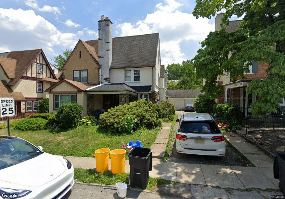
220 Upland Rd Merion Station, PA 19066
Estimated Value: $548,000 - $653,000
4
Beds
3
Baths
1,804
Sq Ft
$326/Sq Ft
Est. Value
About This Home
This home is located at 220 Upland Rd, Merion Station, PA 19066 and is currently estimated at $588,736, approximately $326 per square foot. 220 Upland Rd is a home located in Montgomery County with nearby schools including Merion Elementary School, Bala-Cynwyd Middle School, and Lower Merion High School.
Ownership History
Date
Name
Owned For
Owner Type
Purchase Details
Closed on
Oct 29, 2020
Sold by
Delancey Carol A and Lichmira Waldemar A
Bought by
Friedman Eliot B and Haor Friedman Israela
Current Estimated Value
Home Financials for this Owner
Home Financials are based on the most recent Mortgage that was taken out on this home.
Original Mortgage
$292,500
Outstanding Balance
$260,283
Interest Rate
2.8%
Mortgage Type
New Conventional
Estimated Equity
$328,453
Purchase Details
Closed on
Nov 18, 2005
Sold by
Delancey Carol A and Lichmira Waldemar A
Bought by
Delancey Carol A and Lichmira Waldemar A
Create a Home Valuation Report for This Property
The Home Valuation Report is an in-depth analysis detailing your home's value as well as a comparison with similar homes in the area
Home Values in the Area
Average Home Value in this Area
Purchase History
| Date | Buyer | Sale Price | Title Company |
|---|---|---|---|
| Friedman Eliot B | $390,000 | None Available | |
| Delancey Carol A | -- | -- |
Source: Public Records
Mortgage History
| Date | Status | Borrower | Loan Amount |
|---|---|---|---|
| Open | Friedman Eliot B | $292,500 |
Source: Public Records
Tax History Compared to Growth
Tax History
| Year | Tax Paid | Tax Assessment Tax Assessment Total Assessment is a certain percentage of the fair market value that is determined by local assessors to be the total taxable value of land and additions on the property. | Land | Improvement |
|---|---|---|---|---|
| 2025 | $6,039 | $144,620 | $27,950 | $116,670 |
| 2024 | $6,039 | $144,620 | $27,950 | $116,670 |
| 2023 | $5,788 | $144,620 | $27,950 | $116,670 |
| 2022 | $5,681 | $144,620 | $27,950 | $116,670 |
| 2021 | $5,551 | $144,620 | $27,950 | $116,670 |
| 2020 | $5,416 | $144,620 | $27,950 | $116,670 |
| 2019 | $5,320 | $144,620 | $27,950 | $116,670 |
| 2018 | $5,319 | $144,620 | $27,950 | $116,670 |
| 2017 | $5,125 | $144,620 | $27,950 | $116,670 |
| 2016 | $5,068 | $144,620 | $27,950 | $116,670 |
| 2015 | $4,726 | $144,620 | $27,950 | $116,670 |
| 2014 | $4,726 | $144,620 | $27,950 | $116,670 |
Source: Public Records
Map
Nearby Homes
- 212 Upland Rd
- 251 Stoneway Ln
- 213 Stoneway Ln Unit 90
- 204 Stoneway Ln
- 40 Old Lancaster Rd Unit 605
- 40 Old Lancaster Rd Unit 215
- 40 Old Lancaster Rd Unit 205
- 40 Old Lancaster Rd Unit 302
- 160 Edgehill Rd
- 162 Union Ave
- 5221 Church Rd
- 2405 N 57th St
- 127 Birch Ave
- 5725 Drexel Rd
- 415 City Ave Unit I-2
- 415 City Ave Unit H2
- 5710 Drexel Rd
- 5608 Woodbine Ave
- 211 Bryn Mawr Ave
- 5613 Woodcrest Ave