Estimated Value: $726,000 - $881,000
4
Beds
2
Baths
1,788
Sq Ft
$435/Sq Ft
Est. Value
About This Home
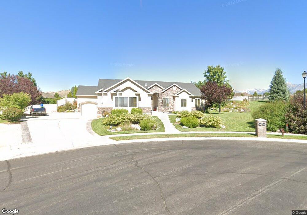
This home is located at 220 W 2125 N, Lehi, UT 84043 and is currently estimated at $777,376, approximately $434 per square foot. 220 W 2125 N is a home located in Utah County with nearby schools including Eaglecrest Elementary School, Lehi Junior High School, and Skyridge High School.
Ownership History
Date
Name
Owned For
Owner Type
Purchase Details
Closed on
Nov 17, 2022
Sold by
Bridenstine David A
Bought by
D & M Bridenstine Family Trust
Current Estimated Value
Purchase Details
Closed on
Dec 21, 2020
Sold by
Bridenstine David A and Bridenstine Melinda M
Bought by
Bridenstine David A and Bridenstine Melinda M
Home Financials for this Owner
Home Financials are based on the most recent Mortgage that was taken out on this home.
Original Mortgage
$270,000
Interest Rate
2.7%
Mortgage Type
New Conventional
Purchase Details
Closed on
Dec 16, 2020
Sold by
Brown Scott
Bought by
Bridenstine David A and Bridenstine Melinda M
Home Financials for this Owner
Home Financials are based on the most recent Mortgage that was taken out on this home.
Original Mortgage
$270,000
Interest Rate
2.7%
Mortgage Type
New Conventional
Purchase Details
Closed on
Nov 1, 2019
Sold by
Brown Scott Robert and Brown Stephanie Fawn
Bought by
Brown Scott
Home Financials for this Owner
Home Financials are based on the most recent Mortgage that was taken out on this home.
Original Mortgage
$432,000
Interest Rate
3.6%
Mortgage Type
New Conventional
Purchase Details
Closed on
Sep 30, 2016
Sold by
Brown Scott R and Brown Stephen F
Bought by
Brown Scott Robert and Brown Stephanie Fawn
Purchase Details
Closed on
Oct 24, 2007
Sold by
Haws Ralph Kelly and Haws Connie Dee T
Bought by
Haws R Kelly and Haws Connie Dee T
Home Financials for this Owner
Home Financials are based on the most recent Mortgage that was taken out on this home.
Original Mortgage
$200,000
Interest Rate
6.27%
Mortgage Type
New Conventional
Purchase Details
Closed on
Aug 15, 2006
Sold by
Brown Scott R
Bought by
Brown Scott R and Brown Stephanie F
Home Financials for this Owner
Home Financials are based on the most recent Mortgage that was taken out on this home.
Original Mortgage
$280,000
Interest Rate
6.76%
Mortgage Type
Purchase Money Mortgage
Purchase Details
Closed on
Jan 9, 2004
Sold by
Haws Connie Ann and Haws Ralph J
Bought by
Brown Scott R and Brown Stephanie F
Create a Home Valuation Report for This Property
The Home Valuation Report is an in-depth analysis detailing your home's value as well as a comparison with similar homes in the area
Home Values in the Area
Average Home Value in this Area
Purchase History
| Date | Buyer | Sale Price | Title Company |
|---|---|---|---|
| D & M Bridenstine Family Trust | -- | Invictus Title | |
| Bridenstine David A | -- | Provo Land Title Company | |
| Bridenstine David A | -- | Provo Land Title Company | |
| Brown Scott | -- | Provo Land Title Co | |
| Brown Scott Robert | -- | None Available | |
| Haws R Kelly | -- | Backman | |
| Brown Scott R | -- | Deer Creek Title Insurance | |
| Brown Scott R | -- | Deer Creek Title Insurance | |
| Brown Scott R | -- | Backman Stewart Title Servi |
Source: Public Records
Mortgage History
| Date | Status | Borrower | Loan Amount |
|---|---|---|---|
| Previous Owner | Bridenstine David A | $270,000 | |
| Previous Owner | Brown Scott | $432,000 | |
| Previous Owner | Haws R Kelly | $200,000 | |
| Previous Owner | Brown Scott R | $280,000 | |
| Previous Owner | Brown Scott R | $35,000 |
Source: Public Records
Tax History Compared to Growth
Tax History
| Year | Tax Paid | Tax Assessment Tax Assessment Total Assessment is a certain percentage of the fair market value that is determined by local assessors to be the total taxable value of land and additions on the property. | Land | Improvement |
|---|---|---|---|---|
| 2025 | $3,035 | $404,965 | $301,700 | $434,600 |
| 2024 | $3,035 | $355,135 | $0 | $0 |
| 2023 | $2,755 | $350,020 | $0 | $0 |
| 2022 | $2,777 | $342,100 | $0 | $0 |
| 2021 | $2,437 | $453,800 | $174,600 | $279,200 |
| 2020 | $2,296 | $422,600 | $161,700 | $260,900 |
| 2019 | $2,208 | $422,600 | $161,700 | $260,900 |
| 2018 | $2,021 | $365,700 | $129,300 | $236,400 |
| 2017 | $2,067 | $198,825 | $0 | $0 |
| 2016 | $2,089 | $186,395 | $0 | $0 |
| 2015 | $2,106 | $178,365 | $0 | $0 |
| 2014 | $1,884 | $158,675 | $0 | $0 |
Source: Public Records
Map
Nearby Homes
- 497 W 2200 N
- 497 W 2280 N
- 1755 N 250 W
- 595 W 2200 N
- 192 E 2200 N
- 4333 N Baiken Ridge Dr Unit 1020
- 2287 N 750 W
- 2539 N 300 E
- 537 W Sandhill Dr
- 1817 W Bad Rock Cir
- 668 W Sandhill Dr
- 804 W 2700 N
- 1011 W Mountain Way Unit 316
- 2687 N 900 W
- 1329 N 100 E Unit 21
- 902 W 1500 N
- 1295 N 190 E
- 2778 N 930 W
- 3105 N 250 W
- 2752 N 600 E
- 212 W 2125 N
- 131 W 2200 N
- 236 W 2125 N
- 171 W 2200 N
- 2139 N Banbury Ct Unit 2
- 2139 N Banbury Ct
- 217 W 2125 N
- 231 W 2125 N
- 231 W 2125 N Unit 9
- 2173 N Banbury Ct Unit 4
- 256 W 2125 N
- 256 W 2125 N Unit 4
- 256 W 2125 N Unit BRCK
- 256 W 2125 N Unit ADD
- 256 W 2125 N Unit WASH
- 256 W 2125 N Unit KEN
- 256 W 2125 N Unit HANN
- 256 W 2125 N Unit LAND
- 256 W 2125 N Unit ASH
- 2117 N Banbury Ct Unit 1