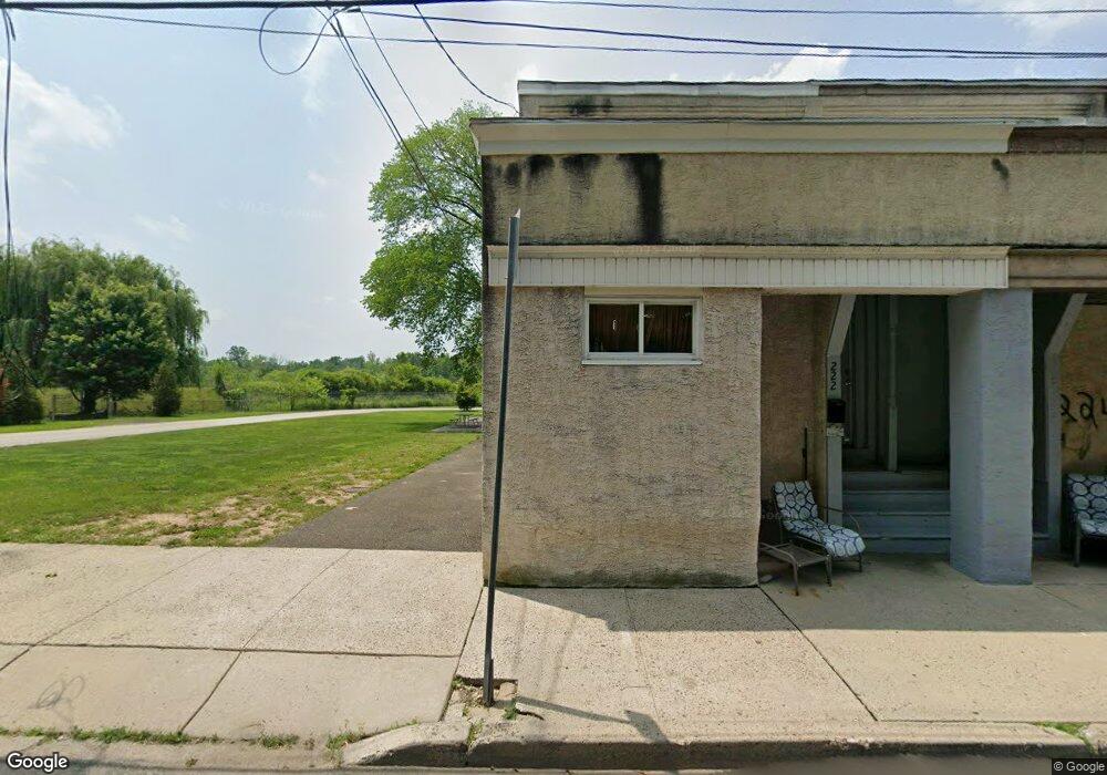
220 W Maple St Ambler, PA 19002
Estimated Value: $307,085
4
Beds
1
Bath
1,344
Sq Ft
$228/Sq Ft
Est. Value
About This Home
This home is located at 220 W Maple St, Ambler, PA 19002 and is currently estimated at $307,085, approximately $228 per square foot. 220 W Maple St is a home located in Montgomery County with nearby schools including Fort Washington Elementary School, Sandy Run Middle School, and Upper Dublin High School.
Ownership History
Date
Name
Owned For
Owner Type
Purchase Details
Closed on
Jun 5, 2020
Sold by
Cashbuy Alliance Llc
Bought by
Whitpain Township
Current Estimated Value
Purchase Details
Closed on
Nov 8, 2010
Sold by
American Heritage Fcu
Bought by
Cashbuy Alliance Llc
Home Financials for this Owner
Home Financials are based on the most recent Mortgage that was taken out on this home.
Original Mortgage
$50,000
Interest Rate
4.3%
Purchase Details
Closed on
Aug 10, 2009
Sold by
Obrien Megan A and Melissen Paul W
Bought by
American Heritage Federal Credit Union
Create a Home Valuation Report for This Property
The Home Valuation Report is an in-depth analysis detailing your home's value as well as a comparison with similar homes in the area
Home Values in the Area
Average Home Value in this Area
Purchase History
| Date | Buyer | Sale Price | Title Company |
|---|---|---|---|
| Whitpain Township | $200,000 | None Available | |
| Cashbuy Alliance Llc | $37,000 | None Available | |
| American Heritage Federal Credit Union | $75,000 | None Available |
Source: Public Records
Mortgage History
| Date | Status | Borrower | Loan Amount |
|---|---|---|---|
| Previous Owner | Cashbuy Alliance Llc | $50,000 |
Source: Public Records
Tax History Compared to Growth
Tax History
| Year | Tax Paid | Tax Assessment Tax Assessment Total Assessment is a certain percentage of the fair market value that is determined by local assessors to be the total taxable value of land and additions on the property. | Land | Improvement |
|---|---|---|---|---|
| 2025 | -- | $8,220 | -- | -- |
| 2024 | -- | $8,220 | -- | -- |
| 2023 | $0 | $8,220 | $0 | $0 |
| 2022 | $0 | $8,220 | $0 | $0 |
| 2021 | $233 | $8,220 | $0 | $0 |
| 2020 | $1,298 | $46,980 | $8,220 | $38,760 |
| 2019 | $1,272 | $46,980 | $8,220 | $38,760 |
| 2018 | $1,272 | $46,980 | $8,220 | $38,760 |
| 2017 | $1,214 | $46,980 | $8,220 | $38,760 |
| 2016 | $1,196 | $46,980 | $8,220 | $38,760 |
| 2015 | $1,140 | $46,980 | $8,220 | $38,760 |
| 2014 | $1,140 | $46,980 | $8,220 | $38,760 |
Source: Public Records
Map
Nearby Homes
- 280 N Main St
- 25 N Ridge Ave Unit A
- 25 N Ridge Ave Unit B
- 157 Edgewood Dr
- 221 Belmont Ave
- 414 Brookside Ave
- 210 S Chestnut St
- 19 Orange Ave
- 409 W Butler Pike
- 294 Batleson Rd
- 232 Southern Ave
- 330 Highland Ave
- 459 Edgewood Dr
- 401 Highland Ave
- 0 Renfrew Ave
- 528 Argyle Ave
- 7292 Mill Spring Dr
- 0 Mill Spring Dr
- 100 Ambler Rd
- 609 Ardross Ave
- 224 W Maple St
- 222 W Maple St
- 218 W Maple St
- 226 W Maple St
- 228 W Maple St
- 216 W Maple St Unit 5
- 250 S Maple St
- 262 W Maple St
- 264 W Maple St
- 266 W Maple St
- 268 W Maple St
- 270 W Maple St
- 279 W Maple St
- 210 N Main St Unit . 1
- 210 N Main St
- 272 W Maple St Unit B (REAR)
- 272 W Maple St
- 3 Reiffs Mill Rd
- 274 W Maple St
- 276 W Maple St