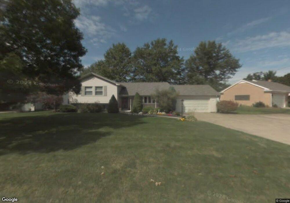
220 Westgate Dr Mansfield, OH 44906
Estimated Value: $225,151 - $266,000
3
Beds
3
Baths
2,232
Sq Ft
$110/Sq Ft
Est. Value
About This Home
This home is located at 220 Westgate Dr, Mansfield, OH 44906 and is currently estimated at $245,288, approximately $109 per square foot. 220 Westgate Dr is a home located in Richland County with nearby schools including Mansfield Elective Academy, Interactive Media & Construction (IMAC) Academy, and Cypress High School.
Ownership History
Date
Name
Owned For
Owner Type
Purchase Details
Closed on
Mar 3, 1998
Sold by
Harris James E
Bought by
Rader Jody A
Current Estimated Value
Home Financials for this Owner
Home Financials are based on the most recent Mortgage that was taken out on this home.
Original Mortgage
$78,000
Outstanding Balance
$14,181
Interest Rate
6.95%
Mortgage Type
New Conventional
Estimated Equity
$231,107
Create a Home Valuation Report for This Property
The Home Valuation Report is an in-depth analysis detailing your home's value as well as a comparison with similar homes in the area
Home Values in the Area
Average Home Value in this Area
Purchase History
| Date | Buyer | Sale Price | Title Company |
|---|---|---|---|
| Rader Jody A | $113,000 | -- |
Source: Public Records
Mortgage History
| Date | Status | Borrower | Loan Amount |
|---|---|---|---|
| Open | Rader Jody A | $78,000 |
Source: Public Records
Tax History
| Year | Tax Paid | Tax Assessment Tax Assessment Total Assessment is a certain percentage of the fair market value that is determined by local assessors to be the total taxable value of land and additions on the property. | Land | Improvement |
|---|---|---|---|---|
| 2024 | $2,455 | $53,640 | $8,230 | $45,410 |
| 2023 | $2,512 | $53,640 | $8,230 | $45,410 |
| 2022 | $2,237 | $40,030 | $7,060 | $32,970 |
| 2021 | $2,252 | $40,030 | $7,060 | $32,970 |
| 2020 | $2,303 | $40,030 | $7,060 | $32,970 |
| 2019 | $2,552 | $40,030 | $7,060 | $32,970 |
| 2018 | $2,517 | $40,030 | $7,060 | $32,970 |
| 2017 | $2,450 | $40,030 | $7,060 | $32,970 |
| 2016 | $2,742 | $43,450 | $7,450 | $36,000 |
| 2015 | $2,619 | $43,450 | $7,450 | $36,000 |
| 2014 | $2,585 | $43,450 | $7,450 | $36,000 |
| 2012 | $985 | $43,450 | $7,840 | $35,610 |
Source: Public Records
Map
Nearby Homes
- 216 S Trimble Rd Unit 218
- 232 S Trimble Rd Unit 234
- 244 S Trimble Rd Unit 246
- 988 Kentland Dr
- 960 W Linden Cir
- 76 Harvard Ave
- 356 S Linden Rd
- 143 Fairlawn Ave
- 135 Fairlawn Ave
- 1157 Deer Run Rd
- 129 Fairlawn Ave
- 679 Coleman Rd
- 143 Buckeye Ave
- 0 Bally Row Unit Lot 22930 223011207
- 0 Bally Row Unit Lot 22929 223011206
- 0 Bally Row Unit Lot 22940 223011208
- 189 Westwood Ave
- 116 Stewart Ave S
- 616 Cline Ave
- 0 W Fourth St - Trimble Lenox
- 232 Westgate Dr
- 1069 Grasmere Cir
- 242 Westgate Dr
- 1071 Grasmere Cir
- 1043 Maumee Ave
- 1055 Maumee Ave
- 233 Westgate Dr
- 215 Westgate Dr
- 219 Westgate Dr
- 209 Westgate Dr
- 225 Westgate Dr
- 1065 Grasmere Cir
- 1065 Grasmere Ave
- 241 Westgate Dr
- 1025 Maumee Ave
- 250 Westgate Dr
- 1073 Grasmere Cir
- 249 Westgate Dr
- 1040 Maumee Ave
- 1015 Maumee Ave
Your Personal Tour Guide
Ask me questions while you tour the home.