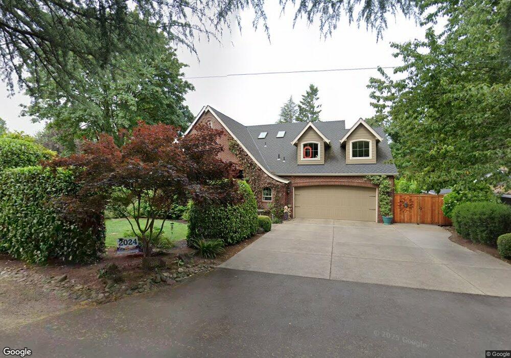
2200 Crest Dr Lake Oswego, OR 97034
Palisades NeighborhoodEstimated Value: $1,274,000 - $1,831,000
4
Beds
4
Baths
3,402
Sq Ft
$471/Sq Ft
Est. Value
About This Home
This home is located at 2200 Crest Dr, Lake Oswego, OR 97034 and is currently estimated at $1,603,396, approximately $471 per square foot. 2200 Crest Dr is a home located in Clackamas County with nearby schools including Westridge Elementary School, Lakeridge Middle School, and Lakeridge High School.
Ownership History
Date
Name
Owned For
Owner Type
Purchase Details
Closed on
Aug 17, 2011
Sold by
Bakouros Kristen Sue
Bought by
Francis Martin and Francis Bridgett
Current Estimated Value
Home Financials for this Owner
Home Financials are based on the most recent Mortgage that was taken out on this home.
Original Mortgage
$300,000
Interest Rate
4.53%
Mortgage Type
Purchase Money Mortgage
Create a Home Valuation Report for This Property
The Home Valuation Report is an in-depth analysis detailing your home's value as well as a comparison with similar homes in the area
Home Values in the Area
Average Home Value in this Area
Purchase History
| Date | Buyer | Sale Price | Title Company |
|---|---|---|---|
| Francis Martin | $238,000 | Wfg Title |
Source: Public Records
Mortgage History
| Date | Status | Borrower | Loan Amount |
|---|---|---|---|
| Closed | Taliesin Homes Nw Llc | $225,000 | |
| Open | Francis Martin | $800,000 | |
| Closed | Francis Martin | $510,400 | |
| Closed | Francis Martin | $250,000 | |
| Closed | Francis Martin | $286,000 | |
| Closed | Francis Martin | $300,000 |
Source: Public Records
Tax History Compared to Growth
Tax History
| Year | Tax Paid | Tax Assessment Tax Assessment Total Assessment is a certain percentage of the fair market value that is determined by local assessors to be the total taxable value of land and additions on the property. | Land | Improvement |
|---|---|---|---|---|
| 2024 | $14,621 | $759,406 | -- | -- |
| 2023 | $14,621 | $737,288 | $0 | $0 |
| 2022 | $13,770 | $715,814 | $0 | $0 |
| 2021 | $12,718 | $694,966 | $0 | $0 |
| 2020 | $12,399 | $674,725 | $0 | $0 |
| 2019 | $12,094 | $655,073 | $0 | $0 |
| 2018 | $11,501 | $635,993 | $0 | $0 |
| 2017 | $11,097 | $617,469 | $0 | $0 |
| 2016 | $10,103 | $599,484 | $0 | $0 |
| 2015 | $9,761 | $582,023 | $0 | $0 |
| 2014 | $9,634 | $565,071 | $0 | $0 |
Source: Public Records
Map
Nearby Homes
- 2306 Mayors Ln
- 18280 Delenka Ln
- 1799 Atherton Dr
- 17958 Saint Clair Dr
- 17808 Hillside Way
- 2651 Lookout Ct
- 1849 Cloverleaf Rd
- 2550 Dellwood Dr
- 17720 Westview Dr
- 17677 Westview Dr
- 17349 Banyan Ln
- 2627 Park Rd
- 2917 Westview Cir
- 1951 Greentree Rd
- 19375 SW Eastside Rd
- 17422 Blue Heron Rd
- 12 Dover Way
- 17035 Westview Dr
- 16878 Canyon Dr
- 1931 Park Forest Ct
- 2311 Palisades Crest Dr
- 2321 Palisades Crest Dr
- 2105 Ridge Pointe Dr
- 2115 Ridge Pointe Dr
- 2316 Palisades Crest Dr
- 2135 Ridge Pointe Dr
- 2125 Ridge Pointe Dr
- 2095 Ridge Pointe Dr
- 2075 Ridge Pointe Dr
- 2085 Ridge Pointe Dr
- 2341 Palisades Crest Dr
- 2080 Ridge Pointe Dr
- 17951 Meadowlark Ln
- 2090 Ridge Pointe Dr
- 2100 Ridge Pointe Dr
- 17981 Meadowlark Ln
- 2065 Ridge Pointe Dr
- 2145 Ridge Pointe Dr
- 2110 Ridge Pointe Dr
- 2155 Ridge Pointe Dr