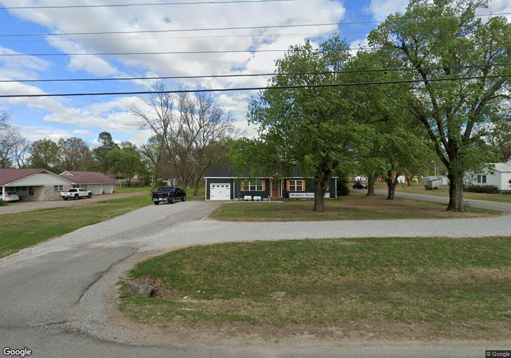
2200 Highway 367 N Newport, AR 72112
Estimated Value: $75,739
--
Bed
1
Bath
1,052
Sq Ft
$72/Sq Ft
Est. Value
About This Home
This home is located at 2200 Highway 367 N, Newport, AR 72112 and is currently priced at $75,739, approximately $71 per square foot. 2200 Highway 367 N is a home located in Jackson County with nearby schools including Newport Elementary School and Newport High School.
Ownership History
Date
Name
Owned For
Owner Type
Purchase Details
Closed on
Mar 17, 2023
Sold by
Fisher Freddy
Bought by
Stroud Jeffrey Oneal and Stroud Alycia
Current Estimated Value
Home Financials for this Owner
Home Financials are based on the most recent Mortgage that was taken out on this home.
Original Mortgage
$147,050
Outstanding Balance
$136,907
Interest Rate
6.12%
Mortgage Type
New Conventional
Purchase Details
Closed on
Nov 1, 2022
Sold by
Edward Allen and Edwards Alyson
Bought by
Aa Edwards Holdings Llc
Purchase Details
Closed on
Jun 9, 2022
Sold by
Ann Raibley Melissa
Bought by
Fisher Freddy
Purchase Details
Closed on
Oct 2, 1997
Bought by
Fisher Lois
Purchase Details
Closed on
Jan 1, 1987
Bought by
Twyford Robert and Twyford Marcilla H
Purchase Details
Closed on
Oct 1, 1985
Bought by
Holbrook Holbrook D and Holbrook Pearl
Create a Home Valuation Report for This Property
The Home Valuation Report is an in-depth analysis detailing your home's value as well as a comparison with similar homes in the area
Home Values in the Area
Average Home Value in this Area
Purchase History
| Date | Buyer | Sale Price | Title Company |
|---|---|---|---|
| Stroud Jeffrey Oneal | -- | Professional Land Title | |
| Aa Edwards Holdings Llc | -- | None Listed On Document | |
| Fisher Freddy | -- | None Listed On Document | |
| Fisher Lois | $151,000 | -- | |
| Twyford Robert | -- | -- | |
| Holbrook Holbrook D | -- | -- |
Source: Public Records
Mortgage History
| Date | Status | Borrower | Loan Amount |
|---|---|---|---|
| Open | Stroud Jeffrey Oneal | $147,050 |
Source: Public Records
Tax History Compared to Growth
Tax History
| Year | Tax Paid | Tax Assessment Tax Assessment Total Assessment is a certain percentage of the fair market value that is determined by local assessors to be the total taxable value of land and additions on the property. | Land | Improvement |
|---|---|---|---|---|
| 2024 | $1,175 | $23,640 | $4,830 | $18,810 |
| 2023 | $393 | $7,560 | $1,800 | $5,760 |
| 2022 | $412 | $7,560 | $1,800 | $5,760 |
| 2021 | $435 | $8,160 | $2,400 | $5,760 |
| 2020 | $435 | $8,160 | $2,400 | $5,760 |
| 2019 | $435 | $8,160 | $2,400 | $5,760 |
| 2018 | $455 | $8,930 | $2,400 | $6,530 |
| 2017 | $455 | $8,930 | $2,400 | $6,530 |
| 2015 | -- | $8,930 | $2,400 | $6,530 |
| 2014 | -- | $8,930 | $2,400 | $6,530 |
| 2013 | -- | $9,070 | $2,000 | $7,070 |
| 2012 | -- | $9,070 | $2,000 | $7,070 |
Source: Public Records
Map
Nearby Homes
- 2412 Linwood St
- 2208 John Cir
- 0 Robinson Rd
- 1212 Graceland Dr
- 1217 Cherokee Dr
- 1620 Brookfield Cir
- 1319 Cindy Ln
- 1303 Cindy Ln
- 2001 S Main St
- 2701 S Main St
- 2708 Robinson St
- 2600 Hollywood St
- 3101 Lax St
- 900 Josephine St
- 1714 Dill St
- 203 Alice Ct
- 1407 Dill St
- 1311 Dill St
- 721 Mclain St
- 1801 Hines St
- 2204 Highway 367 N
- 2122 Highway 367 N
- 2104 Highway 367 N
- 2201 Normandy Dr
- 2109 Normandy Dr
- 2203 Normandy Dr
- 2301 Normandy Dr
- 2105 Normandy Dr
- 2204 Highway 367 N
- 2313 Highway 367 N
- 2600 Mimosa Dr
- 2013 Normandy Dr
- 2604 Mimosa Dr
- 2008 Highway 367 N
- 2608 Mimosa Dr
- 2009 Normandy Dr
- 2200 Normandy Dr
- 2601 Mimosa Dr
- 2701 Park Ave
- 2313 Arkansas 367