Estimated Value: $370,000 - $411,813
4
Beds
2
Baths
2,160
Sq Ft
$181/Sq Ft
Est. Value
About This Home
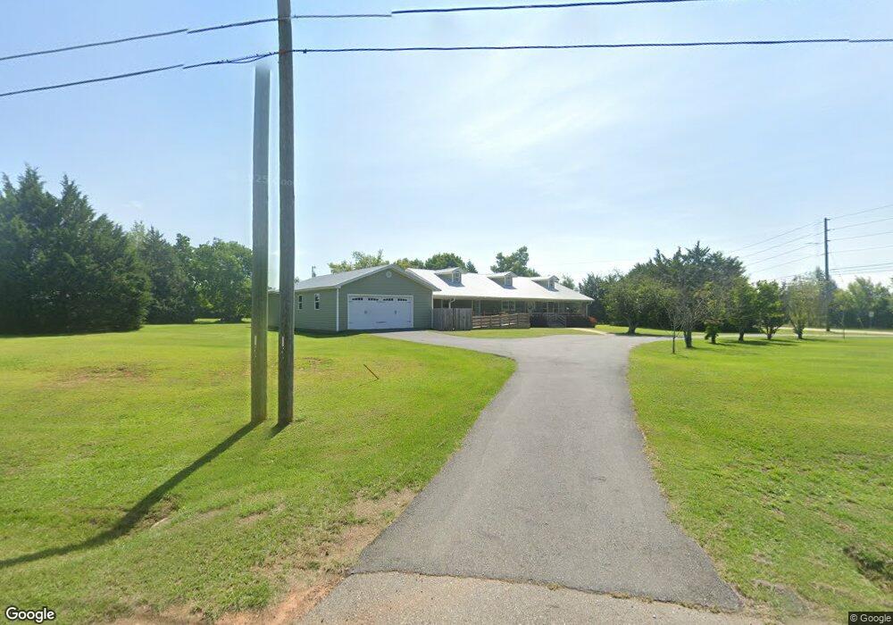
This home is located at 2200 Us Highway 41 N, Perry, GA 31069 and is currently estimated at $390,953, approximately $180 per square foot. 2200 Us Highway 41 N is a home located in Houston County with nearby schools including Langston Road Elementary School, Mossy Creek Middle School, and Perry High School.
Ownership History
Date
Name
Owned For
Owner Type
Purchase Details
Closed on
Oct 5, 2020
Sold by
Pearce Shawn and Pearce Jamie
Bought by
Strout Zach Parker and Strout Brittany Nicole
Current Estimated Value
Home Financials for this Owner
Home Financials are based on the most recent Mortgage that was taken out on this home.
Original Mortgage
$287,850
Outstanding Balance
$256,027
Interest Rate
2.9%
Mortgage Type
New Conventional
Estimated Equity
$134,926
Purchase Details
Closed on
Aug 31, 2018
Sold by
Moss Mobel D
Bought by
Pearce Shawn and Pearce Jamie
Home Financials for this Owner
Home Financials are based on the most recent Mortgage that was taken out on this home.
Original Mortgage
$56,000
Interest Rate
4.6%
Mortgage Type
New Conventional
Create a Home Valuation Report for This Property
The Home Valuation Report is an in-depth analysis detailing your home's value as well as a comparison with similar homes in the area
Home Values in the Area
Average Home Value in this Area
Purchase History
| Date | Buyer | Sale Price | Title Company |
|---|---|---|---|
| Strout Zach Parker | $303,000 | None Available | |
| Pearce Shawn | $70,000 | None Available |
Source: Public Records
Mortgage History
| Date | Status | Borrower | Loan Amount |
|---|---|---|---|
| Open | Strout Zach Parker | $287,850 | |
| Previous Owner | Pearce Shawn | $56,000 |
Source: Public Records
Tax History Compared to Growth
Tax History
| Year | Tax Paid | Tax Assessment Tax Assessment Total Assessment is a certain percentage of the fair market value that is determined by local assessors to be the total taxable value of land and additions on the property. | Land | Improvement |
|---|---|---|---|---|
| 2024 | $3,318 | $140,720 | $30,320 | $110,400 |
| 2023 | $3,102 | $130,320 | $27,600 | $102,720 |
| 2022 | $3,063 | $128,720 | $34,480 | $94,240 |
| 2021 | $2,770 | $114,000 | $20,200 | $93,800 |
| 2020 | $1,175 | $48,120 | $17,720 | $30,400 |
| 2019 | $648 | $26,560 | $17,720 | $8,840 |
| 2018 | $1,281 | $54,480 | $17,720 | $36,760 |
| 2017 | $1,321 | $56,080 | $17,720 | $38,360 |
| 2016 | $1,323 | $56,080 | $17,720 | $38,360 |
Source: Public Records
Map
Nearby Homes
- 0 Hwy 41 & Langston Rd Unit M170042
- 0 Langston Rd Unit 16828609
- 149 MacK Thompson Road Common
- 118 Bramblewood Way
- 128 Bramblewood Ln
- 124 Bramblewood Ln
- 2111 N Us Hwy 41
- 0 MacK Thompson Rd Unit 253661
- 103 Breakwater Way
- 107 Breakwater Way
- 150 MacK Thompson Rd
- 111 Breakwater Way
- 210 Overton Dr
- 302 Brampton Way
- 220 Overton Dr
- Savannah Plan at Bankstone Landing
- Newport Plan at Bankstone Landing
- Delaware Plan at Bankstone Landing
- 219 Overton Dr
- 309 E River Cane Run
- 479 Langston Rd
- 0 Highway 41 and Langston Rd Unit 7027097
- 2203 U S 41
- 477 Langston Rd
- 0 Hwy 41 & Langston Road Hwy Unit 141391
- 2208 Us Highway 41 N
- 0 Langston Rd Unit 51946
- 0 Langston Rd Unit 98024
- 0 Langston Rd Unit M141357
- 0 Langston Rd Unit M144254
- 0 Langston Rd Unit M141296
- 0 Langston Rd Unit 119021
- 0 Langston Rd
- 2210 Us Highway 41 N
- 2140 N Hwy
- 471 Langston Rd
- 459 Langston Rd
- 2212 Us Highway 41 N
- 2140 Us Highway 41 N
- 2214 Us Highway 41 N