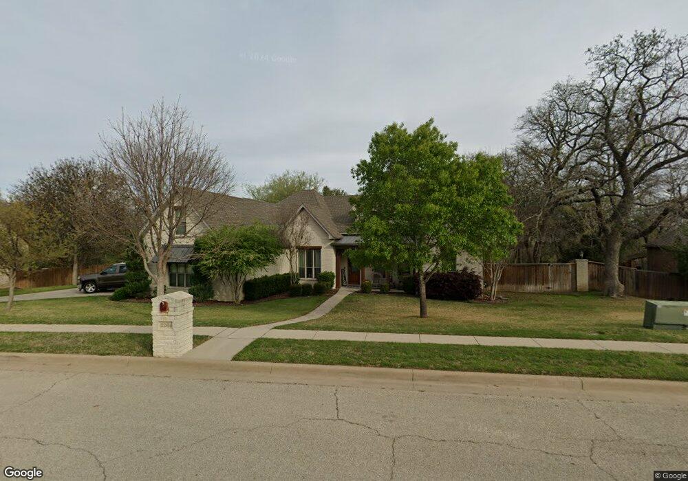
2201 Clear Creek Dr Weatherford, TX 76087
Estimated Value: $469,384 - $554,000
3
Beds
3
Baths
2,573
Sq Ft
$196/Sq Ft
Est. Value
About This Home
This home is located at 2201 Clear Creek Dr, Weatherford, TX 76087 and is currently estimated at $503,846, approximately $195 per square foot. 2201 Clear Creek Dr is a home located in Parker County with nearby schools including Austin Elementary School, Hall Middle School, and Weatherford High School.
Ownership History
Date
Name
Owned For
Owner Type
Purchase Details
Closed on
Oct 27, 2014
Sold by
Miller Thomas Ryan and Miller Melissa
Bought by
Thomas Robert Dean and Clare Denise Dean R
Current Estimated Value
Purchase Details
Closed on
May 26, 2010
Sold by
Miller Thomas C and Miller Vivian L
Bought by
Miller Thomas Ryan
Purchase Details
Closed on
Jul 18, 2008
Sold by
Weatherstone Homes Inc
Bought by
Miller Thomas Ryan and Miller Thomas C
Home Financials for this Owner
Home Financials are based on the most recent Mortgage that was taken out on this home.
Original Mortgage
$196,000
Interest Rate
6.36%
Mortgage Type
Purchase Money Mortgage
Purchase Details
Closed on
Jul 2, 2008
Sold by
Wcpi Ltd
Bought by
Weatherstone Homes Inc
Home Financials for this Owner
Home Financials are based on the most recent Mortgage that was taken out on this home.
Original Mortgage
$196,000
Interest Rate
6.36%
Mortgage Type
Purchase Money Mortgage
Create a Home Valuation Report for This Property
The Home Valuation Report is an in-depth analysis detailing your home's value as well as a comparison with similar homes in the area
Home Values in the Area
Average Home Value in this Area
Purchase History
| Date | Buyer | Sale Price | Title Company |
|---|---|---|---|
| Thomas Robert Dean | -- | Capital Title | |
| Miller Thomas Ryan | -- | None Available | |
| Miller Thomas Ryan | -- | None Available | |
| Weatherstone Homes Inc | -- | Providence Title Company |
Source: Public Records
Mortgage History
| Date | Status | Borrower | Loan Amount |
|---|---|---|---|
| Previous Owner | Miller Thomas Ryan | $196,000 |
Source: Public Records
Tax History Compared to Growth
Tax History
| Year | Tax Paid | Tax Assessment Tax Assessment Total Assessment is a certain percentage of the fair market value that is determined by local assessors to be the total taxable value of land and additions on the property. | Land | Improvement |
|---|---|---|---|---|
| 2025 | $6,049 | $470,920 | $69,000 | $401,920 |
| 2024 | $6,049 | $433,829 | -- | -- |
| 2023 | $6,049 | $394,390 | $0 | $0 |
| 2022 | $7,953 | $358,540 | $40,000 | $318,540 |
| 2021 | $8,610 | $358,540 | $40,000 | $318,540 |
| 2020 | $7,883 | $326,260 | $40,000 | $286,260 |
| 2019 | $7,973 | $326,260 | $40,000 | $286,260 |
| 2018 | $7,280 | $283,830 | $30,000 | $253,830 |
| 2017 | $7,468 | $283,830 | $30,000 | $253,830 |
| 2016 | $7,140 | $271,360 | $30,000 | $241,360 |
| 2015 | $6,992 | $271,360 | $30,000 | $241,360 |
| 2014 | -- | $239,610 | $30,000 | $209,610 |
Source: Public Records
Map
Nearby Homes
- 2102 Clear Creek Dr
- 2113 Country Brook Dr
- 2020 Maplewood Dr
- 104 Carriage Hill Ct
- 1910 Maplewood Dr
- 1905 Clear Creek Dr
- 2116 Clear Lake Rd
- 2202 Lakeforest Dr
- 2214 Lake Country Dr
- 2218 Lake Country Dr
- 2001 Santa fe Dr
- 344 Clear Lake Ln
- 2904 E Bankhead Hwy
- 128 Black Forest Dr
- 115 Autumn Springs Ct
- 118 Black Forest Dr
- 221 Arapahoe Ridge
- 105 Country Green Ct
- 101 Black Forest Dr
- 1421 Highlake Ln
- 2205 Clear Creek Dr
- 2117 Clear Creek Dr
- 2201 Burning Tree Ct
- 2209 Clear Creek Dr
- 2202 Burning Tree Ct
- 2113 Clear Creek Dr
- 2205 Burning Tree Ct
- 2206 Clear Creek Dr
- 2206 Burning Tree Ct
- 2213 Clear Creek Dr
- 2201 Riverwood Dr
- 2209 Burning Tree Ct
- 2109 Clear Creek Dr
- 2222 Clear Creek Ct
- 2205 Riverwood Dr
- 2210 Burning Tree Ct
- 2217 Clear Creek Ct
- 2217 Clear Creek Ct Unit COURT
- 2226 Clear Creek Ct
- 2226 Clear Creek Ct Unit COURT