Estimated Value: $641,385 - $673,000
4
Beds
3
Baths
3,142
Sq Ft
$208/Sq Ft
Est. Value
About This Home
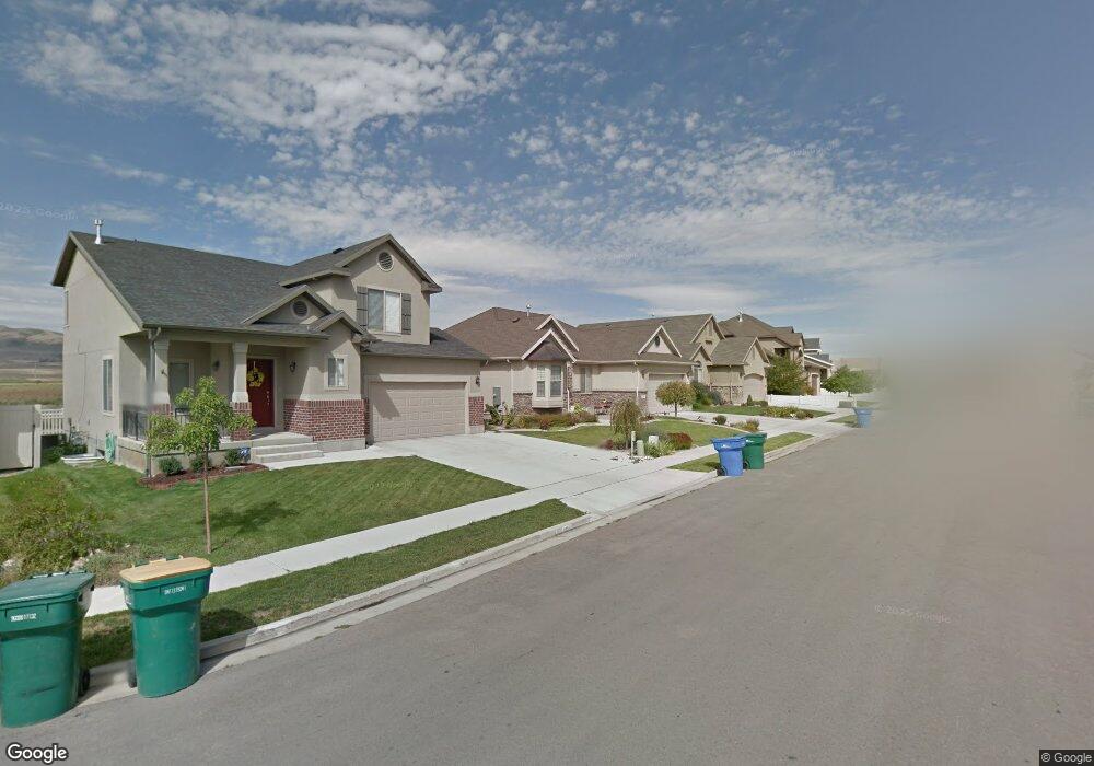
This home is located at 2201 N 2600 W, Lehi, UT 84043 and is currently estimated at $653,096, approximately $207 per square foot. 2201 N 2600 W is a home located in Utah County with nearby schools including Liberty Hills Elementary School, Skyridge High School, and Ascent Academies of Utah - Lehi Campus.
Ownership History
Date
Name
Owned For
Owner Type
Purchase Details
Closed on
Feb 16, 2021
Sold by
Mckinnon Jake David
Bought by
Mckinnon Jake David and Mckinnon Amy L
Current Estimated Value
Home Financials for this Owner
Home Financials are based on the most recent Mortgage that was taken out on this home.
Original Mortgage
$365,000
Outstanding Balance
$326,170
Interest Rate
2.65%
Mortgage Type
New Conventional
Estimated Equity
$326,926
Purchase Details
Closed on
May 5, 2015
Sold by
Parkinson Anthony G and Parkinson Jocelyn M
Bought by
Mckinnon Jake David
Home Financials for this Owner
Home Financials are based on the most recent Mortgage that was taken out on this home.
Original Mortgage
$333,450
Interest Rate
3.64%
Mortgage Type
New Conventional
Purchase Details
Closed on
Feb 6, 2008
Sold by
Parkinson Anthony G
Bought by
Parkinson Anthony G and Parkinson Jocelyn M
Home Financials for this Owner
Home Financials are based on the most recent Mortgage that was taken out on this home.
Original Mortgage
$283,150
Interest Rate
6.17%
Mortgage Type
New Conventional
Purchase Details
Closed on
Aug 31, 2007
Sold by
Parkinson Anthony G
Bought by
Parkinson Anthony G and Parkinson Jocelyn M
Home Financials for this Owner
Home Financials are based on the most recent Mortgage that was taken out on this home.
Original Mortgage
$283,150
Interest Rate
6.67%
Mortgage Type
New Conventional
Purchase Details
Closed on
Apr 6, 2007
Sold by
Parkinson Anthony G
Bought by
Parkinson Anthony G and Parkinson Jocelyn M
Home Financials for this Owner
Home Financials are based on the most recent Mortgage that was taken out on this home.
Original Mortgage
$44,700
Interest Rate
6.31%
Mortgage Type
Stand Alone Second
Purchase Details
Closed on
Mar 7, 2007
Sold by
Ivory Homes Ltd
Bought by
Parkinson Anthony G
Home Financials for this Owner
Home Financials are based on the most recent Mortgage that was taken out on this home.
Original Mortgage
$44,700
Interest Rate
6.31%
Mortgage Type
Stand Alone Second
Create a Home Valuation Report for This Property
The Home Valuation Report is an in-depth analysis detailing your home's value as well as a comparison with similar homes in the area
Home Values in the Area
Average Home Value in this Area
Purchase History
| Date | Buyer | Sale Price | Title Company |
|---|---|---|---|
| Mckinnon Jake David | -- | Inwest Title South Ogden | |
| Mckinnon Jake David | -- | Cottonwood Title Ins Ag | |
| Parkinson Anthony G | -- | Surety Title | |
| Parkinson Anthony G | -- | Surety Title | |
| Parkinson Anthony G | -- | Surety Title | |
| Parkinson Anthony G | -- | Surety Title | |
| Parkinson Anthony G | -- | Accommodation | |
| Parkinson Anthony G | -- | Cottonwood Title | |
| Ivory Homes Ltd | -- | Cottonwood Title |
Source: Public Records
Mortgage History
| Date | Status | Borrower | Loan Amount |
|---|---|---|---|
| Open | Mckinnon Jake David | $365,000 | |
| Closed | Mckinnon Jake David | $333,450 | |
| Previous Owner | Parkinson Anthony G | $283,150 | |
| Previous Owner | Parkinson Anthony G | $283,150 | |
| Previous Owner | Ivory Homes Ltd | $44,700 | |
| Previous Owner | Parkinson Anthony G | $238,450 |
Source: Public Records
Tax History Compared to Growth
Tax History
| Year | Tax Paid | Tax Assessment Tax Assessment Total Assessment is a certain percentage of the fair market value that is determined by local assessors to be the total taxable value of land and additions on the property. | Land | Improvement |
|---|---|---|---|---|
| 2025 | $2,718 | $339,515 | $211,400 | $405,900 |
| 2024 | $2,718 | $318,120 | $0 | $0 |
| 2023 | $2,556 | $324,775 | $0 | $0 |
| 2022 | $2,842 | $350,130 | $0 | $0 |
| 2021 | $2,586 | $481,600 | $122,300 | $359,300 |
| 2020 | $2,439 | $449,000 | $113,200 | $335,800 |
| 2019 | $2,117 | $405,200 | $113,200 | $292,000 |
| 2018 | $1,993 | $360,600 | $106,700 | $253,900 |
| 2017 | $1,970 | $189,475 | $0 | $0 |
| 2016 | $1,835 | $163,735 | $0 | $0 |
| 2015 | $1,702 | $144,155 | $0 | $0 |
| 2014 | $1,650 | $138,985 | $0 | $0 |
Source: Public Records
Map
Nearby Homes
- 2189 N 2600 W
- 2464 W 2250 N
- 2196 N 2350 W
- Huntington Plan at Pioneer Meadows
- Silver Lake Plan at Pioneer Meadows
- Summit Plan at Pioneer Meadows
- Palisade Plan at Pioneer Meadows
- 1968 N 2040 W Unit 40
- 1969 N 2040 St W
- 2013 N 2040 W
- 1990 N 2040 W
- 1990 N 2040 W Unit 41
- 1970 N 2090 St W
- 1854 N 2230 W
- 2419 N 3130 W
- 1842 N 2230 W
- 1870 N 2230 W
- 1870 N 2230 W Unit 23
- 1896 N 2230 W
- 1908 N 2230 W