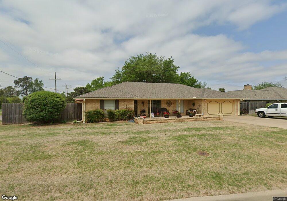
2201 Sunset Dr Duncan, OK 73533
Estimated Value: $222,000 - $276,000
4
Beds
2
Baths
2,092
Sq Ft
$118/Sq Ft
Est. Value
About This Home
This home is located at 2201 Sunset Dr, Duncan, OK 73533 and is currently estimated at $247,751, approximately $118 per square foot. 2201 Sunset Dr is a home with nearby schools including Plato Elementary School, Duncan Middle School, and Duncan High School.
Ownership History
Date
Name
Owned For
Owner Type
Purchase Details
Closed on
Dec 5, 2014
Sold by
Davis John and Davis Dorene
Bought by
Gibbs William F and Gibbs Mary L
Current Estimated Value
Purchase Details
Closed on
May 4, 2007
Sold by
Horining Joe Birden
Bought by
Davis John and Davis Dorene
Home Financials for this Owner
Home Financials are based on the most recent Mortgage that was taken out on this home.
Original Mortgage
$120,000
Interest Rate
6.13%
Mortgage Type
New Conventional
Purchase Details
Closed on
Jun 11, 2004
Sold by
Fraysher Lillian E
Create a Home Valuation Report for This Property
The Home Valuation Report is an in-depth analysis detailing your home's value as well as a comparison with similar homes in the area
Purchase History
| Date | Buyer | Sale Price | Title Company |
|---|---|---|---|
| Gibbs William F | $135,000 | None Available | |
| Davis John | $150,000 | None Available | |
| -- | -- | -- |
Source: Public Records
Mortgage History
| Date | Status | Borrower | Loan Amount |
|---|---|---|---|
| Previous Owner | Davis John | $120,000 |
Source: Public Records
Tax History
| Year | Tax Paid | Tax Assessment Tax Assessment Total Assessment is a certain percentage of the fair market value that is determined by local assessors to be the total taxable value of land and additions on the property. | Land | Improvement |
|---|---|---|---|---|
| 2025 | $1,288 | $16,267 | $2,475 | $13,792 |
| 2024 | $1,301 | $16,268 | $2,388 | $13,880 |
| 2023 | $1,301 | $16,267 | $2,620 | $13,647 |
| 2022 | $1,298 | $16,267 | $2,620 | $13,647 |
| 2021 | $1,300 | $16,267 | $1,641 | $14,626 |
| 2020 | $1,318 | $16,267 | $1,566 | $14,701 |
| 2019 | $1,321 | $16,267 | $1,623 | $14,644 |
| 2018 | $1,360 | $16,267 | $1,623 | $14,644 |
| 2017 | $1,276 | $15,844 | $1,378 | $14,466 |
| 2016 | $1,223 | $15,383 | $1,651 | $13,732 |
| 2015 | $1,328 | $15,383 | $1,651 | $13,732 |
| 2014 | $1,328 | $15,239 | $1,352 | $13,887 |
Source: Public Records
Map
Nearby Homes
- 0 Townsend St
- 2306 Northridge Dr
- 2106 Carolin Dr
- 1108 W Plato Rd Unit 10
- 1108 W Plato Rd Unit 29
- 1108 1108 W Plato Unit 40
- 1108 1108 W Plato Unit 17
- 2324 N 7th St
- 3495 N 5th St
- 1004 Ranchwood Place
- 1014 Oakview Dr
- 2110 W Club Rd
- 1706 Northridge Dr
- 2201 W Club Rd
- 2702 Wildwood Place
- 1616 Northridge Dr
- 3344 3344 N 5th
- 1800 N 5th St
- 1705 Foxboro Dr
- 1527 N 13th St
- 2203 Sunset Dr
- 2202 Northridge Dr
- 2204 Northridge Dr
- 2205 Sunset Dr
- 902 Palm Dr
- 2110 Townsend St
- 2202 Sunset Dr
- 2206 Northridge Dr
- 2204 Sunset Dr
- 2207 Sunset Dr
- 2111 Townsend St
- 2108 Townsend St
- 912 Palm Dr
- 2206 Sunset Dr
- 2208 Northridge Dr
- 2209 Sunset Dr
- 2107 Townsend St
- 807 Palm Dr
- 914 Palm Dr
- 2106 Townsend St
