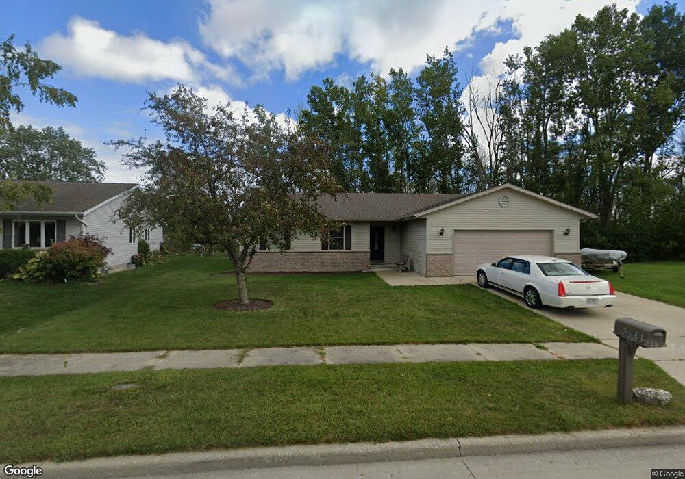
2201 Virginia Dr Manitowoc, WI 54220
Estimated Value: $305,000 - $338,637
3
Beds
2
Baths
1,635
Sq Ft
$197/Sq Ft
Est. Value
About This Home
This home is located at 2201 Virginia Dr, Manitowoc, WI 54220 and is currently estimated at $321,819, approximately $196 per square foot. 2201 Virginia Dr is a home located in Manitowoc County with nearby schools including Jackson Elementary School, Wilson Middle School, and Lincoln High School.
Ownership History
Date
Name
Owned For
Owner Type
Purchase Details
Closed on
Apr 29, 2005
Sold by
Knutson Carl A
Bought by
Westlund Holdings Llc
Current Estimated Value
Purchase Details
Closed on
Jan 10, 2005
Sold by
Woodland Shadows Llc
Bought by
Knuston Carl A
Home Financials for this Owner
Home Financials are based on the most recent Mortgage that was taken out on this home.
Original Mortgage
$150,000
Interest Rate
5.83%
Mortgage Type
Future Advance Clause Open End Mortgage
Create a Home Valuation Report for This Property
The Home Valuation Report is an in-depth analysis detailing your home's value as well as a comparison with similar homes in the area
Home Values in the Area
Average Home Value in this Area
Purchase History
| Date | Buyer | Sale Price | Title Company |
|---|---|---|---|
| Westlund Holdings Llc | $184,900 | None Available | |
| Knuston Carl A | $1,500,000 | None Available |
Source: Public Records
Mortgage History
| Date | Status | Borrower | Loan Amount |
|---|---|---|---|
| Previous Owner | Knuston Carl A | $150,000 |
Source: Public Records
Tax History Compared to Growth
Tax History
| Year | Tax Paid | Tax Assessment Tax Assessment Total Assessment is a certain percentage of the fair market value that is determined by local assessors to be the total taxable value of land and additions on the property. | Land | Improvement |
|---|---|---|---|---|
| 2024 | $4,442 | $253,300 | $21,800 | $231,500 |
| 2023 | $4,122 | $253,300 | $21,800 | $231,500 |
| 2022 | $3,606 | $188,000 | $21,800 | $166,200 |
| 2021 | $3,667 | $188,000 | $21,800 | $166,200 |
| 2020 | $3,701 | $176,400 | $21,800 | $154,600 |
| 2019 | $3,674 | $176,400 | $21,800 | $154,600 |
| 2018 | $3,591 | $176,400 | $21,800 | $154,600 |
| 2017 | $3,503 | $176,400 | $21,800 | $154,600 |
| 2016 | $3,641 | $176,400 | $21,800 | $154,600 |
| 2015 | $3,727 | $176,400 | $21,800 | $154,600 |
| 2014 | -- | $176,400 | $21,800 | $154,600 |
| 2013 | $3,670 | $176,400 | $21,800 | $154,600 |
Source: Public Records
Map
Nearby Homes
- Lt2 Virginia Dr
- Lt3 Virginia Dr
- Lt1 Virginia Dr
- Lt4 Virginia Dr
- 2122 Paul Rd
- 3608 Menasha Ave
- 4207 Menasha Ave
- 3718 Westwood Ln
- 1933 Kellner St
- 2205 Kellner St
- 4412 Just Ct
- 2415 N Rapids Rd
- 4642 Ridge Ct
- 3912 Wildwood Dr
- 4911 Elmer Ln
- 1127 Tanglewood Rd
- 1936 Ravenswood Ln
- 1934 Ravenswood Ln
- 1928 Ravenswood Ln
- 1926 Ravenswood Ln
- 2207 Virginia Dr
- 2209 Virginia Dr
- 2210 Virginia Dr
- 3511 Joseph Rd Unit 3511
- 2211 Virginia Dr
- 2220 Paul Rd
- 3507 Joseph Rd
- 2208 Paul Rd
- 3503 Joseph Rd
- 2230 Paul Rd
- 3510 Joseph Rd Unit 3510
- 2151 Virginia Dr
- Lt.3 Virginia Dr
- Lt1 Virginia Dr Unit Lt1
- 2302 Virginia Dr
- 2301 Virginia Dr
- 2304 Virginia Dr
- 3512 Joseph Rd
- 2144 Paul Rd
- 2229 Paul Rd