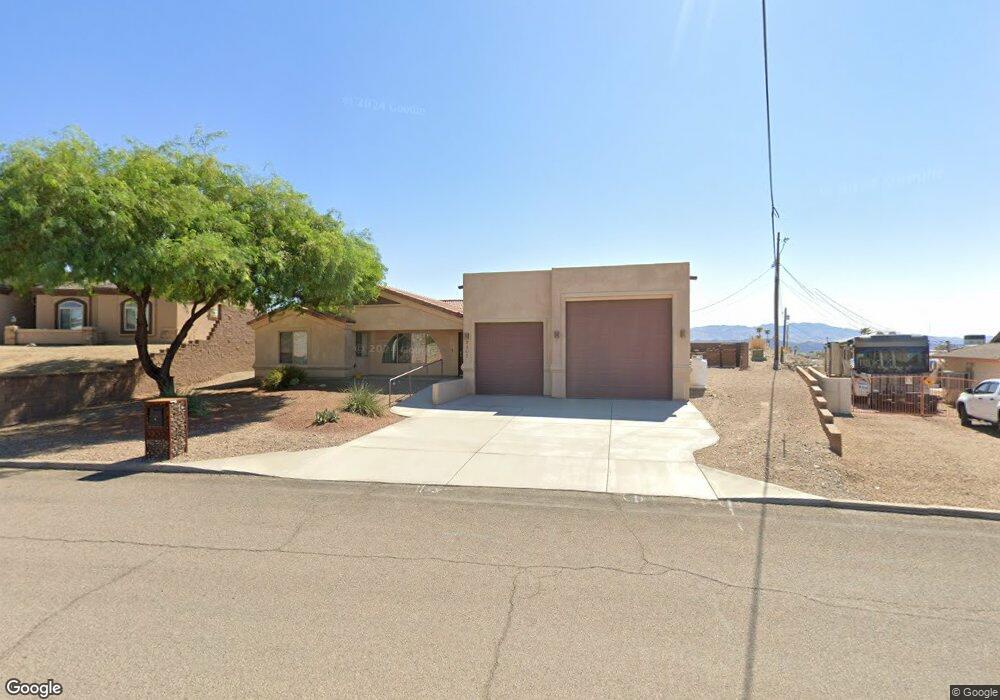
2202 Clarke Dr Lake Havasu City, AZ 86403
Estimated Value: $560,947 - $755,000
3
Beds
2
Baths
2,272
Sq Ft
$281/Sq Ft
Est. Value
About This Home
This home is located at 2202 Clarke Dr, Lake Havasu City, AZ 86403 and is currently estimated at $639,237, approximately $281 per square foot. 2202 Clarke Dr is a home located in Mohave County with nearby schools including Havasupai Elementary School, Thunderbolt Middle School, and Lake Havasu High School.
Ownership History
Date
Name
Owned For
Owner Type
Purchase Details
Closed on
Feb 16, 2010
Sold by
Simecek Dennis and Simecek Christina S
Bought by
Bullock Scott W
Current Estimated Value
Home Financials for this Owner
Home Financials are based on the most recent Mortgage that was taken out on this home.
Original Mortgage
$184,000
Outstanding Balance
$121,777
Interest Rate
5.03%
Mortgage Type
New Conventional
Estimated Equity
$517,460
Purchase Details
Closed on
Apr 3, 2003
Sold by
Nelson Robert B
Bought by
Rivello Anthony J and Rivello Tonya Leigh
Create a Home Valuation Report for This Property
The Home Valuation Report is an in-depth analysis detailing your home's value as well as a comparison with similar homes in the area
Home Values in the Area
Average Home Value in this Area
Purchase History
| Date | Buyer | Sale Price | Title Company |
|---|---|---|---|
| Bullock Scott W | $230,000 | Stewart Title & Trust Of Pho | |
| Rivello Anthony J | $37,000 | First American Title Ins Co |
Source: Public Records
Mortgage History
| Date | Status | Borrower | Loan Amount |
|---|---|---|---|
| Open | Bullock Scott W | $184,000 |
Source: Public Records
Tax History Compared to Growth
Tax History
| Year | Tax Paid | Tax Assessment Tax Assessment Total Assessment is a certain percentage of the fair market value that is determined by local assessors to be the total taxable value of land and additions on the property. | Land | Improvement |
|---|---|---|---|---|
| 2026 | -- | -- | -- | -- |
| 2025 | $2,481 | $51,775 | $0 | $0 |
| 2024 | $2,481 | $55,808 | $0 | $0 |
| 2023 | $2,481 | $49,527 | $0 | $0 |
| 2022 | $2,375 | $36,668 | $0 | $0 |
| 2021 | $2,563 | $34,290 | $0 | $0 |
| 2019 | $2,432 | $30,273 | $0 | $0 |
| 2018 | $2,348 | $28,450 | $0 | $0 |
| 2017 | $2,324 | $25,877 | $0 | $0 |
| 2016 | $2,100 | $24,718 | $0 | $0 |
| 2015 | $2,010 | $21,479 | $0 | $0 |
Source: Public Records
Map
Nearby Homes
- 2200 Clarke Dr
- 640 Acoma Blvd N
- 583 Robin Ln
- 2301 Sahara Dr
- 532 Acoma Blvd N
- 675 Knobhill Ln
- 2311 Rainbow Ave N
- 1986 Bahama Ave
- 1790 Rainbow Ave S
- 2021 Industrial
- 2349 Clarke Dr
- 2320 Tigertail Dr
- 2100 Chaparral Dr
- 1960 Pirate Ln
- 2360 Holly Ave
- 660 Wayside Dr
- 2090 San Juan Dr
- 2270 Constellation Dr
- 2416 Fannin Dr
- 1911 Holly Ave
- 2202 Clarke Dr
- 2208 Clarke Dr
- 664 Acoma Blvd N
- 660 Acoma Blvd N
- 650 Acoma Blvd N
- 2220 Clarke Dr
- 1761 On Your Lot
- 671 Acoma Blvd N
- 661 Acoma Blvd N
- 681 Acoma Blvd N
- 651 Acoma Blvd N
- 2131 Rainbow Ave N
- 2161 Rainbow Ave N
- 630 Acoma Blvd N
- 641 Acoma Blvd N
- 2171 Rainbow Ave N
- 628 Teetsa Ln
- 632 Teetsa Ln
- 631 Acoma Blvd N
- 2181 Rainbow Ave N