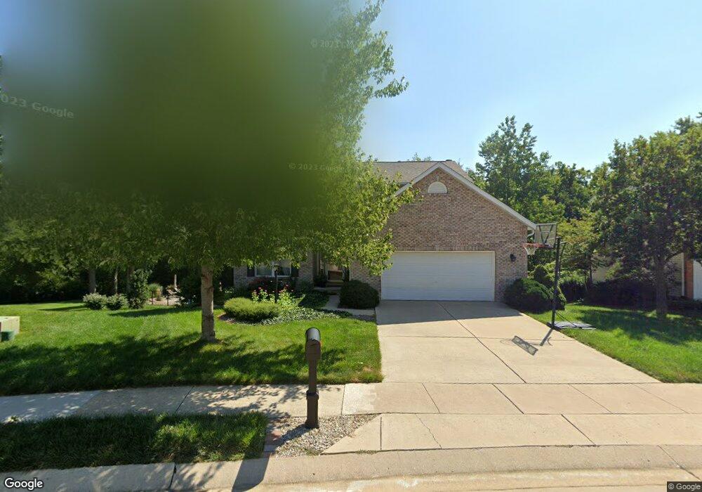
2202 Little Round Top Dr Edwardsville, IL 62025
Estimated Value: $448,000 - $489,000
4
Beds
3
Baths
2,396
Sq Ft
$196/Sq Ft
Est. Value
About This Home
This home is located at 2202 Little Round Top Dr, Edwardsville, IL 62025 and is currently estimated at $468,722, approximately $195 per square foot. 2202 Little Round Top Dr is a home located in Madison County with nearby schools including Goshen Elementary School, Liberty Middle School, and Edwardsville High School.
Ownership History
Date
Name
Owned For
Owner Type
Purchase Details
Closed on
Jun 27, 2008
Sold by
Clasquin Joel Allen and Clasquin Kimberly Marie
Bought by
Basarich Brian and Basarich Kerry
Current Estimated Value
Home Financials for this Owner
Home Financials are based on the most recent Mortgage that was taken out on this home.
Original Mortgage
$135,000
Outstanding Balance
$87,225
Interest Rate
6.1%
Mortgage Type
Purchase Money Mortgage
Estimated Equity
$381,497
Create a Home Valuation Report for This Property
The Home Valuation Report is an in-depth analysis detailing your home's value as well as a comparison with similar homes in the area
Home Values in the Area
Average Home Value in this Area
Purchase History
| Date | Buyer | Sale Price | Title Company |
|---|---|---|---|
| Basarich Brian | $285,000 | Abstracts & Titles Inc |
Source: Public Records
Mortgage History
| Date | Status | Borrower | Loan Amount |
|---|---|---|---|
| Open | Basarich Brian | $135,000 |
Source: Public Records
Tax History Compared to Growth
Tax History
| Year | Tax Paid | Tax Assessment Tax Assessment Total Assessment is a certain percentage of the fair market value that is determined by local assessors to be the total taxable value of land and additions on the property. | Land | Improvement |
|---|---|---|---|---|
| 2024 | $9,207 | $148,320 | $28,490 | $119,830 |
| 2023 | $9,207 | $137,640 | $26,440 | $111,200 |
| 2022 | $8,636 | $127,230 | $24,440 | $102,790 |
| 2021 | $7,723 | $120,760 | $23,200 | $97,560 |
| 2020 | $7,475 | $106,480 | $22,590 | $83,890 |
| 2019 | $7,421 | $104,700 | $22,210 | $82,490 |
| 2018 | $7,294 | $100,000 | $21,220 | $78,780 |
| 2017 | $6,941 | $100,210 | $23,100 | $77,110 |
| 2016 | $6,268 | $100,210 | $23,100 | $77,110 |
| 2015 | $6,659 | $102,180 | $21,410 | $80,770 |
| 2014 | $6,659 | $98,070 | $21,410 | $76,660 |
| 2013 | $6,659 | $102,180 | $21,410 | $80,770 |
Source: Public Records
Map
Nearby Homes
- 7001 Missionary Ridge Ct
- 7008 Seminary Ridge Ct
- 7004 Seminary Ridge Ct
- 112 Chattanooga Ct
- 116 Surrey Ln
- 18 Shiloh Ct
- 103 Carrington Ct
- 3478 Manassas Dr
- 500 Monticello Place
- 6812 Quail Walk
- 307 Monticello Place Unit A
- 6817 Deer Creek
- 0 Governor's Way Unit 23019948
- 815 Amherst Place
- 502 Jaime Lynn Ct
- 638 Yale Ave
- 100 District Dr
- 1511 Oglesby Dr
- 7048 Alston Ct
- Bristol Villa Plan at Governor's Way
- 2200 Little Round Top Dr
- 2206 Little Round Top Dr
- 2106 Little Round Top Dr
- 2105 Little Round Top Dr
- 2208 Little Round Top Dr
- 2205 Little Round Top Dr
- 2104 Little Round Top Dr
- 2103 Little Round Top Dr
- 3465 Wilderness Dr
- 3461 Wilderness Dr
- 2104 Appomattox Ct
- 2300 Little Round Top Dr
- 2207 Little Round Top Dr
- 2102 Appomattox Ct
- 2102 Little Round Top Dr
- 3457 Wilderness Dr
- 2101 Little Round Top Dr
- 2116 Appomattox Ct
- 3453 Wilderness Dr
- 2302 Little Round Top Dr