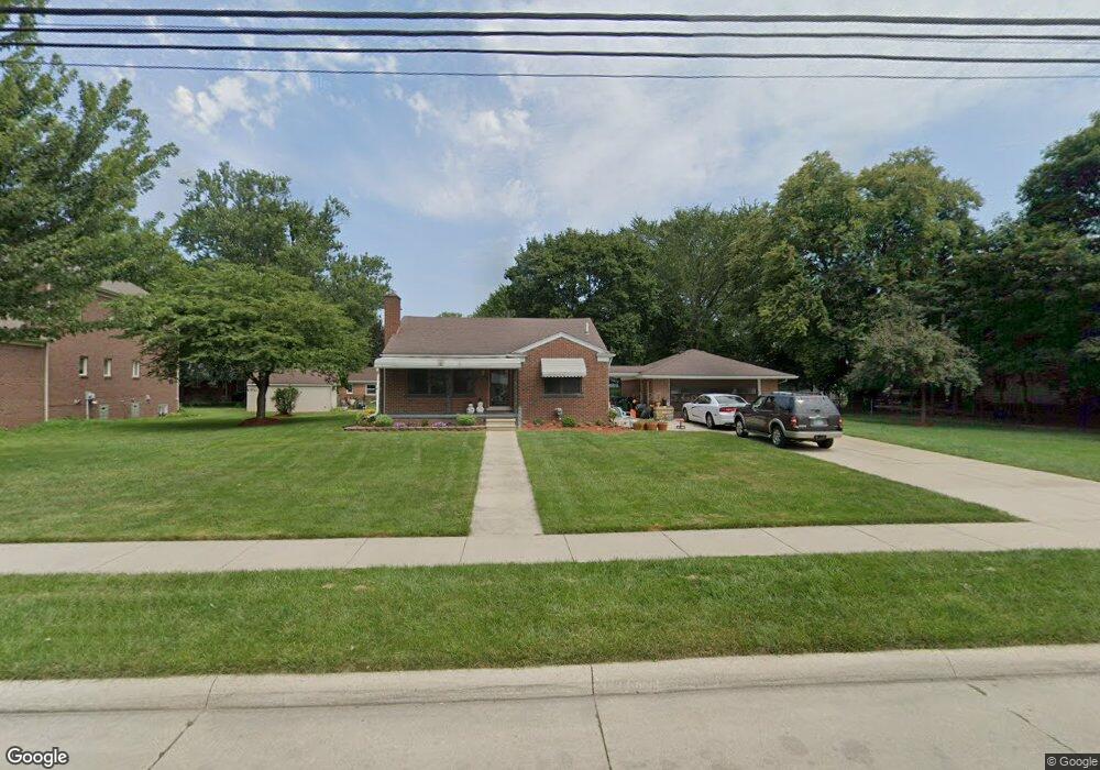
22023 Shady Lane Ave Saint Clair Shores, MI 48080
Estimated Value: $244,377 - $266,000
3
Beds
1
Bath
1,177
Sq Ft
$216/Sq Ft
Est. Value
About This Home
This home is located at 22023 Shady Lane Ave, Saint Clair Shores, MI 48080 and is currently estimated at $254,094, approximately $215 per square foot. 22023 Shady Lane Ave is a home located in Macomb County with nearby schools including South Lake Middle School, South Lake High School, and St. Joan of Arc Elementary School.
Ownership History
Date
Name
Owned For
Owner Type
Purchase Details
Closed on
Jan 25, 2021
Sold by
Dyrda James A and Dyrda Wendy M
Bought by
James A Dyrda And Wendy M Dyrda Revocable Liv and Dyrda
Current Estimated Value
Home Financials for this Owner
Home Financials are based on the most recent Mortgage that was taken out on this home.
Original Mortgage
$105,000
Interest Rate
3%
Mortgage Type
Stand Alone Refi Refinance Of Original Loan
Purchase Details
Closed on
Sep 21, 2020
Sold by
Dyrda James A and Dyrda Wendy M
Bought by
Dyrda James A and Rlt Vendy
Purchase Details
Closed on
Oct 31, 1994
Sold by
Sharon Boda
Bought by
Dyrda James A and Dyrda Wendy M
Home Financials for this Owner
Home Financials are based on the most recent Mortgage that was taken out on this home.
Original Mortgage
$83,610
Interest Rate
8.86%
Mortgage Type
New Conventional
Create a Home Valuation Report for This Property
The Home Valuation Report is an in-depth analysis detailing your home's value as well as a comparison with similar homes in the area
Home Values in the Area
Average Home Value in this Area
Purchase History
| Date | Buyer | Sale Price | Title Company |
|---|---|---|---|
| James A Dyrda And Wendy M Dyrda Revocable Liv | -- | None Listed On Document | |
| Dyrda James A | -- | None Listed On Document | |
| Dyrda James A | -- | Amrock Llc | |
| Dyrda James A | -- | Amrock Llc | |
| Dyrda James A | -- | None Available | |
| Dyrda James A | $92,900 | -- |
Source: Public Records
Mortgage History
| Date | Status | Borrower | Loan Amount |
|---|---|---|---|
| Previous Owner | Dyrda James A | $105,000 | |
| Previous Owner | Dyrda James A | $83,610 |
Source: Public Records
Tax History Compared to Growth
Tax History
| Year | Tax Paid | Tax Assessment Tax Assessment Total Assessment is a certain percentage of the fair market value that is determined by local assessors to be the total taxable value of land and additions on the property. | Land | Improvement |
|---|---|---|---|---|
| 2025 | $3,432 | $128,700 | $0 | $0 |
| 2024 | $3,330 | $123,800 | $0 | $0 |
| 2023 | $3,268 | $113,100 | $0 | $0 |
| 2022 | $3,274 | $106,300 | $0 | $0 |
| 2021 | $3,177 | $99,700 | $0 | $0 |
| 2020 | $3,125 | $89,200 | $0 | $0 |
| 2019 | $2,633 | $83,700 | $0 | $0 |
| 2018 | $2,836 | $69,200 | $0 | $0 |
| 2017 | $2,836 | $67,100 | $17,200 | $49,900 |
| 2016 | $2,633 | $67,100 | $0 | $0 |
| 2015 | $2,983 | $54,800 | $0 | $0 |
| 2012 | -- | $52,600 | $15,700 | $36,900 |
Source: Public Records
Map
Nearby Homes
- 22035 Sunnyside St
- 22141 Edmunton St
- 22017 Rosedale St
- 22026 Alger St
- 22109 Alger St
- 21835 Alger St
- 21751 Edmunton St
- 22306 Alger St
- 21715 Alger St
- 22305 Alger St
- 22401 Alger St
- 1846 Aline Dr
- 21640 Chalon St
- 22525 E 8 Mile Rd
- 2104 Roslyn Rd
- 2147 Roslyn Rd
- 2169 Roslyn Rd
- 20618 Sunnyside St
- 21737 Roslyn Rd
- 21525 Brys Dr
- 22024 Sunnyside St
- 22017 Shady Lane Ave
- 22018 Sunnyside St
- 22019 Shady Lane Ave
- 22034 Sunnyside St
- 22115 Shady Lane Ave
- 22010 Sunnyside St
- 22005 Shady Lane Ave
- 22106 Sunnyside St
- 22000 Sunnyside St
- 22025 Sunnyside St
- 22015 Sunnyside St
- 22101 Sunnyside St
- 21925 Shady Lane Ave
- 22119 Shady Lane Ave
- 22024 Shady Lane Ave
- 22110 Sunnyside St
- 21924 Sunnyside St
- 22001 Sunnyside St
- 22100 Shady Lane Ave