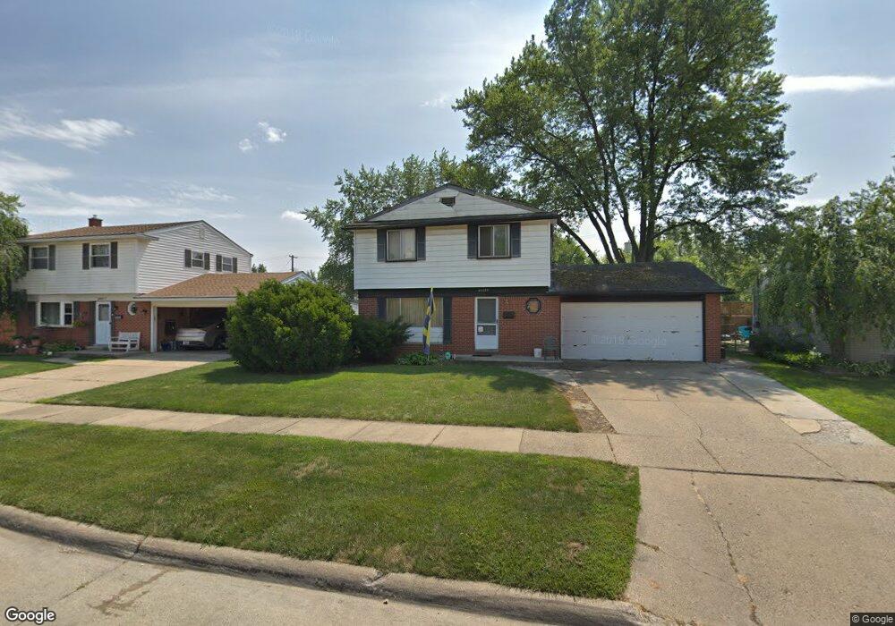
22029 Kensington St Taylor, MI 48180
Estimated Value: $189,946 - $257,000
--
Bed
1
Bath
1,518
Sq Ft
$155/Sq Ft
Est. Value
About This Home
This home is located at 22029 Kensington St, Taylor, MI 48180 and is currently estimated at $235,487, approximately $155 per square foot. 22029 Kensington St is a home located in Wayne County with nearby schools including Kinyon Elementary School, Robert J. West Middle School, and Taylor Preparatory High School.
Ownership History
Date
Name
Owned For
Owner Type
Purchase Details
Closed on
Sep 1, 2023
Sold by
Favot Anna
Bought by
22029 Kensington Llc
Current Estimated Value
Home Financials for this Owner
Home Financials are based on the most recent Mortgage that was taken out on this home.
Original Mortgage
$103,000
Outstanding Balance
$100,815
Interest Rate
6.96%
Mortgage Type
New Conventional
Estimated Equity
$134,672
Purchase Details
Closed on
Dec 9, 2021
Sold by
Favot Michael A
Bought by
Favot Anna
Create a Home Valuation Report for This Property
The Home Valuation Report is an in-depth analysis detailing your home's value as well as a comparison with similar homes in the area
Home Values in the Area
Average Home Value in this Area
Purchase History
| Date | Buyer | Sale Price | Title Company |
|---|---|---|---|
| 22029 Kensington Llc | $103,000 | None Listed On Document | |
| Favot Anna | -- | -- |
Source: Public Records
Mortgage History
| Date | Status | Borrower | Loan Amount |
|---|---|---|---|
| Open | 22029 Kensington Llc | $103,000 |
Source: Public Records
Tax History Compared to Growth
Tax History
| Year | Tax Paid | Tax Assessment Tax Assessment Total Assessment is a certain percentage of the fair market value that is determined by local assessors to be the total taxable value of land and additions on the property. | Land | Improvement |
|---|---|---|---|---|
| 2025 | $6,346 | $111,100 | $0 | $0 |
| 2024 | $6,346 | $103,500 | $0 | $0 |
| 2023 | $2,770 | $93,100 | $0 | $0 |
| 2022 | $2,575 | $84,000 | $0 | $0 |
| 2021 | $2,433 | $76,800 | $0 | $0 |
| 2020 | $2,411 | $69,100 | $0 | $0 |
| 2019 | $351,169 | $58,200 | $0 | $0 |
| 2018 | $1,898 | $48,300 | $0 | $0 |
| 2017 | $3,381 | $45,200 | $0 | $0 |
| 2016 | $3,397 | $43,900 | $0 | $0 |
| 2015 | $4,288 | $43,800 | $0 | $0 |
| 2013 | $4,270 | $44,400 | $0 | $0 |
| 2012 | $1,870 | $43,100 | $12,800 | $30,300 |
Source: Public Records
Map
Nearby Homes
- 9883 Roosevelt St
- 22129 Kinyon St Unit 52
- 22333 Kinyon St
- 9942 Lincoln St
- 22455 Meadow Woods Cir
- 22150 Haig St
- 10880 Pardee Rd Unit 45
- 22662 Goddard Rd Unit 7
- 22730 Goddard Rd Unit 37
- 22654 Cloverlawn St
- 11187 Pardee Rd
- 9560 Sylvester St
- 10769 Birch St
- 10219 Island Lake Dr
- 10272 Island Lake Dr
- 9381 Pardee Rd
- 10578 Island Lake Dr
- 23364 Baker St
- 22311 Wick Rd
- 23395 Pinewood Dr Unit 121
- 22017 Kensington St
- 22041 Kensington St
- 22030 Harmon St
- 22053 Kensington St
- 22005 Kensington St
- 22018 Harmon St
- 22042 Harmon St
- 22054 Harmon St
- 22006 Harmon St
- 22065 Kensington St
- 22028 Kensington St
- 22016 Kensington St
- 22040 Kensington St
- 22066 Harmon St
- 22052 Kensington St
- 22004 Kensington St
- 22077 Kensington St
- 22064 Kensington St
- 22078 Harmon St
- 22089 Kensington St