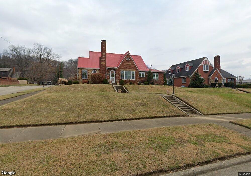
2203 S 10th St Ironton, OH 45638
Estimated Value: $239,000 - $337,000
2
Beds
2
Baths
3,170
Sq Ft
$86/Sq Ft
Est. Value
About This Home
This home is located at 2203 S 10th St, Ironton, OH 45638 and is currently estimated at $273,348, approximately $86 per square foot. 2203 S 10th St is a home located in Lawrence County with nearby schools including Ironton Elementary School, Ironton Middle School, and Ironton High School.
Ownership History
Date
Name
Owned For
Owner Type
Purchase Details
Closed on
Dec 28, 2009
Sold by
Fairchild Michael G and Fairchild Mark A
Bought by
Hankins Aaron D and Castle Kacie E
Current Estimated Value
Home Financials for this Owner
Home Financials are based on the most recent Mortgage that was taken out on this home.
Original Mortgage
$140,000
Outstanding Balance
$91,122
Interest Rate
4.78%
Mortgage Type
New Conventional
Estimated Equity
$182,226
Purchase Details
Closed on
Aug 7, 2009
Sold by
Fairchild Glen B
Bought by
Fairchild Glen B and Fairchild Family Irrevocable Trust
Purchase Details
Closed on
Jan 1, 1987
Bought by
Fairchild Glen B and Fairchild Maxine H
Create a Home Valuation Report for This Property
The Home Valuation Report is an in-depth analysis detailing your home's value as well as a comparison with similar homes in the area
Home Values in the Area
Average Home Value in this Area
Purchase History
| Date | Buyer | Sale Price | Title Company |
|---|---|---|---|
| Hankins Aaron D | $175,000 | Attorney | |
| Fairchild Glen B | -- | None Available | |
| Fairchild Glen B | -- | None Available | |
| Fairchild Glen B | -- | -- |
Source: Public Records
Mortgage History
| Date | Status | Borrower | Loan Amount |
|---|---|---|---|
| Open | Hankins Aaron D | $140,000 |
Source: Public Records
Tax History Compared to Growth
Tax History
| Year | Tax Paid | Tax Assessment Tax Assessment Total Assessment is a certain percentage of the fair market value that is determined by local assessors to be the total taxable value of land and additions on the property. | Land | Improvement |
|---|---|---|---|---|
| 2024 | -- | $73,560 | $6,780 | $66,780 |
| 2023 | $2,632 | $73,560 | $6,780 | $66,780 |
| 2022 | $2,630 | $73,560 | $6,780 | $66,780 |
| 2021 | $2,358 | $62,750 | $6,380 | $56,370 |
| 2020 | $2,373 | $62,750 | $6,380 | $56,370 |
| 2019 | $2,364 | $62,750 | $6,380 | $56,370 |
| 2018 | $2,391 | $62,750 | $6,380 | $56,370 |
| 2017 | $1,678 | $44,010 | $6,380 | $37,630 |
| 2016 | $1,617 | $44,010 | $6,380 | $37,630 |
| 2015 | $1,732 | $45,500 | $7,020 | $38,480 |
| 2014 | $1,673 | $45,500 | $7,020 | $38,480 |
| 2013 | $1,668 | $45,500 | $7,020 | $38,480 |
Source: Public Records
Map
Nearby Homes
- 2008 S 9th St
- 2008 S 9th St Unit KO-2
- 2001 Liberty Ave
- 707 Mastin Ave
- 2418 S 12th St
- 2121 S 6th St
- 2503 S 9th St
- 1902 S 7th St
- 1819 S 6th St
- 2322 S 5th St
- 1917 Woodland Dr
- 2436 S 5th St
- 2520 S 6th St Unit BO-1
- 1619 S 6th St
- 1703 S 5th St
- 2626 S 11th St
- 2434 S 4th St
- 2616 S 13th St
- 2601 S 6th St
- 2620 S 13th St