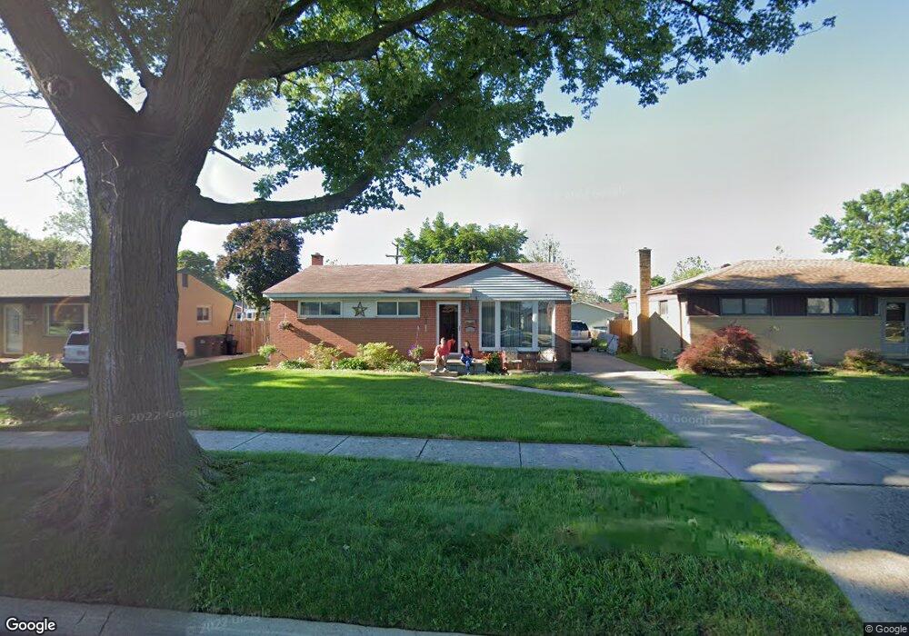
22031 Charles Ct Taylor, MI 48180
Estimated Value: $179,403 - $232,000
--
Bed
--
Bath
1,040
Sq Ft
$189/Sq Ft
Est. Value
About This Home
This home is located at 22031 Charles Ct, Taylor, MI 48180 and is currently estimated at $196,351, approximately $188 per square foot. 22031 Charles Ct is a home located in Wayne County with nearby schools including Clarence Randall Elementary School, Robert J. West Middle School, and Taylor High School.
Ownership History
Date
Name
Owned For
Owner Type
Purchase Details
Closed on
Jan 26, 2022
Sold by
Lowell James E and Lowell Deborah M
Bought by
Allen Kimberly M and Allen John
Current Estimated Value
Home Financials for this Owner
Home Financials are based on the most recent Mortgage that was taken out on this home.
Original Mortgage
$124,000
Outstanding Balance
$115,003
Interest Rate
3.45%
Mortgage Type
New Conventional
Estimated Equity
$81,348
Create a Home Valuation Report for This Property
The Home Valuation Report is an in-depth analysis detailing your home's value as well as a comparison with similar homes in the area
Home Values in the Area
Average Home Value in this Area
Purchase History
| Date | Buyer | Sale Price | Title Company |
|---|---|---|---|
| Allen Kimberly M | $155,000 | None Listed On Document | |
| Allen Kimberly M | $155,000 | None Listed On Document |
Source: Public Records
Mortgage History
| Date | Status | Borrower | Loan Amount |
|---|---|---|---|
| Open | Allen Kimberly M | $124,000 | |
| Closed | Allen Kimberly M | $124,000 |
Source: Public Records
Tax History Compared to Growth
Tax History
| Year | Tax Paid | Tax Assessment Tax Assessment Total Assessment is a certain percentage of the fair market value that is determined by local assessors to be the total taxable value of land and additions on the property. | Land | Improvement |
|---|---|---|---|---|
| 2025 | $3,261 | $92,600 | $0 | $0 |
| 2024 | $3,261 | $85,300 | $0 | $0 |
| 2023 | $3,853 | $71,600 | $0 | $0 |
| 2022 | $1,775 | $61,300 | $0 | $0 |
| 2021 | $2,902 | $58,500 | $0 | $0 |
| 2020 | $2,749 | $55,300 | $0 | $0 |
| 2019 | $255,201 | $49,200 | $0 | $0 |
| 2018 | $1,524 | $40,200 | $0 | $0 |
| 2017 | $4,365 | $37,100 | $0 | $0 |
| 2016 | $2,788 | $36,000 | $0 | $0 |
| 2015 | $3,444 | $36,600 | $0 | $0 |
| 2013 | $3,430 | $35,000 | $0 | $0 |
| 2012 | $1,507 | $34,500 | $10,500 | $24,000 |
Source: Public Records
Map
Nearby Homes
- 22028 Guidot St
- 7584 William St
- 7866 Katherine St
- 7267 William St
- 7564 Clippert St
- 7847 William St
- 8021 Trafalgar St
- 8316 Roosevelt St
- 22303 Wohlfeil St
- 22931 Champaign St
- 6724 Polk St
- 7965 Elm St
- 20742 Champaign St
- 8008 Elm St
- 22726 Haskell St
- 6631 Elm St
- 8818 Clippert St
- 8094 Elm St
- 7954 Oak St
- 8095 Oak St
- 22043 Charles Ct
- 22019 Charles Ct
- 22053 Charles Ct
- 22007 Charles Ct
- 7450 Monroe Blvd
- 22038 Guidot St
- 22101 Charles Ct
- 22048 Guidot St
- 7470 Monroe Blvd
- 22030 Charles Ct Unit Bldg-Unit
- 22030 Charles Ct
- 22040 Charles Ct
- 22018 Charles Ct
- 22100 Guidot St
- 22052 Charles Ct
- 22111 Charles Ct
- 22006 Charles Ct
- 22100 Charles Ct
- 22110 Guidot St
- 22123 Charles Ct