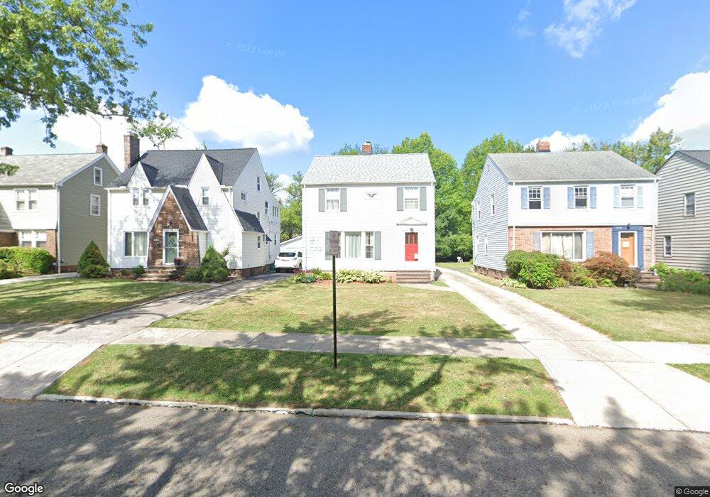
2204 Cranston Rd University Heights, OH 44118
Estimated Value: $210,651 - $249,000
3
Beds
2
Baths
1,492
Sq Ft
$156/Sq Ft
Est. Value
About This Home
This home is located at 2204 Cranston Rd, University Heights, OH 44118 and is currently estimated at $232,913, approximately $156 per square foot. 2204 Cranston Rd is a home located in Cuyahoga County with nearby schools including Canterbury Elementary School, Roxboro Middle School, and Cleveland Heights High School.
Ownership History
Date
Name
Owned For
Owner Type
Purchase Details
Closed on
Aug 17, 1983
Sold by
Shetler Larry R
Bought by
Price Kenneth A
Current Estimated Value
Purchase Details
Closed on
Sep 5, 1980
Bought by
Shetler Larry R
Purchase Details
Closed on
Sep 14, 1976
Sold by
Knable Michael D
Bought by
Knable Karen S
Purchase Details
Closed on
Mar 16, 1976
Sold by
Benjamin Idele S
Bought by
Knable Michael D
Purchase Details
Closed on
Jan 1, 1975
Bought by
Benjamin Idele S
Create a Home Valuation Report for This Property
The Home Valuation Report is an in-depth analysis detailing your home's value as well as a comparison with similar homes in the area
Home Values in the Area
Average Home Value in this Area
Purchase History
| Date | Buyer | Sale Price | Title Company |
|---|---|---|---|
| Price Kenneth A | $63,900 | -- | |
| Shetler Larry R | $58,000 | -- | |
| Diamond Shamrock Corp | -- | -- | |
| Knable Karen S | -- | -- | |
| Knable Michael D | $39,000 | -- | |
| Benjamin Idele S | -- | -- |
Source: Public Records
Tax History Compared to Growth
Tax History
| Year | Tax Paid | Tax Assessment Tax Assessment Total Assessment is a certain percentage of the fair market value that is determined by local assessors to be the total taxable value of land and additions on the property. | Land | Improvement |
|---|---|---|---|---|
| 2024 | $5,469 | $63,385 | $14,420 | $48,965 |
| 2023 | $4,799 | $42,460 | $9,730 | $32,730 |
| 2022 | $4,677 | $42,455 | $9,730 | $32,725 |
| 2021 | $4,583 | $42,460 | $9,730 | $32,730 |
| 2020 | $4,525 | $37,910 | $8,680 | $29,230 |
| 2019 | $4,279 | $108,300 | $24,800 | $83,500 |
| 2018 | $4,282 | $37,910 | $8,680 | $29,230 |
| 2017 | $4,370 | $36,020 | $6,900 | $29,120 |
| 2016 | $4,314 | $36,020 | $6,900 | $29,120 |
| 2015 | $4,012 | $36,020 | $6,900 | $29,120 |
| 2014 | $4,012 | $35,320 | $6,760 | $28,560 |
Source: Public Records
Map
Nearby Homes
- 2216 Barrington Rd
- 2208 Cranston Rd
- 3621 Cedarbrook Rd
- 2244 Edgerton Rd
- 13605 Cedar Rd
- 3790 Bushnell Rd
- 13785 Cedar Rd Unit 302
- 3797 Northwood Rd
- 3554 Raymont Blvd
- 3544 Silsby Rd
- 3841 Washington Blvd
- 2320 Allison Rd
- 2232 Fenwick Rd
- 13526 Cedar Rd
- 3526 Raymont Blvd
- 2223 Fenwick Rd
- 3525 Raymont Blvd
- 3631 Cummings Rd
- 3809 Warrendale Rd
- 3850 Colony Rd
- 2200 Cranston Rd
- 2196 Cranston Rd
- 2212 Cranston Rd
- 2192 Cranston Rd
- 2216 Cranston Rd
- 2199 Brockway Rd
- 2188 Cranston Rd
- 2220 Cranston Rd
- 2211 Brockway Rd
- 2195 Brockway Rd
- 2215 Brockway Rd
- 2184 Cranston Rd
- 2224 Cranston Rd
- 2219 Brockway Rd
- 2187 Brockway Rd
- 2203 Cranston Rd
- 2199 Cranston Rd
- 2199 Cranston Rd Unit ID1057684P
- 2207 Cranston Rd
- 2195 Cranston Rd