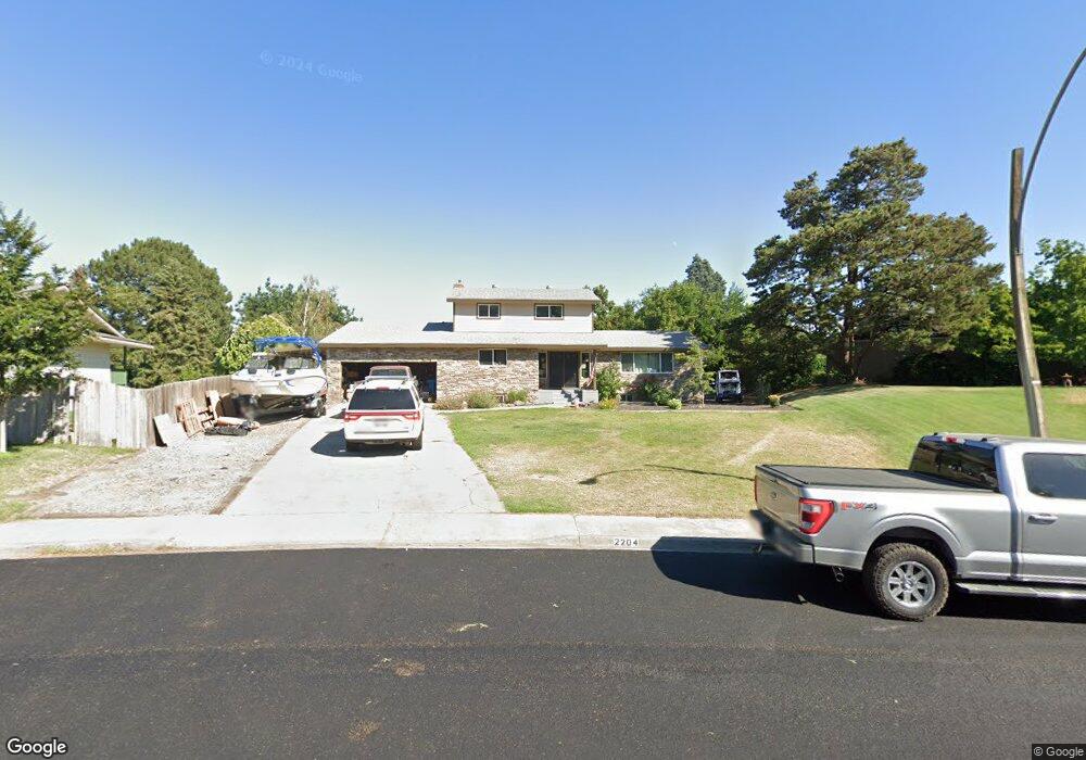
2204 Enterprise Dr Richland, WA 99354
Estimated Value: $578,000 - $701,000
5
Beds
4
Baths
3,560
Sq Ft
$177/Sq Ft
Est. Value
About This Home
This home is located at 2204 Enterprise Dr, Richland, WA 99354 and is currently estimated at $629,386, approximately $176 per square foot. 2204 Enterprise Dr is a home located in Benton County with nearby schools including Jefferson Elementary School, Chief Joseph Middle School, and Hanford High School.
Ownership History
Date
Name
Owned For
Owner Type
Purchase Details
Closed on
Apr 18, 2011
Sold by
Fredenburg Edward A and Fredenburg Barbara
Bought by
Creer Britton and Creer April
Current Estimated Value
Home Financials for this Owner
Home Financials are based on the most recent Mortgage that was taken out on this home.
Original Mortgage
$283,002
Outstanding Balance
$195,520
Interest Rate
4.83%
Mortgage Type
Future Advance Clause Open End Mortgage
Estimated Equity
$433,866
Create a Home Valuation Report for This Property
The Home Valuation Report is an in-depth analysis detailing your home's value as well as a comparison with similar homes in the area
Home Values in the Area
Average Home Value in this Area
Purchase History
| Date | Buyer | Sale Price | Title Company |
|---|---|---|---|
| Creer Britton | $215,000 | Benton Franklin Title Co |
Source: Public Records
Mortgage History
| Date | Status | Borrower | Loan Amount |
|---|---|---|---|
| Open | Creer Britton | $283,002 |
Source: Public Records
Tax History Compared to Growth
Tax History
| Year | Tax Paid | Tax Assessment Tax Assessment Total Assessment is a certain percentage of the fair market value that is determined by local assessors to be the total taxable value of land and additions on the property. | Land | Improvement |
|---|---|---|---|---|
| 2024 | $4,957 | $542,770 | $50,000 | $492,770 |
| 2023 | $4,957 | $530,130 | $50,000 | $480,130 |
| 2022 | $4,458 | $454,320 | $50,000 | $404,320 |
| 2021 | $4,206 | $403,780 | $50,000 | $353,780 |
| 2020 | $3,891 | $365,880 | $50,000 | $315,880 |
| 2019 | $3,272 | $319,620 | $48,000 | $271,620 |
| 2018 | $3,368 | $289,440 | $48,000 | $241,440 |
| 2017 | $2,969 | $249,200 | $48,000 | $201,200 |
| 2016 | $2,926 | $249,200 | $48,000 | $201,200 |
| 2015 | $2,981 | $249,200 | $48,000 | $201,200 |
| 2014 | -- | $249,200 | $48,000 | $201,200 |
| 2013 | -- | $249,200 | $48,000 | $201,200 |
Source: Public Records
Map
Nearby Homes
- 2342 Davison Ave
- 324 Saint St
- 2110 Davison Ave
- 2462 Mullet Ct
- 42 Mercury Dr
- 1947 Hetrick St
- 2445 Westmoreland Dr
- 2460 Westmoreland Dr
- 560 Spengler St
- 562 Fuller St
- 49 Galaxy Ln
- 63 Galaxy Ln
- 517 Catskill St
- 1920 Howell Ave
- 21 Nuclear Ln
- 325 McDonald Dr
- 515 Blue St
- 45 Cosmic Ln
- 11702 Cordon Crest Ct
- 733 Snyder St
- 101 Enterprise Dr
- 2210 Enterprise Dr
- 2211 Harris Ave
- 2217 Harris Ave
- 107 Enterprise Dr
- 2205 Harris Ave
- 2216 Enterprise Dr
- 2207 Enterprise Dr
- 2223 Harris Ave
- 2213 Enterprise Dr
- 2229 Harris Ave
- 110 Enterprise Dr
- 2222 Enterprise Dr
- 2219 Enterprise Dr
- 113 Enterprise Dr
- 2225 Enterprise Dr
- 2218 Benton Ave
- 2212 Benton Ave
- 2235 Harris Ave
- 2228 Enterprise Dr