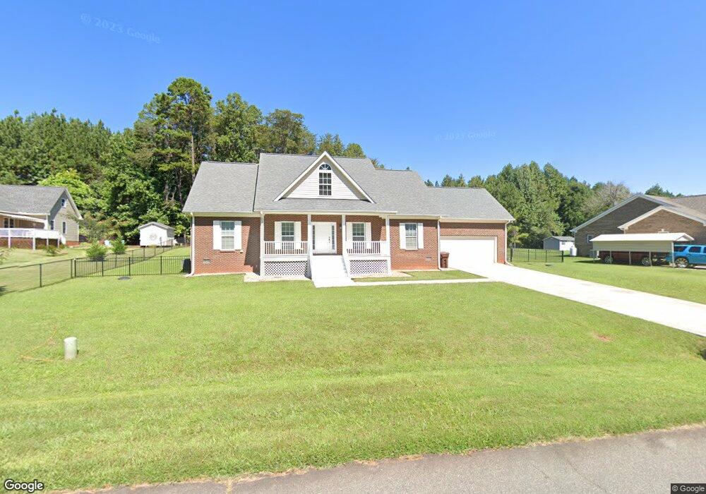
2204 Rock Bridge Dr Unit 2 Mebane, NC 27302
Estimated Value: $354,000 - $447,000
3
Beds
2
Baths
1,836
Sq Ft
$220/Sq Ft
Est. Value
About This Home
This home is located at 2204 Rock Bridge Dr Unit 2, Mebane, NC 27302 and is currently estimated at $404,661, approximately $220 per square foot. 2204 Rock Bridge Dr Unit 2 is a home located in Alamance County with nearby schools including Garrett Elementary School, Hawfields Middle School, and Bradford Academy.
Ownership History
Date
Name
Owned For
Owner Type
Purchase Details
Closed on
May 19, 2016
Sold by
Howerton Douglas and Howerton Janie Daniels
Bought by
Howerton Douglas and Howerton Daniels
Current Estimated Value
Create a Home Valuation Report for This Property
The Home Valuation Report is an in-depth analysis detailing your home's value as well as a comparison with similar homes in the area
Home Values in the Area
Average Home Value in this Area
Purchase History
| Date | Buyer | Sale Price | Title Company |
|---|---|---|---|
| Howerton Douglas | -- | None Available |
Source: Public Records
Tax History Compared to Growth
Tax History
| Year | Tax Paid | Tax Assessment Tax Assessment Total Assessment is a certain percentage of the fair market value that is determined by local assessors to be the total taxable value of land and additions on the property. | Land | Improvement |
|---|---|---|---|---|
| 2025 | $2,316 | $410,613 | $60,000 | $350,613 |
| 2024 | $2,213 | $410,613 | $60,000 | $350,613 |
| 2023 | $2,051 | $410,613 | $60,000 | $350,613 |
| 2022 | $1,661 | $221,151 | $30,000 | $191,151 |
| 2021 | $1,683 | $221,151 | $30,000 | $191,151 |
| 2020 | $1,705 | $221,151 | $30,000 | $191,151 |
| 2019 | $1,714 | $221,151 | $30,000 | $191,151 |
| 2018 | $0 | $221,151 | $30,000 | $191,151 |
| 2017 | $1,482 | $221,151 | $30,000 | $191,151 |
| 2016 | $241 | $36,000 | $36,000 | $0 |
| 2015 | $240 | $36,000 | $36,000 | $0 |
| 2014 | -- | $36,000 | $36,000 | $0 |
Source: Public Records
Map
Nearby Homes
- 2170 Farrell Rd
- 2028 Webster Grove Dr
- 2715 Burgess Dr
- 2733 Burgess Dr
- 2750 Burgess Dr
- 2762 Burgess Dr
- 2757 Burgess Dr
- 2781 Burgess Dr
- 2813 Burgess Dr
- 2981 Burgess Dr
- 2823 Burgess Dr
- 2844 Burgess Dr
- 2831 Burgess Dr
- 2885 Burgess Dr Unit 399
- 2867 Burgess Dr Unit 401
- 2803 Burgess Dr
- 2885 Burgess Dr
- 2826 Burgess Dr
- 2867 Burgess Dr
- 2925 Burgess Dr
- 2204 Rock Bridge Dr
- 2074 Turner Rd
- 2212 Rock Bridge Dr
- 2104 Turner Rd
- 2118 Turner Rd
- 2073 Turner Rd
- 2064 Turner Rd
- 2069 Turner Rd
- 2220 Rock Bridge Dr Unit 4
- 2220 Rock Bridge Dr
- 2100 Turner Rd
- 2148 Turner Rd
- 2228 Rock Bridge Dr
- 2217 Rock Bridge Dr
- 2217 Rock Bridge Dr Unit 21
- 2217 Rock Bridge Dr Unit 2
- 2107 Turner Rd
- 2233 Rock Bridge Dr
- 2115 Turner Rd
- 2236 Rock Bridge Dr