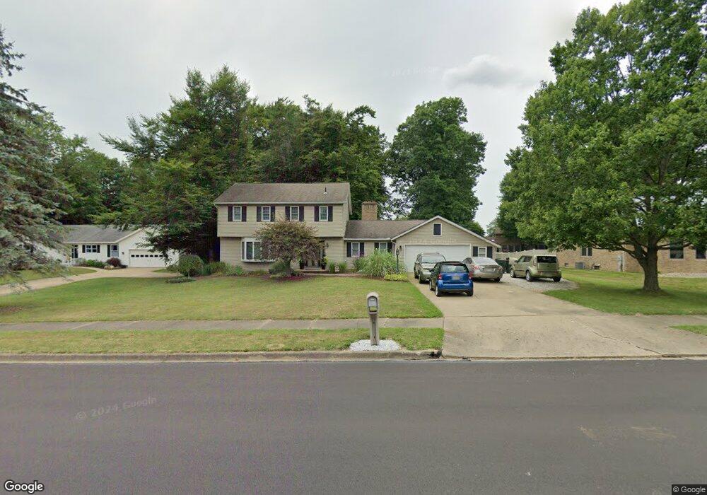
2205 Hedgewood Ave Alliance, OH 44601
Estimated Value: $253,000 - $319,000
4
Beds
3
Baths
1,944
Sq Ft
$145/Sq Ft
Est. Value
About This Home
This home is located at 2205 Hedgewood Ave, Alliance, OH 44601 and is currently estimated at $282,785, approximately $145 per square foot. 2205 Hedgewood Ave is a home located in Stark County with nearby schools including Marlington High School.
Ownership History
Date
Name
Owned For
Owner Type
Purchase Details
Closed on
Jun 10, 2003
Sold by
Watson Donnie and Watson Susan W
Bought by
Loy Derrick E and Loy Shannon K
Current Estimated Value
Home Financials for this Owner
Home Financials are based on the most recent Mortgage that was taken out on this home.
Original Mortgage
$152,000
Outstanding Balance
$66,583
Interest Rate
5.78%
Mortgage Type
Purchase Money Mortgage
Estimated Equity
$216,202
Purchase Details
Closed on
Jun 12, 1996
Sold by
Lepley Clyde A
Bought by
Watson Donnie and Watson Susan
Home Financials for this Owner
Home Financials are based on the most recent Mortgage that was taken out on this home.
Original Mortgage
$125,883
Interest Rate
8.05%
Mortgage Type
New Conventional
Create a Home Valuation Report for This Property
The Home Valuation Report is an in-depth analysis detailing your home's value as well as a comparison with similar homes in the area
Home Values in the Area
Average Home Value in this Area
Purchase History
| Date | Buyer | Sale Price | Title Company |
|---|---|---|---|
| Loy Derrick E | $160,000 | Union Title Co | |
| Watson Donnie | $126,000 | -- |
Source: Public Records
Mortgage History
| Date | Status | Borrower | Loan Amount |
|---|---|---|---|
| Open | Loy Derrick E | $152,000 | |
| Closed | Watson Donnie | $125,883 |
Source: Public Records
Tax History Compared to Growth
Tax History
| Year | Tax Paid | Tax Assessment Tax Assessment Total Assessment is a certain percentage of the fair market value that is determined by local assessors to be the total taxable value of land and additions on the property. | Land | Improvement |
|---|---|---|---|---|
| 2025 | -- | $84,320 | $24,610 | $59,710 |
| 2024 | -- | $84,320 | $24,610 | $59,710 |
| 2023 | $1,790 | $57,860 | $16,000 | $41,860 |
| 2022 | $899 | $57,860 | $16,000 | $41,860 |
| 2021 | $1,803 | $57,860 | $16,000 | $41,860 |
| 2020 | $1,739 | $49,880 | $13,900 | $35,980 |
| 2019 | $1,724 | $49,880 | $13,900 | $35,980 |
| 2018 | $1,726 | $49,880 | $13,900 | $35,980 |
| 2017 | $1,542 | $44,870 | $11,620 | $33,250 |
| 2016 | $1,478 | $42,980 | $11,620 | $31,360 |
| 2015 | $1,480 | $42,980 | $11,620 | $31,360 |
| 2014 | $1,489 | $39,590 | $10,710 | $28,880 |
| 2013 | $745 | $39,590 | $10,710 | $28,880 |
Source: Public Records
Map
Nearby Homes
- 2851 Patriots Path Unit 3D
- 0 Easton St NE
- 0 Valewood Cir Unit 5006281
- 1870 Northview Ave
- 0 Winchester St
- 0 Winchester St Unit 5162877
- 2195 Blenheim Ave
- 3030 Center Ave
- 1201 Overlook Dr
- 1059 Oakwood Dr
- 1042 Hartshorn St
- 0 W Main St Unit 5090123
- 856 Birchwood Dr
- 1030 Sunset Dr
- 2245 Ridgewood Ave
- 1039 Glamorgan St
- 970 Kingsway St
- 1136 Parkway Blvd
- 1050 Parkway Blvd
- 10666 Wilma Ave NE
- 2189 Hedgewood Ave
- 2221 Hedgewood Ave
- 2188 Sunray Cir
- 2171 Hedgewood Ave
- 2174 Sunray Cir
- 2196 Sunray Cir
- 2392 Cambury St
- 2156 Sunray Cir
- 2381 Cambury St
- 2382 Cambury St
- 2140 Sunray Cir
- 2195 Sunray Cir
- 2154 Hedgewood Ave
- 2187 Sunray Cir
- 2371 Cambury St
- 2137 Hedgewood Ave
- 2372 Cambury St
- 2124 Sunray Cir
- 2138 Hedgewood Ave Unit 2138
- 2155 Sunray Cir