Estimated Value: $229,478 - $311,000
Studio
3
Baths
1,824
Sq Ft
$148/Sq Ft
Est. Value
About This Home
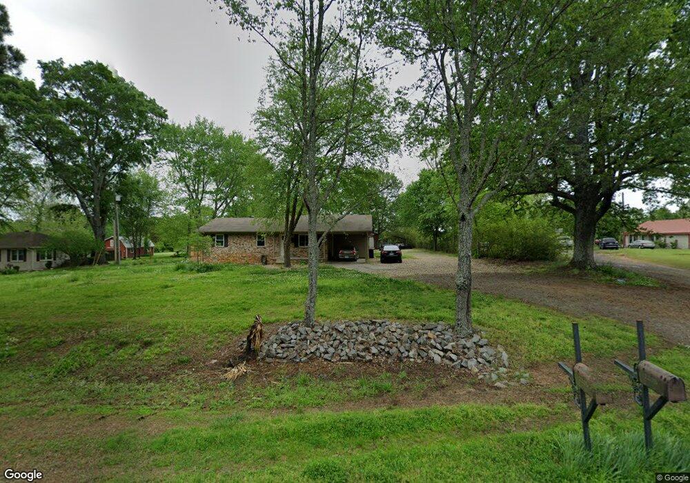
This home is located at 2205 Highway 321 N, Ward, AR 72176 and is currently estimated at $270,370, approximately $148 per square foot. 2205 Highway 321 N is a home located in Lonoke County with nearby schools including Eastside Elementary School, Cabot Middle School North, and Cabot Junior High North.
Ownership History
Date
Name
Owned For
Owner Type
Purchase Details
Closed on
Nov 26, 2018
Sold by
Emerson Larry D and Emerson Diane
Bought by
Creel Amanda and Creel John
Current Estimated Value
Home Financials for this Owner
Home Financials are based on the most recent Mortgage that was taken out on this home.
Original Mortgage
$133,000
Outstanding Balance
$79,094
Interest Rate
4.8%
Mortgage Type
New Conventional
Estimated Equity
$191,276
Purchase Details
Closed on
Jun 4, 1993
Bought by
Emerson
Create a Home Valuation Report for This Property
The Home Valuation Report is an in-depth analysis detailing your home's value as well as a comparison with similar homes in the area
Purchase History
| Date | Buyer | Sale Price | Title Company |
|---|---|---|---|
| Creel Amanda | $168,000 | Cabot Title | |
| Emerson | $65,000 | -- | |
| Emerson | $65,000 | -- |
Source: Public Records
Mortgage History
| Date | Status | Borrower | Loan Amount |
|---|---|---|---|
| Open | Creel Amanda | $133,000 |
Source: Public Records
Tax History
| Year | Tax Paid | Tax Assessment Tax Assessment Total Assessment is a certain percentage of the fair market value that is determined by local assessors to be the total taxable value of land and additions on the property. | Land | Improvement |
|---|---|---|---|---|
| 2025 | $1,464 | $31,900 | $2,000 | $29,900 |
| 2024 | $1,464 | $31,900 | $2,000 | $29,900 |
| 2023 | $1,360 | $31,900 | $2,000 | $29,900 |
| 2022 | $985 | $31,900 | $2,000 | $29,900 |
| 2021 | $923 | $31,900 | $2,000 | $29,900 |
| 2020 | $861 | $26,920 | $1,500 | $25,420 |
| 2019 | $861 | $26,920 | $1,500 | $25,420 |
| 2018 | $886 | $26,920 | $1,500 | $25,420 |
| 2017 | $1,141 | $26,920 | $1,500 | $25,420 |
| 2016 | $1,236 | $26,920 | $1,500 | $25,420 |
| 2015 | $1,088 | $25,670 | $1,500 | $24,170 |
| 2014 | $1,178 | $25,670 | $1,500 | $24,170 |
Source: Public Records
Map
Nearby Homes
- 2227 Highway 321 N
- 2330 Highway 321 N
- 2255 Highway 321 N
- Lot 50 Patty Dr
- 50 Patty Rd
- 2422 Arkansas 321
- 2422 Highway 321 N
- 30 ac Arkansas 321
- 2205 Arkansas 321
- 193 Patty Rd
- 2183 Highway 321 N
- 2121 Highway 321 N
- 2545 Highway 321 N
- 000 Ray Sowell Rd
- 00 Ray Sowell Rd
- 2504 Highway 321 N
- 2504 Ar Hwy 321
- 235 Patty Rd
- 2466 Ray Sowell Rd
- 2477 Ray Sowell Rd
Your Personal Tour Guide
Ask me questions while you tour the home.