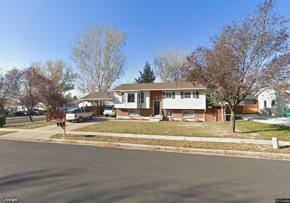
2205 N 1100 W Layton, UT 84041
Estimated Value: $389,000 - $444,000
5
Beds
2
Baths
1,969
Sq Ft
$216/Sq Ft
Est. Value
About This Home
This home is located at 2205 N 1100 W, Layton, UT 84041 and is currently estimated at $424,545, approximately $215 per square foot. 2205 N 1100 W is a home located in Davis County with nearby schools including Lincoln Elementary School, North Layton Junior High School, and Northridge High School.
Ownership History
Date
Name
Owned For
Owner Type
Purchase Details
Closed on
Apr 5, 2013
Sold by
Vine Michael G
Bought by
Merrihew Kain G and Marrihew Katelyn Rose
Current Estimated Value
Home Financials for this Owner
Home Financials are based on the most recent Mortgage that was taken out on this home.
Original Mortgage
$168,547
Interest Rate
3.54%
Mortgage Type
VA
Purchase Details
Closed on
Jun 23, 2009
Sold by
Aldridge Dustin J and Williams Laura J
Bought by
Vine Michael G
Home Financials for this Owner
Home Financials are based on the most recent Mortgage that was taken out on this home.
Original Mortgage
$137,750
Interest Rate
4.83%
Mortgage Type
Purchase Money Mortgage
Purchase Details
Closed on
Nov 30, 2006
Sold by
Smith Roberta Diane
Bought by
Aldridge Dustin J and Williams Laura J
Home Financials for this Owner
Home Financials are based on the most recent Mortgage that was taken out on this home.
Original Mortgage
$32,000
Interest Rate
6.38%
Mortgage Type
Stand Alone Second
Purchase Details
Closed on
Apr 12, 2005
Sold by
Haase Kristina
Bought by
Smith Roberta Diane
Purchase Details
Closed on
Nov 3, 2003
Sold by
Smith Marty Dale and Smith Lance Edward
Bought by
Haase Kristina
Home Financials for this Owner
Home Financials are based on the most recent Mortgage that was taken out on this home.
Original Mortgage
$110,500
Interest Rate
7.75%
Mortgage Type
Purchase Money Mortgage
Purchase Details
Closed on
Sep 16, 2003
Sold by
Smith Marty Dale
Bought by
Smith Marty Dale and Smith Lance Edward
Home Financials for this Owner
Home Financials are based on the most recent Mortgage that was taken out on this home.
Original Mortgage
$110,500
Interest Rate
7.75%
Mortgage Type
Purchase Money Mortgage
Create a Home Valuation Report for This Property
The Home Valuation Report is an in-depth analysis detailing your home's value as well as a comparison with similar homes in the area
Home Values in the Area
Average Home Value in this Area
Purchase History
| Date | Buyer | Sale Price | Title Company |
|---|---|---|---|
| Merrihew Kain G | -- | Security Title Of Davis Coun | |
| Vine Michael G | -- | Surety Title Agency | |
| Aldridge Dustin J | -- | Equity Title Ins Agency Inc | |
| Smith Roberta Diane | -- | None Available | |
| Haase Kristina | -- | -- | |
| Smith Marty Dale | -- | Surety Title Agency | |
| Smith Marty Dale | -- | Surety Title Agency |
Source: Public Records
Mortgage History
| Date | Status | Borrower | Loan Amount |
|---|---|---|---|
| Previous Owner | Merrihew Kain G | $168,547 | |
| Previous Owner | Vine Michael G | $137,750 | |
| Previous Owner | Aldridge Dustin J | $32,000 | |
| Previous Owner | Aldridge Dustin J | $128,000 | |
| Previous Owner | Smith Marty Dale | $110,500 |
Source: Public Records
Tax History Compared to Growth
Tax History
| Year | Tax Paid | Tax Assessment Tax Assessment Total Assessment is a certain percentage of the fair market value that is determined by local assessors to be the total taxable value of land and additions on the property. | Land | Improvement |
|---|---|---|---|---|
| 2025 | $1,954 | $205,150 | $96,355 | $108,795 |
| 2024 | $1,878 | $198,549 | $112,306 | $86,243 |
| 2023 | $1,872 | $191,950 | $73,604 | $118,345 |
| 2022 | $1,929 | $355,000 | $128,480 | $226,520 |
| 2021 | $1,775 | $268,000 | $98,877 | $169,123 |
| 2020 | $1,602 | $232,000 | $83,301 | $148,699 |
| 2019 | $1,608 | $228,000 | $79,210 | $148,790 |
| 2018 | $1,454 | $207,000 | $79,210 | $127,790 |
| 2016 | $1,170 | $85,910 | $25,176 | $60,734 |
| 2015 | $1,176 | $81,980 | $25,176 | $56,804 |
| 2014 | $966 | $68,891 | $25,176 | $43,715 |
| 2013 | -- | $76,775 | $18,612 | $58,163 |
Source: Public Records
Map
Nearby Homes
- 1155 W 2200 N
- 2298 N 1085 W
- 2149 N 750 W
- 1094 N Angel St W
- 1036 N Angel St W
- 2211 N 525 W
- 1574 W 1920 N
- 1606 W 1960 N
- 1615 N Angel St W
- 506 W 2200 N
- 1425 W 1650 N
- 2248 N 500 W
- 2233 N 475 W
- 1615 N Angel St Unit F
- 1615 N Angel St Unit I
- 1615 N Angel St Unit E
- 1615 N Angel St Unit B
- 1615 N Angel St
- 1615 N Angel St Unit C
- 1615 N Angel St Unit H
- 2219 N 1100 W
- 2206 N 1150 W
- 2206 N 1100 W
- 1111 W 2200 N
- 2222 N 1150 W
- 1101 W 2200 N
- 2220 N 1100 W
- 1121 W 2200 N
- 2233 N 1100 W
- 1091 W 2200 N
- 1080 W 2200 N
- 1149 W 2200 N
- 2234 N 1100 W
- 2223 N 1050 W
- 2224 N 1150 W
- 1113 Spring Creek Dr
- 1119 Spring Creek Dr
- 1160 W 2200 N
- 1070 W 2200 N
- 1127 Spring Creek Dr