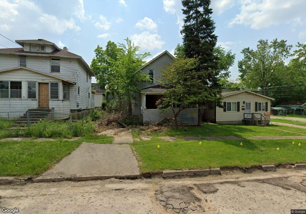
2205 Reid St Flint, MI 48503
Southwest Flint NeighborhoodEstimated Value: $48,000 - $68,000
3
Beds
1
Bath
1,181
Sq Ft
$49/Sq Ft
Est. Value
About This Home
This home is located at 2205 Reid St, Flint, MI 48503 and is currently estimated at $58,000, approximately $49 per square foot. 2205 Reid St is a home located in Genesee County with nearby schools including Eisenhower School, St. Paul Lutheran School, and St John Vianney Catholic School.
Ownership History
Date
Name
Owned For
Owner Type
Purchase Details
Closed on
Dec 16, 2024
Sold by
Genesee County Land Bank Authority
Bought by
Aagr Llc
Current Estimated Value
Purchase Details
Closed on
Dec 19, 2019
Sold by
Cherry Deborah L
Bought by
County Land Bank Authority
Purchase Details
Closed on
Apr 19, 2017
Sold by
Stair Philip G
Bought by
Carter David J
Purchase Details
Closed on
Apr 5, 2013
Sold by
The Genesee County Land Bank Authority
Bought by
Carter David J
Purchase Details
Closed on
Dec 20, 2012
Sold by
Cherry Deborah L and Genesee County Treasurer
Bought by
Genesee County Land Bank
Purchase Details
Closed on
Apr 1, 2010
Sold by
Racely William F
Bought by
Carter Jeremy
Create a Home Valuation Report for This Property
The Home Valuation Report is an in-depth analysis detailing your home's value as well as a comparison with similar homes in the area
Home Values in the Area
Average Home Value in this Area
Purchase History
| Date | Buyer | Sale Price | Title Company |
|---|---|---|---|
| Aagr Llc | $2,500 | None Listed On Document | |
| County Land Bank Authority | -- | None Available | |
| Carter David J | -- | None Available | |
| Carter David J | $4,000 | None Available | |
| Genesee County Land Bank | -- | None Available | |
| Carter Jeremy | -- | None Available |
Source: Public Records
Mortgage History
| Date | Status | Borrower | Loan Amount |
|---|---|---|---|
| Closed | Carter David J | $0 |
Source: Public Records
Tax History Compared to Growth
Tax History
| Year | Tax Paid | Tax Assessment Tax Assessment Total Assessment is a certain percentage of the fair market value that is determined by local assessors to be the total taxable value of land and additions on the property. | Land | Improvement |
|---|---|---|---|---|
| 2025 | -- | $16,900 | $0 | $0 |
| 2024 | -- | $0 | $0 | $0 |
| 2023 | -- | $0 | $0 | $0 |
| 2022 | $0 | $0 | $0 | $0 |
| 2021 | $0 | $0 | $0 | $0 |
| 2020 | $268 | $0 | $0 | $0 |
| 2019 | $669 | $8,600 | $0 | $0 |
| 2018 | $727 | $9,800 | $0 | $0 |
| 2017 | $737 | $0 | $0 | $0 |
| 2016 | $733 | $0 | $0 | $0 |
| 2015 | -- | $0 | $0 | $0 |
| 2014 | -- | $0 | $0 | $0 |
| 2012 | -- | $7,800 | $0 | $0 |
Source: Public Records
Map
Nearby Homes
- 2124 Swayze St
- 2437 Zimmerman St
- 1402 Woodcroft Ave
- 1926 W Court St
- 1412 Durand St
- 2429 Brown St
- 2464 Gibson St
- 2433 Brown St
- 2509 Corunna Rd
- 1202 Pershing St
- 1505 Downey St
- 1506 Downey St
- 2537 Swayze St
- 2608 Cumings Ave
- 2618 Brown St
- 1006 Hammond Ave
- 1516 Gainey Ave
- 1820 Chelsea Cir
- 1810 Chelsea Cir
- 1725 Lincoln Dr