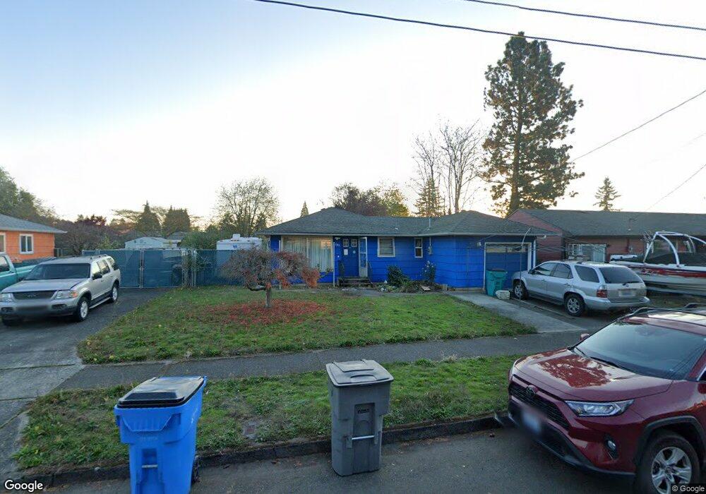
2205 Sheridan Dr Vancouver, WA 98661
Meadow Homes NeighborhoodEstimated Value: $368,000 - $396,937
3
Beds
1
Bath
999
Sq Ft
$386/Sq Ft
Est. Value
About This Home
This home is located at 2205 Sheridan Dr, Vancouver, WA 98661 and is currently estimated at $385,234, approximately $385 per square foot. 2205 Sheridan Dr is a home located in Clark County with nearby schools including Martin Luther King Elementary School, McLoughlin Middle School, and Fort Vancouver High School.
Ownership History
Date
Name
Owned For
Owner Type
Purchase Details
Closed on
Oct 13, 2005
Sold by
Phan Lieu
Bought by
Sparks Leslie D
Current Estimated Value
Home Financials for this Owner
Home Financials are based on the most recent Mortgage that was taken out on this home.
Original Mortgage
$33,000
Interest Rate
5.68%
Mortgage Type
Fannie Mae Freddie Mac
Purchase Details
Closed on
May 23, 2000
Sold by
Antush Ruth A
Bought by
Rohlfing Chris
Home Financials for this Owner
Home Financials are based on the most recent Mortgage that was taken out on this home.
Original Mortgage
$95,500
Interest Rate
8.08%
Create a Home Valuation Report for This Property
The Home Valuation Report is an in-depth analysis detailing your home's value as well as a comparison with similar homes in the area
Home Values in the Area
Average Home Value in this Area
Purchase History
| Date | Buyer | Sale Price | Title Company |
|---|---|---|---|
| Sparks Leslie D | -- | Stewart Title | |
| Sparks Leslie D | $165,000 | Stewart Title | |
| Rohlfing Chris | $98,500 | Charter Title Corporation |
Source: Public Records
Mortgage History
| Date | Status | Borrower | Loan Amount |
|---|---|---|---|
| Closed | Sparks Leslie D | $33,000 | |
| Open | Sparks Leslie D | $132,000 | |
| Closed | Sparks Leslie D | $33,000 | |
| Previous Owner | Rohlfing Chris | $95,500 |
Source: Public Records
Tax History Compared to Growth
Tax History
| Year | Tax Paid | Tax Assessment Tax Assessment Total Assessment is a certain percentage of the fair market value that is determined by local assessors to be the total taxable value of land and additions on the property. | Land | Improvement |
|---|---|---|---|---|
| 2025 | $3,442 | $363,253 | $185,022 | $178,231 |
| 2024 | $3,222 | $352,210 | $185,022 | $167,188 |
| 2023 | $3,172 | $344,173 | $181,776 | $162,397 |
| 2022 | $3,017 | $340,176 | $181,776 | $158,400 |
| 2021 | $2,748 | $301,501 | $162,300 | $139,201 |
| 2020 | $2,481 | $258,817 | $121,448 | $137,369 |
| 2019 | $2,336 | $242,152 | $106,746 | $135,406 |
| 2018 | $2,315 | $236,111 | $0 | $0 |
| 2017 | $2,096 | $194,309 | $0 | $0 |
| 2016 | $1,835 | $183,536 | $0 | $0 |
| 2015 | $1,667 | $153,536 | $0 | $0 |
| 2014 | -- | $131,842 | $0 | $0 |
| 2013 | -- | $121,072 | $0 | $0 |
Source: Public Records
Map
Nearby Homes
- 3921 E Fourth Plain Blvd
- 3921 E Fourth Plain Blvd Unit 53
- 3921 E 4th Plain Blvd Unit 54
- 3909 E Fourth Plain Blvd Unit 11
- 3909 E Fourth Plain Blvd Unit 4
- 3909 E Fourth Plain Blvd Unit 61
- 3909 E Fourth Plain Blvd
- 3909 E 4th Plain Blvd Unit 47
- 4613 E 18th St Unit 28
- 4001 E 18th St
- 4311 Plomondon St
- 3903 E 18th St Unit 22
- 3903 E 18th St
- 5301 Plomondon St Unit F24
- 4305 E 15th St
- 13 Algona Dr
- 0 Falk Rd
- 1620 Brandt Rd
- 1307 Ogden Ave
- 1618 Brandt Rd
- 2301 Sheridan Dr
- 2203 Sheridan Dr
- 4706 Sheridan Dr
- 2210 General Anderson Rd
- 2305 Sheridan Dr
- 4710 Sheridan Dr
- 2300 General Anderson Rd
- 2210 General Anderson Ave
- 2300 Sheridan Dr
- 2300 General Anderson Ave
- 2304 General Anderson Rd
- 2200 General Anderson Rd
- 2307 Sheridan Dr
- 2204 Sheridan Dr
- 2308 General Anderson Rd
- 2200 Sheridan Dr
- 2316 Sheridan Dr
- 2313 Sheridan Dr
- 2304 Sheridan Dr
- 2312 General Anderson Rd