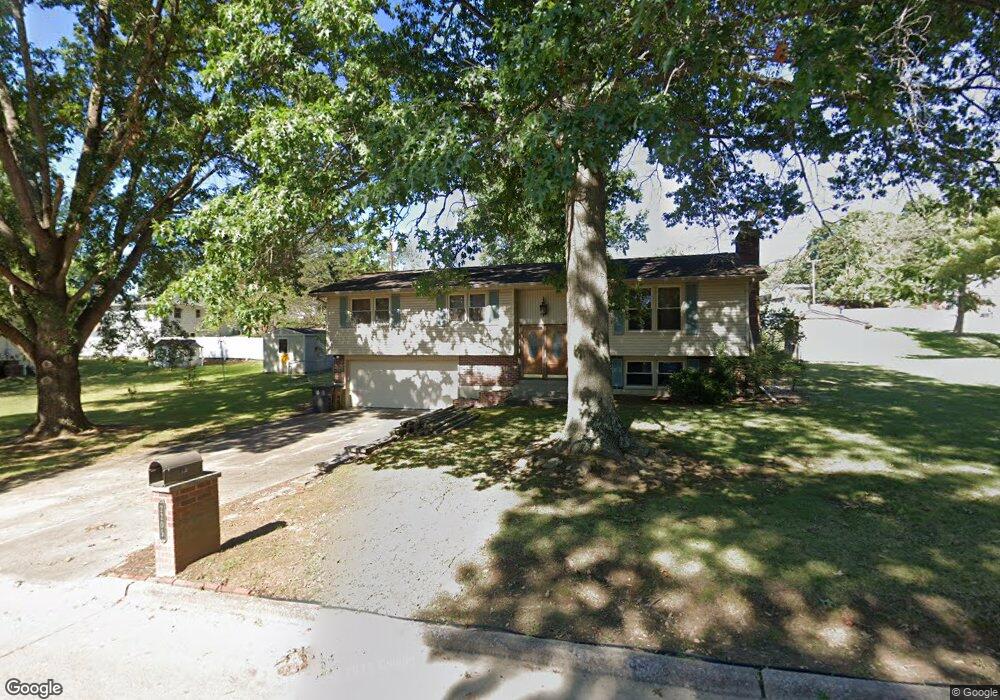
2205 Sherwood Dr Cape Girardeau, MO 63701
Estimated Value: $218,202 - $245,000
4
Beds
3
Baths
1,275
Sq Ft
$181/Sq Ft
Est. Value
About This Home
This home is located at 2205 Sherwood Dr, Cape Girardeau, MO 63701 and is currently estimated at $230,801, approximately $181 per square foot. 2205 Sherwood Dr is a home located in Cape Girardeau County with nearby schools including Alma Schrader Elementary School, Central Middle School, and Central Junior High School.
Ownership History
Date
Name
Owned For
Owner Type
Purchase Details
Closed on
Jul 5, 2007
Sold by
Khsura Shirley and Khsura Shirley B
Bought by
Oslund Michael D and Oslund Pamela J
Current Estimated Value
Home Financials for this Owner
Home Financials are based on the most recent Mortgage that was taken out on this home.
Original Mortgage
$132,905
Outstanding Balance
$82,504
Interest Rate
6.37%
Mortgage Type
New Conventional
Estimated Equity
$148,297
Create a Home Valuation Report for This Property
The Home Valuation Report is an in-depth analysis detailing your home's value as well as a comparison with similar homes in the area
Home Values in the Area
Average Home Value in this Area
Purchase History
| Date | Buyer | Sale Price | Title Company |
|---|---|---|---|
| Oslund Michael D | -- | None Available |
Source: Public Records
Mortgage History
| Date | Status | Borrower | Loan Amount |
|---|---|---|---|
| Open | Oslund Michael D | $132,905 |
Source: Public Records
Tax History Compared to Growth
Tax History
| Year | Tax Paid | Tax Assessment Tax Assessment Total Assessment is a certain percentage of the fair market value that is determined by local assessors to be the total taxable value of land and additions on the property. | Land | Improvement |
|---|---|---|---|---|
| 2025 | $11 | $23,030 | $3,980 | $19,050 |
| 2024 | $11 | $21,930 | $3,790 | $18,140 |
| 2023 | $1,140 | $21,930 | $3,790 | $18,140 |
| 2022 | $1,051 | $20,220 | $3,500 | $16,720 |
| 2021 | $1,051 | $20,220 | $3,500 | $16,720 |
| 2020 | $1,054 | $20,220 | $3,500 | $16,720 |
| 2019 | $1,053 | $20,220 | $0 | $0 |
| 2018 | $1,051 | $20,220 | $0 | $0 |
| 2017 | $1,053 | $20,220 | $0 | $0 |
| 2016 | $986 | $19,000 | $0 | $0 |
| 2015 | $968 | $18,640 | $0 | $0 |
| 2014 | $1,189 | $22,780 | $0 | $0 |
Source: Public Records
Map
Nearby Homes
- 1912 Perryville Rd
- 1938 Westwood Dr
- 1960 Briarwood Dr
- 2323 Brookwood Dr
- 1623 Lexington Ave
- 1608 Lexington Ave
- 1717 Perryville Rd
- 1572 Lexington Ave
- 1701 Brookwood Dr
- 1577 Saratoga St
- 2412 Masters Dr
- 1910 Sherwood Dr
- 2062 Concord Place
- 1966 Randol Ave
- 1835 Westridge Dr
- 1413 Parkmor Dr
- 1553 Valley Forge Ln
- 2449 Janet Dr
- 1230 Brookshire Rd Unit 1230 & 1232
- 2550 Marvin St
- 1905 Perryville Rd
- 2210 Sherwood Dr
- 2213 Sherwood Dr
- 2202 Sherwood Dr
- 1808 Weissinger Ln E
- 1909 Perryville Rd
- 2138 Sherwood Dr
- 2212 Sherwood Dr
- 1814 Weissinger Ln E
- 1852 Perryville Rd
- 2214 Sherwood Dr
- 2134 Sherwood Dr
- 1913 Perryville Rd
- 2219 Sherwood Dr
- 1904 Weissinger Ln E
- 1908 Perryville Rd
- 2205 Hillbrook Dr
- 2130 Sherwood Dr
- 2218 Sherwood Dr
- 1917 Perryville Rd