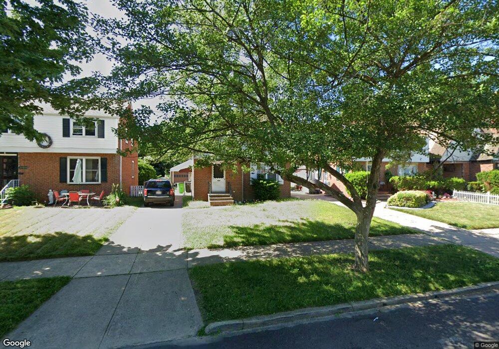
22050 Roberts Ave Euclid, OH 44123
Estimated Value: $128,000 - $194,000
3
Beds
1
Bath
1,300
Sq Ft
$119/Sq Ft
Est. Value
About This Home
This home is located at 22050 Roberts Ave, Euclid, OH 44123 and is currently estimated at $155,224, approximately $119 per square foot. 22050 Roberts Ave is a home located in Cuyahoga County with nearby schools including Arbor Elementary School, Euclid Middle School, and Euclid High School.
Ownership History
Date
Name
Owned For
Owner Type
Purchase Details
Closed on
Oct 28, 2021
Sold by
Kennelly Holdings Llc
Bought by
Buffalo Properties Mgmt Holdings Iv Llc
Current Estimated Value
Purchase Details
Closed on
Mar 5, 2020
Sold by
12345 Norman Properties Llc
Bought by
Kennelly Holdings Llc
Purchase Details
Closed on
Oct 17, 2013
Sold by
Mercadante Joseph
Bought by
12345 Norman Properties Llc
Purchase Details
Closed on
Oct 11, 2013
Sold by
Oriti Joseph
Bought by
Mercadante Joseph
Purchase Details
Closed on
Dec 27, 2004
Sold by
Mercadante Joseph M
Bought by
Oriti Joseph
Home Financials for this Owner
Home Financials are based on the most recent Mortgage that was taken out on this home.
Original Mortgage
$102,510
Interest Rate
5.87%
Mortgage Type
Construction
Purchase Details
Closed on
Nov 29, 2004
Sold by
Smith Jim
Bought by
Mercadante Joseph M
Home Financials for this Owner
Home Financials are based on the most recent Mortgage that was taken out on this home.
Original Mortgage
$102,510
Interest Rate
5.87%
Mortgage Type
Construction
Purchase Details
Closed on
Sep 27, 1996
Sold by
Raffurty Elizabeth N
Bought by
Smith Jim
Home Financials for this Owner
Home Financials are based on the most recent Mortgage that was taken out on this home.
Original Mortgage
$79,800
Interest Rate
7.97%
Mortgage Type
New Conventional
Purchase Details
Closed on
Nov 26, 1991
Sold by
Bandi Pamela
Bought by
Raffurty Raymond W
Purchase Details
Closed on
Jul 22, 1988
Sold by
Czeck James E and Pamela Bandi
Bought by
Bandi Pamela
Purchase Details
Closed on
Jul 21, 1983
Sold by
Defranco Virginia M
Bought by
Czeck James E and Pamela Bandi
Purchase Details
Closed on
Aug 28, 1975
Sold by
Defranco Jos L and Defranco Virginia
Bought by
Defranco Virginia M
Purchase Details
Closed on
Jan 1, 1975
Bought by
Defranco Jos L and Defranco Virginia
Create a Home Valuation Report for This Property
The Home Valuation Report is an in-depth analysis detailing your home's value as well as a comparison with similar homes in the area
Home Values in the Area
Average Home Value in this Area
Purchase History
| Date | Buyer | Sale Price | Title Company |
|---|---|---|---|
| Buffalo Properties Mgmt Holdings Iv Llc | $125,000 | Ohio Real Title | |
| Kennelly Holdings Llc | $36,000 | Enterprise Title Agency | |
| 12345 Norman Properties Llc | $27,000 | Golden Eagle Title | |
| Mercadante Joseph | -- | Golden Eagle Title | |
| Oriti Joseph | -- | -- | |
| Mercadante Joseph M | $113,900 | Executive Title Agency | |
| Smith Jim | $84,000 | -- | |
| Raffurty Raymond W | $76,900 | -- | |
| Bandi Pamela | -- | -- | |
| Czeck James E | $63,000 | -- | |
| Defranco Virginia M | -- | -- | |
| Defranco Jos L | -- | -- |
Source: Public Records
Mortgage History
| Date | Status | Borrower | Loan Amount |
|---|---|---|---|
| Previous Owner | Mercadante Joseph M | $102,510 | |
| Previous Owner | Smith Jim | $79,800 |
Source: Public Records
Tax History Compared to Growth
Tax History
| Year | Tax Paid | Tax Assessment Tax Assessment Total Assessment is a certain percentage of the fair market value that is determined by local assessors to be the total taxable value of land and additions on the property. | Land | Improvement |
|---|---|---|---|---|
| 2024 | $3,507 | $50,225 | $9,450 | $40,775 |
| 2023 | $3,094 | $35,210 | $6,790 | $28,420 |
| 2022 | $3,025 | $35,210 | $6,790 | $28,420 |
| 2021 | $3,377 | $35,210 | $6,790 | $28,420 |
| 2020 | $3,429 | $32,620 | $6,300 | $26,320 |
| 2019 | $3,092 | $93,200 | $18,000 | $75,200 |
| 2018 | $3,093 | $32,620 | $6,300 | $26,320 |
| 2017 | $1,157 | $9,450 | $5,250 | $4,200 |
| 2016 | $1,159 | $9,450 | $5,250 | $4,200 |
| 2015 | $1,084 | $9,450 | $5,250 | $4,200 |
| 2014 | $1,084 | $9,450 | $5,250 | $4,200 |
Source: Public Records
Map
Nearby Homes
- 22000 Kennison Ave
- 21561 Maydale Ave
- 22301 Milton Dr
- 421 Kenwood Dr Unit G
- 430 Kenwood Dr Unit C11
- 441 Kenwood Dr Unit M
- 450 Kenwood Dr Unit E12
- 290 E 216th St
- 22751 Fox Ave
- 470 Kenwood Dr Unit D
- 461 Kenwood Dr Unit T3
- 490 Kenwood Dr Unit B
- 362 E 214th St
- 521 Kenwood Dr Unit A5
- 254 E 214th St
- 21251 S Lake Shore Blvd
- 226 E 216th St
- 21051 S Lake Shore Blvd
- 231 E 210th St
- 273 E 208th St
- 22020 Roberts Ave
- 22080 Roberts Ave
- 21990 Roberts Ave
- 21960 Roberts Ave
- 434 E 222nd St
- 430 E 222nd St
- 440 E 222nd St
- 22051 Maydale Ave
- 22021 Maydale Ave
- 22081 Maydale Ave
- 444 E 222nd St
- 22001 Maydale Ave
- 21930 Roberts Ave
- 448 E 222nd St
- 21961 Maydale Ave
- 22051 Roberts Ave
- 424 E 222nd St
- 22081 Roberts Ave
- 22021 Roberts Ave
- 21900 Roberts Ave