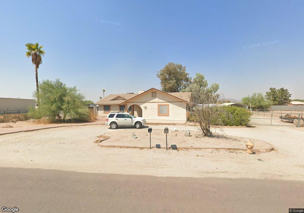
22050 W Ripple Rd Buckeye, AZ 85326
Estimated Value: $494,473 - $588,000
3
Beds
2
Baths
1,734
Sq Ft
$316/Sq Ft
Est. Value
About This Home
This home is located at 22050 W Ripple Rd, Buckeye, AZ 85326 and is currently estimated at $548,118, approximately $316 per square foot. 22050 W Ripple Rd is a home located in Maricopa County with nearby schools including Liberty Elementary School, Youngker High School, and The Odyssey Institute for Advanced and International Studies.
Ownership History
Date
Name
Owned For
Owner Type
Purchase Details
Closed on
Mar 14, 2001
Sold by
Rice Gene G and Rice Geraldine C
Bought by
Kendall David B
Current Estimated Value
Home Financials for this Owner
Home Financials are based on the most recent Mortgage that was taken out on this home.
Original Mortgage
$173,555
Outstanding Balance
$63,007
Interest Rate
6.98%
Mortgage Type
VA
Estimated Equity
$485,111
Purchase Details
Closed on
Jun 9, 1995
Sold by
Karre Dennis C and Karre Toni L
Bought by
Rice Gene G and Rice Geraldine C
Home Financials for this Owner
Home Financials are based on the most recent Mortgage that was taken out on this home.
Original Mortgage
$117,300
Interest Rate
7.62%
Mortgage Type
New Conventional
Create a Home Valuation Report for This Property
The Home Valuation Report is an in-depth analysis detailing your home's value as well as a comparison with similar homes in the area
Home Values in the Area
Average Home Value in this Area
Purchase History
| Date | Buyer | Sale Price | Title Company |
|---|---|---|---|
| Kendall David B | $168,500 | Capital Title Agency | |
| Rice Gene G | $123,500 | First American Title |
Source: Public Records
Mortgage History
| Date | Status | Borrower | Loan Amount |
|---|---|---|---|
| Open | Kendall David B | $173,555 | |
| Previous Owner | Rice Gene G | $117,300 |
Source: Public Records
Tax History Compared to Growth
Tax History
| Year | Tax Paid | Tax Assessment Tax Assessment Total Assessment is a certain percentage of the fair market value that is determined by local assessors to be the total taxable value of land and additions on the property. | Land | Improvement |
|---|---|---|---|---|
| 2025 | $1,855 | $19,491 | -- | -- |
| 2024 | $1,845 | $18,563 | -- | -- |
| 2023 | $1,845 | $38,310 | $7,660 | $30,650 |
| 2022 | $1,710 | $31,000 | $6,200 | $24,800 |
| 2021 | $1,814 | $28,700 | $5,740 | $22,960 |
| 2020 | $1,731 | $27,470 | $5,490 | $21,980 |
| 2019 | $1,593 | $24,680 | $4,930 | $19,750 |
| 2018 | $1,529 | $21,320 | $4,260 | $17,060 |
| 2017 | $1,491 | $18,630 | $3,720 | $14,910 |
| 2016 | $1,428 | $17,980 | $3,590 | $14,390 |
| 2015 | $1,423 | $17,150 | $3,430 | $13,720 |
Source: Public Records
Map
Nearby Homes
- 2038 S 221st Ave
- 22038 W Hilton Ave
- 22029 W Hopi St
- 22417 W Lower Buckeye Rd
- 1799 S 221st Ave
- 22145 W Ashleigh Marie Dr
- 2521 S 217th Dr
- 22504 W Meade Ln
- 21884 W Hopi St
- 21686 W Hess Ave
- 1897 S 217th Ave
- 2401 S 226th Dr
- 22354 W Mohave St
- 12510 S 218th Ln Unit n/a
- 1673 S 218th Ave
- 21877 W Sonora St
- 1779 S 225th Ave
- 1492 S 218th Ln
- 21972 W Pima St
- 21873 W Pima St
- 22051 W Ripple Rd
- 22101 W Meade Ln
- 22101 W Ripple Rd
- 22035 W Ripple Rd
- 22034 W Ripple Rd
- 22113 W Ripple Rd
- 2421 S 221st Ave
- 22031 W Ripple Rd
- 22115 W Meade Ln
- 00000 W Ripple Rd Unit 217
- 2420 S 221st Ave
- 2411 S 221st Ave
- 22102 W Meade Ln
- 22130 W Ripple Rd
- 22012 W Ripple Rd
- 22125 W Meade Ln
- 22129 W Ripple Rd Unit 216
- 22129 W Ripple Rd
- 22011 W Ripple Rd
- 22126 W Meade Ln Unit 183