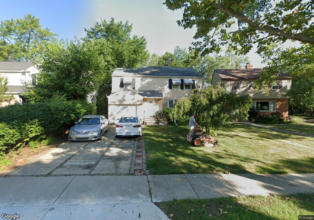
2206 Campus Rd Beachwood, OH 44122
Estimated Value: $340,685 - $377,000
3
Beds
2
Baths
1,944
Sq Ft
$186/Sq Ft
Est. Value
About This Home
This home is located at 2206 Campus Rd, Beachwood, OH 44122 and is currently estimated at $361,921, approximately $186 per square foot. 2206 Campus Rd is a home located in Cuyahoga County with nearby schools including Gearity Professional Development School, Monticello Middle School, and Cleveland Heights High School.
Ownership History
Date
Name
Owned For
Owner Type
Purchase Details
Closed on
Nov 1, 1999
Sold by
Last Will Of Ratner Zelda
Bought by
Blyumin Vladimir I and Tarkhanova Yelena
Current Estimated Value
Home Financials for this Owner
Home Financials are based on the most recent Mortgage that was taken out on this home.
Original Mortgage
$118,800
Outstanding Balance
$30,080
Interest Rate
5.5%
Estimated Equity
$331,841
Purchase Details
Closed on
Oct 23, 1990
Sold by
Ratner Bernard
Bought by
Ratner Zelda
Purchase Details
Closed on
Nov 21, 1983
Sold by
Ratner Bernard and Ratner Zelda S
Bought by
Ratner Bernard
Purchase Details
Closed on
Jan 1, 1975
Bought by
Ratner Bernard and Ratner Zelda S
Create a Home Valuation Report for This Property
The Home Valuation Report is an in-depth analysis detailing your home's value as well as a comparison with similar homes in the area
Home Values in the Area
Average Home Value in this Area
Purchase History
| Date | Buyer | Sale Price | Title Company |
|---|---|---|---|
| Blyumin Vladimir I | $148,500 | -- | |
| Ratner Zelda | -- | -- | |
| Ratner Bernard | -- | -- | |
| Ratner Bernard | -- | -- |
Source: Public Records
Mortgage History
| Date | Status | Borrower | Loan Amount |
|---|---|---|---|
| Open | Blyumin Vladimir I | $118,800 | |
| Closed | Blyumin Vladimir I | $26,000 |
Source: Public Records
Tax History Compared to Growth
Tax History
| Year | Tax Paid | Tax Assessment Tax Assessment Total Assessment is a certain percentage of the fair market value that is determined by local assessors to be the total taxable value of land and additions on the property. | Land | Improvement |
|---|---|---|---|---|
| 2024 | $5,328 | $104,195 | $22,190 | $82,005 |
| 2023 | $5,370 | $86,660 | $23,940 | $62,720 |
| 2022 | $5,171 | $86,660 | $23,940 | $62,720 |
| 2021 | $5,130 | $86,660 | $23,940 | $62,720 |
| 2020 | $4,698 | $72,840 | $20,130 | $52,710 |
| 2019 | $4,593 | $208,100 | $57,500 | $150,600 |
| 2018 | $4,254 | $72,840 | $20,130 | $52,710 |
| 2017 | $3,973 | $63,070 | $15,750 | $47,320 |
| 2016 | $3,949 | $63,070 | $15,750 | $47,320 |
| 2015 | $4,042 | $63,070 | $15,750 | $47,320 |
| 2014 | $4,042 | $63,070 | $15,750 | $47,320 |
Source: Public Records
Map
Nearby Homes
- 4446 Baintree Rd
- 23105 E Groveland Rd
- 23100 E Groveland Rd
- 4586 Greenwold Rd
- 2172 Lyndway Rd
- 4532 Mackall Rd
- 4390 Groveland Rd
- 23614 Cedar Rd
- 23710 E Baintree Rd
- 23903 E Baintree Rd
- 2060 Langerdale Rd
- 2015 S Green Rd
- 2091 S Belvoir Blvd
- 4396 University Pkwy
- 2108 S Belvoir Blvd
- 2243 Wrenford Rd
- 4321 University Pkwy
- 14213 Cedar Rd
- 1940 Temblethurst Rd
- 4197 Okalona Rd
- 2210 Campus Rd
- 2200 Campus Rd
- 2241 S Green Rd
- 2180 Fenway Dr
- 2237 S Green Rd
- 2231 S Green Rd
- 2176 Fenway Dr
- 2227 S Green Rd
- 2176 Campus Rd
- 2207 Campus Rd
- 2205 Campus Rd
- 2211 Campus Rd
- 2201 Campus Rd
- 2170 Fenway Dr
- 2223 S Green Rd
- 2173 Fenway Dr
- 2187 Campus Rd
- 23005 Beachwood Blvd
- 2183 Campus Rd
- 2219 S Green Rd