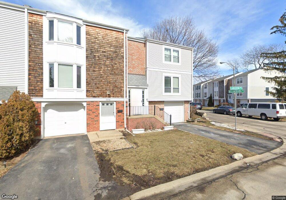
2206 Langdon Place Unit 1 Hoffman Estates, IL 60169
South Hoffman Estates NeighborhoodEstimated Value: $266,000 - $307,000
3
Beds
3
Baths
1,366
Sq Ft
$216/Sq Ft
Est. Value
About This Home
This home is located at 2206 Langdon Place Unit 1, Hoffman Estates, IL 60169 and is currently estimated at $294,535, approximately $215 per square foot. 2206 Langdon Place Unit 1 is a home located in Cook County with nearby schools including John Muir Literacy Academy, Dwight D Eisenhower Junior High School, and Hoffman Estates High School.
Ownership History
Date
Name
Owned For
Owner Type
Purchase Details
Closed on
Jan 26, 2005
Sold by
Patel Bijal and Patel Dhirubhai
Bought by
Kielpinski Mieczyslaw
Current Estimated Value
Purchase Details
Closed on
Apr 22, 1999
Sold by
Siver Jeffrey S and Siver Grace
Bought by
Patel Bijal and Patel Dhirubhai
Home Financials for this Owner
Home Financials are based on the most recent Mortgage that was taken out on this home.
Original Mortgage
$90,800
Interest Rate
7.04%
Create a Home Valuation Report for This Property
The Home Valuation Report is an in-depth analysis detailing your home's value as well as a comparison with similar homes in the area
Home Values in the Area
Average Home Value in this Area
Purchase History
| Date | Buyer | Sale Price | Title Company |
|---|---|---|---|
| Kielpinski Mieczyslaw | $177,000 | -- | |
| Patel Bijal | $113,500 | -- |
Source: Public Records
Mortgage History
| Date | Status | Borrower | Loan Amount |
|---|---|---|---|
| Previous Owner | Patel Bijal | $90,800 |
Source: Public Records
Tax History Compared to Growth
Tax History
| Year | Tax Paid | Tax Assessment Tax Assessment Total Assessment is a certain percentage of the fair market value that is determined by local assessors to be the total taxable value of land and additions on the property. | Land | Improvement |
|---|---|---|---|---|
| 2024 | $1,792 | $19,500 | $3,000 | $16,500 |
| 2023 | $1,789 | $19,500 | $3,000 | $16,500 |
| 2022 | $1,789 | $19,500 | $3,000 | $16,500 |
| 2021 | $2,942 | $14,776 | $2,381 | $12,395 |
| 2020 | $1,788 | $14,776 | $2,381 | $12,395 |
| 2019 | $1,768 | $16,418 | $2,381 | $14,037 |
| 2018 | $1,973 | $15,939 | $2,079 | $13,860 |
| 2017 | $1,904 | $15,939 | $2,079 | $13,860 |
| 2016 | $4,749 | $15,939 | $2,079 | $13,860 |
| 2015 | $2,842 | $13,345 | $1,814 | $11,531 |
| 2014 | $3,400 | $13,345 | $1,814 | $11,531 |
| 2013 | $2,717 | $13,345 | $1,814 | $11,531 |
Source: Public Records
Map
Nearby Homes
- 2230 Stratham Place
- 1949 Blackberry Ln Unit 91
- 1996 Blackberry Ln Unit 14
- 1956 Georgetown Ln Unit 4
- 1672 Cornell Dr
- 1685 Cornell Dr
- 1925 Georgetown Ln Unit 4
- 1795 Marquette Ln Unit 5601
- 1886 Stockton Dr Unit 3253
- 1840 Huntington Blvd Unit 412
- 1840 Huntington Blvd Unit 415
- 1808 Fayette Walk Unit H
- 1800 Huntington Blvd Unit AE615
- 1763 Bristol Walk Unit 1763
- 1738 Ardwick Dr
- 1704 Fayette Walk Unit B
- 1475 Rebecca Dr Unit 217
- 1977 Kenilworth Cir Unit D
- 1975 Kenilworth Cir Unit B
- 1375 Rebecca Dr Unit 318
- 2210 Langdon Place Unit 1
- 2214 Langdon Place
- 2218 Langdon Place Unit 1
- 2222 Langdon Place Unit 1
- 2197 Harwinton Place Unit 1
- 2201 Harwinton Place
- 2205 Harwinton Place Unit 1
- 2226 Langdon Place Unit 1
- 2209 Harwinton Place
- 1929 Williamsburg Dr Unit 1
- 1925 Williamsburg Dr Unit 1
- 2213 Harwinton Place Unit 1
- 1933 Williamsburg Dr Unit 1
- 2211 Langdon Place Unit 1
- 2230 Langdon Place Unit 1
- 1921 Williamsburg Dr Unit 1
- 1937 Williamsburg Dr Unit 1
- 2215 Langdon Place
- 2217 Harwinton Place
- 1941 Williamsburg Dr