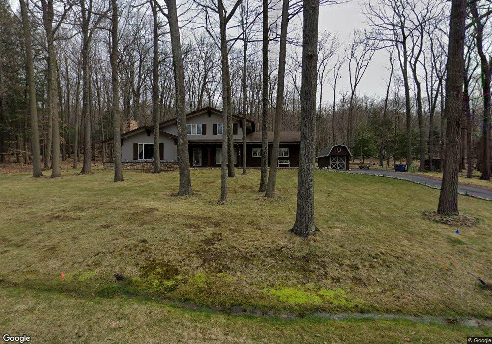
2206 Mint Ln Wausau, WI 54401
Estimated Value: $401,836 - $435,000
Studio
--
Bath
--
Sq Ft
52,272
Sq Ft Lot
About This Home
This home is located at 2206 Mint Ln, Wausau, WI 54401 and is currently estimated at $416,209. 2206 Mint Ln is a home located in Marathon County with nearby schools including South Mountain Elementary School, John Muir Middle School, and West High School.
Ownership History
Date
Name
Owned For
Owner Type
Purchase Details
Closed on
Oct 30, 2020
Sold by
Wendell Jason C and Wendell Melissa J
Bought by
Ting Michael and Ngo Hong Ngoc
Current Estimated Value
Home Financials for this Owner
Home Financials are based on the most recent Mortgage that was taken out on this home.
Original Mortgage
$206,000
Outstanding Balance
$181,561
Interest Rate
2.9%
Mortgage Type
New Conventional
Estimated Equity
$234,648
Create a Home Valuation Report for This Property
The Home Valuation Report is an in-depth analysis detailing your home's value as well as a comparison with similar homes in the area
Home Values in the Area
Average Home Value in this Area
Purchase History
| Date | Buyer | Sale Price | Title Company |
|---|---|---|---|
| Ting Michael | $261,500 | Knight Barry Title |
Source: Public Records
Mortgage History
| Date | Status | Borrower | Loan Amount |
|---|---|---|---|
| Open | Ting Michael | $206,000 |
Source: Public Records
Tax History
| Year | Tax Paid | Tax Assessment Tax Assessment Total Assessment is a certain percentage of the fair market value that is determined by local assessors to be the total taxable value of land and additions on the property. | Land | Improvement |
|---|---|---|---|---|
| 2025 | $5,042 | $416,700 | $99,200 | $317,500 |
| 2024 | $4,164 | $233,600 | $66,100 | $167,500 |
| 2023 | $4,237 | $233,600 | $66,100 | $167,500 |
| 2022 | $4,448 | $233,600 | $66,100 | $167,500 |
| 2021 | $4,325 | $233,600 | $66,100 | $167,500 |
| 2020 | $4,228 | $230,600 | $63,100 | $167,500 |
| 2019 | $4,025 | $230,600 | $63,100 | $167,500 |
| 2018 | $3,789 | $183,100 | $56,800 | $126,300 |
| 2017 | $3,681 | $183,100 | $56,800 | $126,300 |
| 2016 | $3,701 | $183,100 | $56,800 | $126,300 |
| 2015 | $3,555 | $183,100 | $56,800 | $126,300 |
| 2014 | $3,494 | $183,100 | $56,800 | $126,300 |
Source: Public Records
Map
Nearby Homes
- Lot #34 Buck Wood Ln
- Lot #35 Buck Wood Ln
- Lot #33 Buck Wood Ln
- Lot #37 Buck Wood Ln
- 150684 Strawberry Ln
- 150453 Begonia St
- Lot #24 Deer Tail Ln
- 17 Acres Snowflake Ln
- 224635-224637 Country Ln
- 4201 Rib Mountain Dr
- 226473 Kingbird Ave
- 226302 Swan Ave
- 153318 Shoreland Ln
- 227160 Dove Ave
- .47 acres Robin Ln
- 227308 Shrike Ave
- 149943 Wineberry Ln Unit 7306
- 301 Pine Island Ln
- 153270 Dusty Miller Rd
- 153226 Ambrosia Ln
Your Personal Tour Guide
Ask me questions while you tour the home.