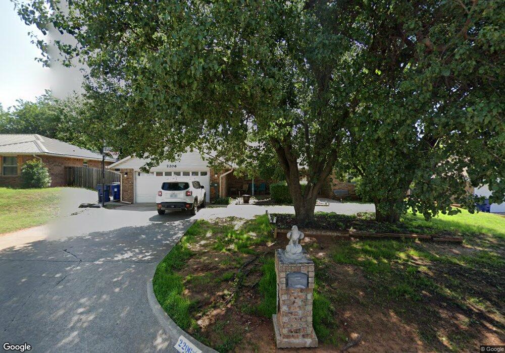
2206 N Timbergate Rd Duncan, OK 73533
Estimated Value: $203,000 - $216,000
3
Beds
2
Baths
1,861
Sq Ft
$111/Sq Ft
Est. Value
About This Home
This home is located at 2206 N Timbergate Rd, Duncan, OK 73533 and is currently estimated at $207,122, approximately $111 per square foot. 2206 N Timbergate Rd is a home located in Stephens County with nearby schools including Horace Mann Elementary School, Duncan Middle School, and Duncan High School.
Ownership History
Date
Name
Owned For
Owner Type
Purchase Details
Closed on
Nov 26, 2013
Sold by
Barnett Clinton
Bought by
Harvey Robert A and Harvey Brooke M
Current Estimated Value
Home Financials for this Owner
Home Financials are based on the most recent Mortgage that was taken out on this home.
Original Mortgage
$115,862
Outstanding Balance
$84,732
Interest Rate
3.75%
Mortgage Type
FHA
Estimated Equity
$122,390
Purchase Details
Closed on
Aug 4, 2005
Sold by
Robeson L D
Bought by
Barnett Clinton and Clinton Barnett 1996 Revocable Family Tr
Purchase Details
Closed on
Jun 15, 1990
Create a Home Valuation Report for This Property
The Home Valuation Report is an in-depth analysis detailing your home's value as well as a comparison with similar homes in the area
Home Values in the Area
Average Home Value in this Area
Purchase History
| Date | Buyer | Sale Price | Title Company |
|---|---|---|---|
| Harvey Robert A | $118,000 | None Available | |
| Barnett Clinton | $109,000 | None Available | |
| -- | $3,500 | -- |
Source: Public Records
Mortgage History
| Date | Status | Borrower | Loan Amount |
|---|---|---|---|
| Open | Harvey Robert A | $115,862 |
Source: Public Records
Tax History Compared to Growth
Tax History
| Year | Tax Paid | Tax Assessment Tax Assessment Total Assessment is a certain percentage of the fair market value that is determined by local assessors to be the total taxable value of land and additions on the property. | Land | Improvement |
|---|---|---|---|---|
| 2025 | $1,382 | $17,031 | $1,520 | $15,511 |
| 2024 | $1,382 | $16,220 | $1,520 | $14,700 |
| 2023 | $1,382 | $16,220 | $1,520 | $14,700 |
| 2022 | $1,251 | $15,448 | $1,520 | $13,928 |
| 2021 | $1,193 | $14,012 | $1,520 | $12,492 |
| 2020 | $1,258 | $14,573 | $1,520 | $13,053 |
| 2019 | $1,204 | $13,918 | $1,520 | $12,398 |
| 2018 | $1,275 | $15,030 | $1,520 | $13,510 |
| 2017 | $1,172 | $14,315 | $1,520 | $12,795 |
| 2016 | $1,104 | $12,984 | $1,520 | $11,464 |
| 2015 | $1,208 | $12,984 | $1,520 | $11,464 |
| 2014 | $1,208 | $12,984 | $1,520 | $11,464 |
Source: Public Records
Map
Nearby Homes
- 1927 High Meadow Dr
- 3990 N Ridgeview Dr
- 30 Canterbury Ln
- 28 Canterbury Ln
- 1706 Windsor Dr
- 2403 Meadow View Dr
- 1829 1829 Terrace Dr
- 2810 Stagestand Rd
- 2814 2814 Springdale Ln
- 2360 Rockwell Dr
- 2321 Rockwell Dr
- 2110 2110 Club W
- 2108 W Club Rd
- 1706 1706 Foxboro
- 1601 1601 Pearl
- 1108 1108 W Plato Unit 49
- 1108 1108 W Plato Unit 40
- 1108 1108 W Plato Unit 17
- 1108 1108 W Plato Unit 1
- 2518 Wildwood Place
- 2210 N Timbergate Rd
- 2202 N Timbergate Rd
- 2214 N Timbergate Rd
- 2205 Briarcrest
- 2209 Briarcrest
- 2201 Briarcrest
- 2001 2001 Crestline Dr
- 2001 Crestline Dr
- 2002 Crestmont Dr
- 273890 Osage Rd
- 2213 Briarcrest
- 1914 Crestline Dr
- 2302 N Timbergate Rd
- 1914 1914 Crestline Dr
- 1914 1914 Crerstline Dr
- 1910 Crestline Dr
- 1906 Crestline Dr
- 2006 Crestmont Dr
- 2301 Briarcrest
- 2007 Crestline Dr