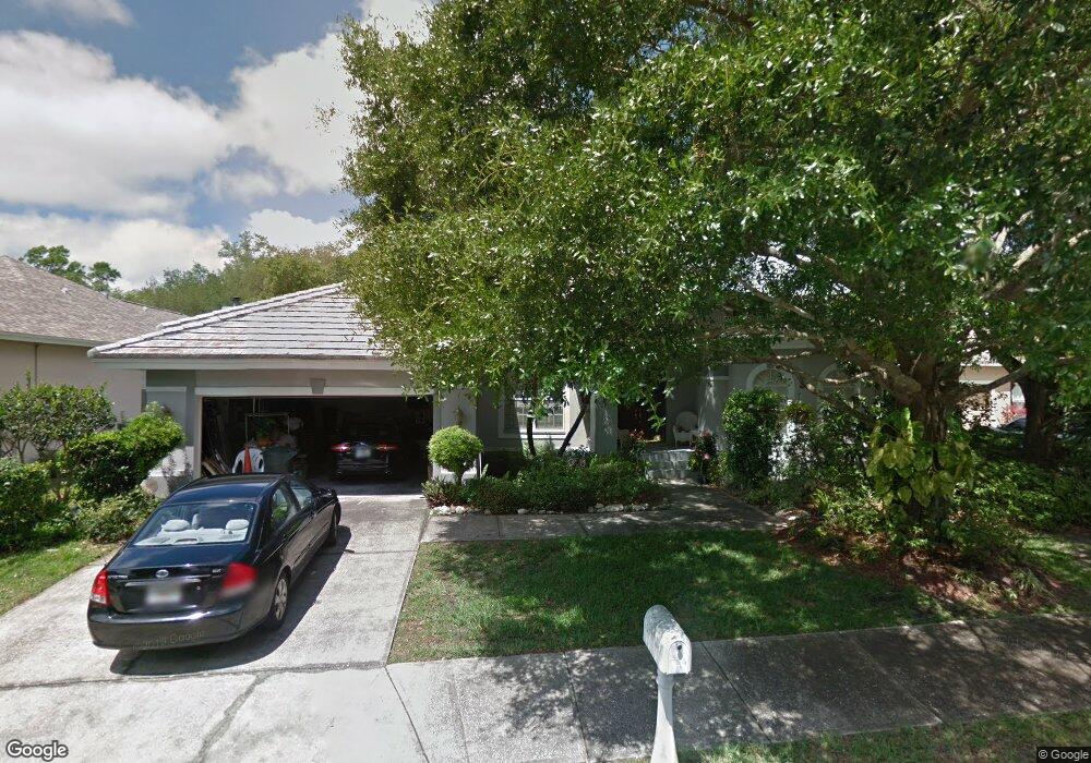
2206 Ramsgate Ct Safety Harbor, FL 34695
Estimated Value: $752,705 - $901,000
Studio
1
Bath
2,540
Sq Ft
$332/Sq Ft
Est. Value
About This Home
This home is located at 2206 Ramsgate Ct, Safety Harbor, FL 34695 and is currently estimated at $843,426, approximately $332 per square foot. 2206 Ramsgate Ct is a home located in Pinellas County with nearby schools including Safety Harbor Elementary School, Countryside High School, and Safety Harbor Middle School.
Ownership History
Date
Name
Owned For
Owner Type
Purchase Details
Closed on
Jun 7, 1996
Sold by
Perry William W and Perry Jeannie A
Bought by
Moyle William D and Moyle Tanga M
Current Estimated Value
Home Financials for this Owner
Home Financials are based on the most recent Mortgage that was taken out on this home.
Original Mortgage
$140,000
Interest Rate
7.88%
Mortgage Type
New Conventional
Purchase Details
Closed on
Jun 2, 1995
Sold by
Roberts Bernard C and Roberts Lea B
Bought by
Perry William W and Perry Jeannie A
Home Financials for this Owner
Home Financials are based on the most recent Mortgage that was taken out on this home.
Original Mortgage
$170,400
Interest Rate
8.22%
Create a Home Valuation Report for This Property
The Home Valuation Report is an in-depth analysis detailing your home's value as well as a comparison with similar homes in the area
Home Values in the Area
Average Home Value in this Area
Purchase History
| Date | Buyer | Sale Price | Title Company |
|---|---|---|---|
| Moyle William D | $208,000 | -- | |
| Perry William W | $213,000 | -- |
Source: Public Records
Mortgage History
| Date | Status | Borrower | Loan Amount |
|---|---|---|---|
| Open | Perry William W | $135,861 | |
| Closed | Perry William W | $140,000 | |
| Previous Owner | Perry William W | $170,400 |
Source: Public Records
Tax History
| Year | Tax Paid | Tax Assessment Tax Assessment Total Assessment is a certain percentage of the fair market value that is determined by local assessors to be the total taxable value of land and additions on the property. | Land | Improvement |
|---|---|---|---|---|
| 2025 | $4,209 | $302,383 | -- | -- |
| 2024 | $4,142 | $293,861 | -- | -- |
| 2023 | $4,142 | $285,302 | $0 | $0 |
| 2022 | $4,103 | $276,992 | $0 | $0 |
| 2021 | $4,159 | $268,924 | $0 | $0 |
| 2020 | $4,150 | $265,211 | $0 | $0 |
| 2019 | $4,079 | $259,248 | $0 | $0 |
| 2018 | $4,024 | $254,414 | $0 | $0 |
| 2017 | $3,992 | $249,181 | $0 | $0 |
| 2016 | $3,960 | $244,056 | $0 | $0 |
| 2015 | $4,044 | $242,359 | $0 | $0 |
| 2014 | $4,024 | $240,436 | $0 | $0 |
Source: Public Records
Map
Nearby Homes
- 2225 Windsong Ct
- 2303 Oxford Ct
- 1009 Wyndham Way
- 3321 Meander Ln
- 1006 Wyndham Way
- 1609 Hampton Ct
- 110 Woodcreek Dr S
- 167 Woodcreek Dr W
- 3 Booth Blvd
- 708 Quail Keep Dr Unit 1605
- 706 Quail Keep Dr Unit 1604
- 625 Fayette Dr S
- 2363 Flanders Way Unit C
- 612 Baldwin Ave Unit C
- 602 Quail Keep Dr
- 2368 Flanders Way Unit D
- 612 Fairmont Ave Unit D
- 603 Baldwin Ave Unit B
- 1852 Lake Cypress Dr
- 1858 Lake Cypress Dr Unit 202
- 2204 Ramsgate Ct
- 2208 Ramsgate Ct
- 2205 Ramsgate Ct
- 2207 Ramsgate Ct
- 2210 Ramsgate Ct
- 1606 Governors Ln
- 2209 Ramsgate Ct
- 2211 Ramsgate Ct
- 2201 Windsong Ct
- 1604 Governors Ln
- 2221 Windsong Ct
- 2206 Hampstead Ct
- 1605 Governors Ln
- 2203 Windsong Ct
- 2223 Windsong Ct
- 2219 Windsong Ct
- 1608 Huntington Ln
- 2208 Hampstead Ct
- 1602 Governors Ln
- 1606 Huntington Ln
Your Personal Tour Guide
Ask me questions while you tour the home.