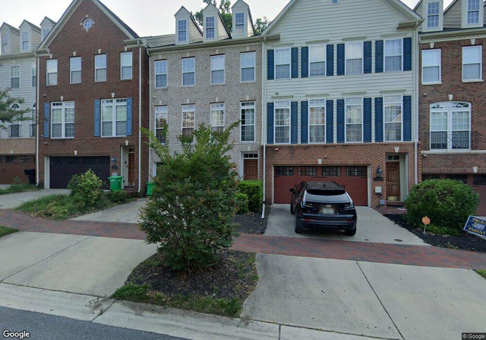
2207 Barnstable Dr Upper Marlboro, MD 20774
Estimated Value: $549,000 - $588,000
3
Beds
4
Baths
2,304
Sq Ft
$246/Sq Ft
Est. Value
About This Home
This home is located at 2207 Barnstable Dr, Upper Marlboro, MD 20774 and is currently estimated at $567,873, approximately $246 per square foot. 2207 Barnstable Dr is a home located in Prince George's County with nearby schools including Patuxent Elementary School, James Madison Middle School, and Dr. Henry A. Wise Jr. High School.
Ownership History
Date
Name
Owned For
Owner Type
Purchase Details
Closed on
Jun 12, 2014
Sold by
Alsobrooks Androne T
Bought by
Alsobrooks Paul A
Current Estimated Value
Purchase Details
Closed on
Mar 11, 2010
Sold by
Ceritficateholders Strd Asst Mtg
Bought by
Alsobrook Paul and Alsobrooks Paul
Home Financials for this Owner
Home Financials are based on the most recent Mortgage that was taken out on this home.
Original Mortgage
$309,411
Interest Rate
5.02%
Mortgage Type
FHA
Purchase Details
Closed on
Jan 11, 2010
Sold by
Johnson Lashay and Gra Terrance
Bought by
Ceritficateholders Strd Asst Mtg
Home Financials for this Owner
Home Financials are based on the most recent Mortgage that was taken out on this home.
Original Mortgage
$309,411
Interest Rate
5.02%
Mortgage Type
FHA
Create a Home Valuation Report for This Property
The Home Valuation Report is an in-depth analysis detailing your home's value as well as a comparison with similar homes in the area
Home Values in the Area
Average Home Value in this Area
Purchase History
| Date | Buyer | Sale Price | Title Company |
|---|---|---|---|
| Alsobrooks Paul A | -- | None Available | |
| Alsobrook Paul | $315,120 | -- | |
| Ceritficateholders Strd Asst Mtg | $535,000 | -- |
Source: Public Records
Mortgage History
| Date | Status | Borrower | Loan Amount |
|---|---|---|---|
| Previous Owner | Alsobrook Paul | $309,411 |
Source: Public Records
Tax History Compared to Growth
Tax History
| Year | Tax Paid | Tax Assessment Tax Assessment Total Assessment is a certain percentage of the fair market value that is determined by local assessors to be the total taxable value of land and additions on the property. | Land | Improvement |
|---|---|---|---|---|
| 2025 | $7,146 | $512,100 | $150,000 | $362,100 |
| 2024 | $7,146 | $467,233 | -- | -- |
| 2023 | $6,497 | $422,367 | $0 | $0 |
| 2022 | $5,849 | $377,500 | $100,000 | $277,500 |
| 2021 | $5,849 | $377,500 | $100,000 | $277,500 |
| 2020 | $5,849 | $377,500 | $100,000 | $277,500 |
| 2019 | $5,964 | $385,500 | $100,000 | $285,500 |
| 2018 | $5,808 | $374,667 | $0 | $0 |
| 2017 | $5,652 | $363,833 | $0 | $0 |
| 2016 | -- | $353,000 | $0 | $0 |
| 2015 | $4,665 | $338,967 | $0 | $0 |
| 2014 | $4,665 | $324,933 | $0 | $0 |
Source: Public Records
Map
Nearby Homes
- 15303 Glastonbury Way
- 15517 Glastonbury Way
- 15625 Copper Beech Dr
- 8300 Hook Ln
- 2512 Crain Hwy
- 2135 Congresbury Place
- 15503 Humberside Way
- 2403 Lake Forest Dr
- 15608 Bibury Aly
- 2814 Medstead Ln
- 2704 Beech Orchard Ln
- 15606 Beech Tree Pkwy
- 15218 N Berwick Ln
- 2429 Newmoor Way
- 15301 Kettlebaston Ln
- 17000 Swanson Rd
- 16115 Brookmead Ct
- 16503 Rolling Knolls Ln
- 16500 Rolling Knolls Ln
- 16502 Rolling Knolls Ln
- 2205 Barnstable Dr
- 2209 Barnstable Dr
- 2203 Barnstable Dr
- 2211 Barnstable Dr
- 2201 Barnstable Dr
- 2213 Barnstable Dr
- 2215 Barnstable Dr
- 2206 Barnstable Dr
- 2204 Barnstable Dr
- 2208 Barnstable Dr
- 2202 Barnstable Dr
- 2210 Barnstable Dr
- 2200 Barnstable Dr
- 2217 Barnstable Dr
- 15800 Buxton Place
- 2219 Barnstable Dr
- 15802 Buxton Place
- 2221 Barnstable Dr
- 15804 Buxton Place
- 15806 Buxton Place