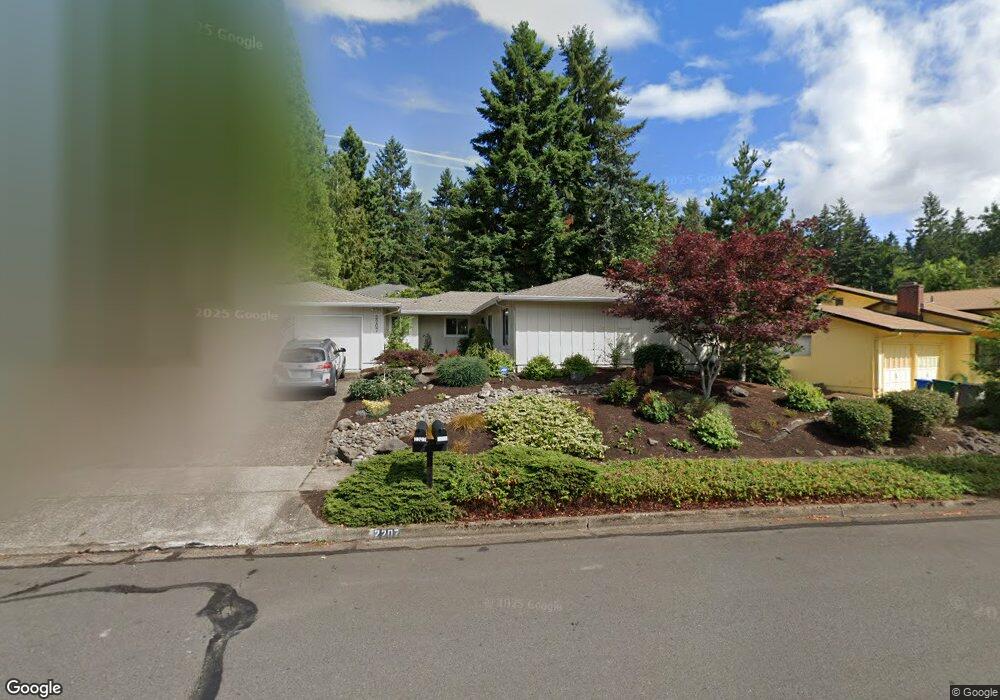
2207 Brittany St Eugene, OR 97405
Churchill NeighborhoodEstimated Value: $460,000 - $508,000
4
Beds
2
Baths
1,588
Sq Ft
$299/Sq Ft
Est. Value
About This Home
This home is located at 2207 Brittany St, Eugene, OR 97405 and is currently estimated at $475,244, approximately $299 per square foot. 2207 Brittany St is a home located in Lane County with nearby schools including McCornack Elementary School, Kennedy Middle School, and Churchill High School.
Ownership History
Date
Name
Owned For
Owner Type
Purchase Details
Closed on
Jan 22, 2025
Sold by
Dye Drew E and Dye Sharyn Lea
Bought by
Dye Revocable Living Trust and Dye
Current Estimated Value
Purchase Details
Closed on
Apr 30, 1998
Sold by
Lea Shaw Sharyn
Bought by
Dye Drew E and Dye Sharyn Lea Henery
Home Financials for this Owner
Home Financials are based on the most recent Mortgage that was taken out on this home.
Original Mortgage
$107,600
Interest Rate
7.06%
Create a Home Valuation Report for This Property
The Home Valuation Report is an in-depth analysis detailing your home's value as well as a comparison with similar homes in the area
Home Values in the Area
Average Home Value in this Area
Purchase History
| Date | Buyer | Sale Price | Title Company |
|---|---|---|---|
| Dye Revocable Living Trust | -- | None Listed On Document | |
| Dye Drew E | -- | Evergreen Land Title Co |
Source: Public Records
Mortgage History
| Date | Status | Borrower | Loan Amount |
|---|---|---|---|
| Previous Owner | Dye Drew E | $107,600 |
Source: Public Records
Tax History
| Year | Tax Paid | Tax Assessment Tax Assessment Total Assessment is a certain percentage of the fair market value that is determined by local assessors to be the total taxable value of land and additions on the property. | Land | Improvement |
|---|---|---|---|---|
| 2025 | $5,160 | $264,821 | -- | -- |
| 2024 | $5,096 | $257,108 | -- | -- |
| 2023 | $5,096 | $249,620 | $0 | $0 |
| 2022 | $4,774 | $242,350 | $0 | $0 |
| 2021 | $4,484 | $235,292 | $0 | $0 |
| 2020 | $4,431 | $228,439 | $0 | $0 |
| 2019 | $4,215 | $221,786 | $0 | $0 |
| 2018 | $3,932 | $209,055 | $0 | $0 |
| 2017 | $3,685 | $209,055 | $0 | $0 |
| 2016 | $3,574 | $202,966 | $0 | $0 |
| 2015 | $3,458 | $197,054 | $0 | $0 |
| 2014 | $3,380 | $191,315 | $0 | $0 |
Source: Public Records
Map
Nearby Homes
- 3752 Kevington Ave
- 3685 Westleigh St
- 3534 Westleigh St
- 3837 Kevington Ave
- 3823 Wilshire Ln
- 2239 Hawkins Ln
- 3845 Colony Oaks Dr
- 3574 Colony Oaks Dr Unit 6
- 3586 Colony Oaks Dr Unit 5
- 2111 Hawkins Ln Unit 45
- 3899 Colony Oaks Dr
- 3817 Colony Oaks Dr
- 2671 Woodstone Place
- 3809 Colony Oaks Dr
- 3812 Colony Oaks Dr Unit 28
- 2610 Park Forest Dr
- 0 Aerie Park Place Unit 563784902
- 0 Aerie Park Place Unit 625628092
- 0 Aerie Park Place Unit 595870203
- 0 Mountain Ash Blvd Unit 410068044
- 2217 Brittany St
- 2211 Brittany St
- 2201 Brittany St
- 3380 Kevington Ave
- 2208 Brittany St
- 2200 Brittany St
- 2221 Brittany St
- 3360 Kevington Ave
- 2214 Brittany St
- 2233 Brittany St
- 3470 Kevington Ave
- 2237 Brittany St
- 2225 Brittany St
- 3665 Thames St
- 2229 Brittany St
- 3340 Kevington Ave
- 2197 Brittany St
- 3490 Kevington Ave
- 3389 Kevington Ave
- 3290 Kevington Ave
Your Personal Tour Guide
Ask me questions while you tour the home.