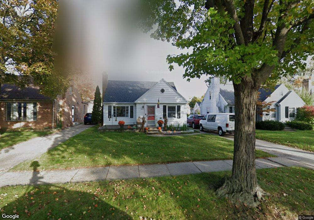
2207 Quentin Ave Lansing, MI 48910
Colonial Village NeighborhoodEstimated Value: $163,000 - $177,000
--
Bed
--
Bath
1,055
Sq Ft
$160/Sq Ft
Est. Value
About This Home
This home is located at 2207 Quentin Ave, Lansing, MI 48910 and is currently estimated at $169,143, approximately $160 per square foot. 2207 Quentin Ave is a home located in Ingham County with nearby schools including Averill Elementary School, Attwood School, and J.W. Sexton High School.
Ownership History
Date
Name
Owned For
Owner Type
Purchase Details
Closed on
Jun 16, 2021
Sold by
2207 Quentin Llc
Bought by
Patsey Angela and Patsey Larry
Current Estimated Value
Home Financials for this Owner
Home Financials are based on the most recent Mortgage that was taken out on this home.
Original Mortgage
$112,500
Outstanding Balance
$101,855
Interest Rate
2.9%
Mortgage Type
New Conventional
Estimated Equity
$67,288
Purchase Details
Closed on
Dec 23, 2008
Sold by
Perkowski Gregory J
Bought by
2207 Quentin Llc
Create a Home Valuation Report for This Property
The Home Valuation Report is an in-depth analysis detailing your home's value as well as a comparison with similar homes in the area
Home Values in the Area
Average Home Value in this Area
Purchase History
| Date | Buyer | Sale Price | Title Company |
|---|---|---|---|
| Patsey Angela | $125,000 | Transnation Title Agency | |
| 2207 Quentin Llc | -- | None Available |
Source: Public Records
Mortgage History
| Date | Status | Borrower | Loan Amount |
|---|---|---|---|
| Open | Patsey Angela | $112,500 |
Source: Public Records
Tax History Compared to Growth
Tax History
| Year | Tax Paid | Tax Assessment Tax Assessment Total Assessment is a certain percentage of the fair market value that is determined by local assessors to be the total taxable value of land and additions on the property. | Land | Improvement |
|---|---|---|---|---|
| 2025 | $4,427 | $76,000 | $9,100 | $66,900 |
| 2024 | $36 | $70,100 | $9,100 | $61,000 |
| 2023 | $4,149 | $64,800 | $9,100 | $55,700 |
| 2022 | $3,776 | $62,400 | $8,600 | $53,800 |
| 2021 | $3,484 | $58,300 | $5,900 | $52,400 |
| 2020 | $3,460 | $54,800 | $5,900 | $48,900 |
| 2019 | $3,345 | $52,600 | $5,900 | $46,700 |
| 2018 | $3,169 | $47,200 | $5,900 | $41,300 |
| 2017 | $3,052 | $47,200 | $5,900 | $41,300 |
| 2016 | $2,930 | $42,300 | $5,900 | $36,400 |
| 2015 | $2,930 | $40,900 | $11,776 | $29,124 |
| 2014 | $2,930 | $39,900 | $8,832 | $31,068 |
Source: Public Records
Map
Nearby Homes
- 1420 Poxson Ave
- 2118 Marion Ave
- 1404 Kelsey Ave
- 1618 Loraine Ave
- 1312 W Mount Hope Ave
- 1315 Goodrich St
- 1120 Kelsey Ave
- 1114 Goodrich St
- 1032 Kelsey Ave
- 1740 Wellington Rd Unit 103
- 2515 S Martin Luther King Junior Blvd
- 1116 George St
- 2112 Stirling Ave
- 2310 Stirling Ave
- 1607 Holly Way
- 1913 Stirling Ave
- 2421 Stirling Ave
- 907 Lenore Ave
- 1309 Hammond St
- 1721 Fletcher St
- 2201 Quentin Ave
- 2211 Quentin Ave
- 2135 Quentin Ave
- 2215 Quentin Ave
- 2204 Pattengill Ave
- 2200 Pattengill Ave
- 2208 Pattengill Ave
- 2131 Quentin Ave
- 2200 Quentin Ave
- 2221 Quentin Ave
- 2120 Pattengill Ave
- 2212 Pattengill Ave
- 2218 Quentin Ave
- 2114 Pattengill Ave
- 2127 Quentin Ave
- 1500 Gordon Ave
- 1607 Cooper Ave
- 2110 Pattengill Ave
- 1606 Gordon Ave
- 1600 Cooper Ave