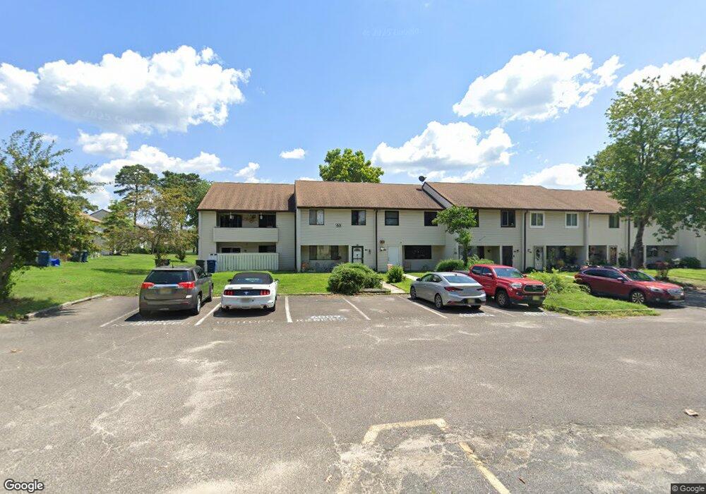
2208 Forest Ln Mays Landing, NJ 08330
Estimated Value: $203,000 - $228,000
--
Bed
--
Bath
1,628
Sq Ft
$131/Sq Ft
Est. Value
About This Home
This home is located at 2208 Forest Ln, Mays Landing, NJ 08330 and is currently estimated at $212,817, approximately $130 per square foot. 2208 Forest Ln is a home located in Atlantic County with nearby schools including George L. Hess Educational Complex, Joseph Shaner School, and William Davies Middle School.
Ownership History
Date
Name
Owned For
Owner Type
Purchase Details
Closed on
Jun 10, 2003
Sold by
Repko Steven
Bought by
Repko Steven and Repko Bonnie
Current Estimated Value
Home Financials for this Owner
Home Financials are based on the most recent Mortgage that was taken out on this home.
Original Mortgage
$75,150
Interest Rate
5.05%
Mortgage Type
Purchase Money Mortgage
Purchase Details
Closed on
Dec 8, 1995
Sold by
Travis James R
Bought by
Repko Steven E
Create a Home Valuation Report for This Property
The Home Valuation Report is an in-depth analysis detailing your home's value as well as a comparison with similar homes in the area
Home Values in the Area
Average Home Value in this Area
Purchase History
| Date | Buyer | Sale Price | Title Company |
|---|---|---|---|
| Repko Steven | -- | -- | |
| Repko Steven E | -- | -- | |
| Repko Steven E | $59,900 | -- |
Source: Public Records
Mortgage History
| Date | Status | Borrower | Loan Amount |
|---|---|---|---|
| Closed | Repko Steven E | $75,150 |
Source: Public Records
Tax History Compared to Growth
Tax History
| Year | Tax Paid | Tax Assessment Tax Assessment Total Assessment is a certain percentage of the fair market value that is determined by local assessors to be the total taxable value of land and additions on the property. | Land | Improvement |
|---|---|---|---|---|
| 2025 | $2,230 | $84,900 | $25,000 | $59,900 |
| 2024 | $2,230 | $65,000 | $10,000 | $55,000 |
| 2023 | $2,097 | $65,000 | $10,000 | $55,000 |
| 2022 | $2,097 | $65,000 | $10,000 | $55,000 |
| 2021 | $1,931 | $60,000 | $5,000 | $55,000 |
| 2020 | $1,931 | $60,000 | $5,000 | $55,000 |
| 2019 | $1,936 | $60,000 | $5,000 | $55,000 |
| 2018 | $1,868 | $60,000 | $5,000 | $55,000 |
| 2017 | $1,839 | $60,000 | $5,000 | $55,000 |
| 2016 | $1,787 | $60,000 | $5,000 | $55,000 |
| 2015 | $1,727 | $60,000 | $5,000 | $55,000 |
| 2014 | $1,800 | $68,500 | $7,000 | $61,500 |
Source: Public Records
Map
Nearby Homes
- 2340 Primrose Ct
- 2418 Primrose Ct
- 2501 Oleander Ct Unit 3412
- 2127 Rhododendron Ct Unit 25
- 2123 Rhododendron Ct Unit 57B
- 2626 Nutmeg Ct Unit 385
- 2614 Dogwood Ct Unit 2614
- 2723 Mimosa Ct
- 2725 Mimosa Ct
- 2728 Mimosa Ct Unit 445
- 2731 Mimosa Ct
- 2904 Woodlands Dr
- 2818 Hawthorn Ct Unit 2818
- 3017 Ivy Bush Ct Unit 3017
- 3054 Ivy Bush Ct Unit 515
- 3110 Woodlands Dr
- 4406 Yorktown Place
- 3137 Woodlands Dr Unit 3137
- 3514 Woodlands Dr Unit 51
- 4455 Yorktown Place Unit 28
- 2207 Forest Ln Unit 604
- 2209 Forest Ln
- 2210 Forest Ln
- 2206 Forest Ln Unit 2206 Forest Lane
- 2206 Forest Ln Unit 605
- 2205 Forest Ln Unit 606
- 2141 Rhododendron Ct Unit 5910
- 2204 Forest Ln Unit 607
- 2142 Rhododendron Ct Unit 599
- 2142 Rhododendron Ct Unit 50
- 2143 Rhododendron Ct Unit 598
- 2203 Forest Ln Unit 608
- 2144 Rhododendron Ct
- 2302 Primrose Ct Unit 2910
- 2304 Primrose Ct
- 2305 Primrose Ct Unit 297
- 2305 Primrose Ct Unit 2305 Primrose
- 2202 Forest Ln
- 2303 Primrose Ct Unit 299
- 2306 Primrose Ct Unit 296