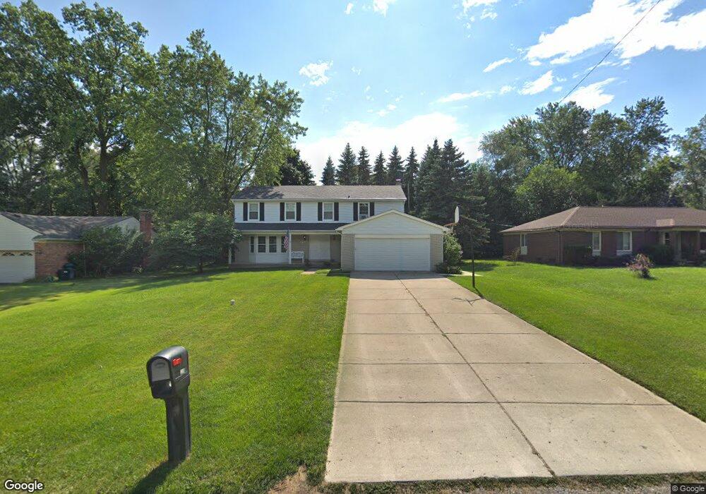
2208 Somerset Rd Bloomfield Hills, MI 48302
Estimated Value: $450,000 - $524,000
4
Beds
3
Baths
2,511
Sq Ft
$194/Sq Ft
Est. Value
About This Home
This home is located at 2208 Somerset Rd, Bloomfield Hills, MI 48302 and is currently estimated at $487,547, approximately $194 per square foot. 2208 Somerset Rd is a home located in Oakland County with nearby schools including Eastover Elementary School, Bloomfield Hills High School, and Arts & Technology Academy of Pontiac.
Ownership History
Date
Name
Owned For
Owner Type
Purchase Details
Closed on
Feb 22, 2021
Sold by
Kyes Leslie Ann and Pettway Leslie Ann
Bought by
Kyes Leslie Ann
Current Estimated Value
Home Financials for this Owner
Home Financials are based on the most recent Mortgage that was taken out on this home.
Original Mortgage
$158,000
Interest Rate
2.73%
Mortgage Type
New Conventional
Purchase Details
Closed on
Feb 21, 2003
Sold by
Pettway Hugh Lawson
Bought by
Pettway Leslie Ann
Create a Home Valuation Report for This Property
The Home Valuation Report is an in-depth analysis detailing your home's value as well as a comparison with similar homes in the area
Home Values in the Area
Average Home Value in this Area
Purchase History
| Date | Buyer | Sale Price | Title Company |
|---|---|---|---|
| Kyes Leslie Ann | -- | Mortgage Connect Lp | |
| Pettway Leslie Ann | -- | -- |
Source: Public Records
Mortgage History
| Date | Status | Borrower | Loan Amount |
|---|---|---|---|
| Closed | Kyes Leslie Ann | $158,000 |
Source: Public Records
Tax History Compared to Growth
Tax History
| Year | Tax Paid | Tax Assessment Tax Assessment Total Assessment is a certain percentage of the fair market value that is determined by local assessors to be the total taxable value of land and additions on the property. | Land | Improvement |
|---|---|---|---|---|
| 2024 | $1,830 | $233,530 | $0 | $0 |
| 2023 | $1,771 | $219,420 | $0 | $0 |
| 2022 | $3,328 | $175,100 | $0 | $0 |
| 2021 | $3,304 | $159,890 | $0 | $0 |
| 2020 | $1,620 | $155,980 | $0 | $0 |
| 2019 | $3,110 | $171,180 | $0 | $0 |
| 2018 | $3,124 | $163,440 | $0 | $0 |
| 2017 | $3,102 | $158,660 | $0 | $0 |
| 2016 | $3,108 | $151,490 | $0 | $0 |
| 2015 | -- | $142,430 | $0 | $0 |
| 2014 | -- | $128,870 | $0 | $0 |
| 2011 | -- | $73,720 | $0 | $0 |
Source: Public Records
Map
Nearby Homes
- 2449 Mulberry Square Unit 28
- 2383 Mulberry Square Unit 72
- 95 Hillsdale Rd
- 1965 Devonshire Rd
- 2665 Lahser Rd
- 396 Concord Place Unit 3
- 42285 Woodward Ave # S1-3
- 2625 Plum Brook Dr
- 136 Belroi Place
- 454 N Fox Hills Dr Unit A-8
- 480 Fox Hills Dr N Unit 6
- 448 Fox Hills Dr S Unit 3
- 42160 Woodward Ave Unit 8
- 445 Fox Hills Dr N Unit 81
- 1987 Hunters Ridge Dr
- 240 Applewood Ln
- 466 Rolling Rock Rd
- 164 Timber Trace Ln
- 112 E Hickory Grove Rd Unit 26
- 723 E Fox Hills Dr Unit X186
- 2218 Somerset Rd
- 0 Somerset Rd
- 2198 Somerset Rd
- 2228 Somerset Rd
- 2241 Bedford Rd
- 2255 Bedford Rd
- 2184 Somerset Rd
- 2265 Bedford Rd
- 2213 Somerset Rd
- 290 Marlborough Dr
- 2238 Somerset Rd
- 2223 Somerset Rd
- 302 Marlborough Dr
- 2277 Bedford Rd
- 2168 Somerset Rd Unit Bldg-Unit
- 2168 Somerset Rd
- 2248 Somerset Rd
- 2233 Somerset Rd
- 2295 Bedford Rd
- 316 Marlborough Dr