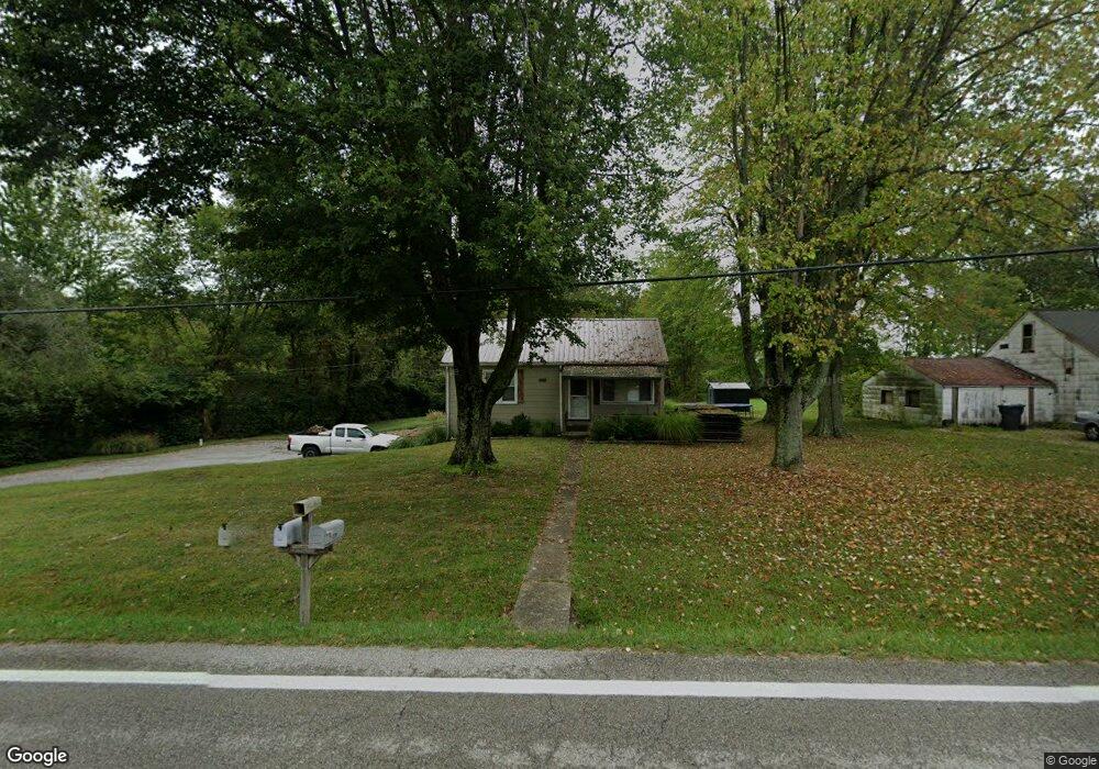
2208 State Route 222 New Richmond, OH 45157
Estimated Value: $148,594 - $218,000
2
Beds
1
Bath
768
Sq Ft
$245/Sq Ft
Est. Value
About This Home
This home is located at 2208 State Route 222, New Richmond, OH 45157 and is currently estimated at $188,149, approximately $244 per square foot. 2208 State Route 222 is a home located in Clermont County with nearby schools including Bick Primary Elementary School, Hill Intermediate Elementary School, and Bethel-Tate Middle School.
Ownership History
Date
Name
Owned For
Owner Type
Purchase Details
Closed on
Nov 1, 2010
Sold by
Meyer William M
Bought by
Meyer Barbara A
Current Estimated Value
Purchase Details
Closed on
Jul 29, 2010
Sold by
Secretary Of Veterans Affairs
Bought by
Meyer William M and Meyer Barbara A
Purchase Details
Closed on
Mar 23, 2010
Sold by
Moore Michael E
Bought by
Secretary Of Veterans Affairs
Purchase Details
Closed on
Feb 7, 2003
Sold by
Hensley Gordon
Bought by
Moore Michael E
Home Financials for this Owner
Home Financials are based on the most recent Mortgage that was taken out on this home.
Original Mortgage
$86,700
Interest Rate
6.01%
Mortgage Type
VA
Purchase Details
Closed on
Dec 11, 2000
Sold by
Mitchell Roger D
Bought by
Hensley Gordon and Hensley Novea
Home Financials for this Owner
Home Financials are based on the most recent Mortgage that was taken out on this home.
Original Mortgage
$74,386
Interest Rate
7.7%
Mortgage Type
FHA
Purchase Details
Closed on
Nov 23, 1992
Create a Home Valuation Report for This Property
The Home Valuation Report is an in-depth analysis detailing your home's value as well as a comparison with similar homes in the area
Home Values in the Area
Average Home Value in this Area
Purchase History
| Date | Buyer | Sale Price | Title Company |
|---|---|---|---|
| Meyer Barbara A | -- | Attorney | |
| Meyer William M | -- | Attorney | |
| Secretary Of Veterans Affairs | $43,334 | None Available | |
| Moore Michael E | $86,700 | -- | |
| Hensley Gordon | $75,000 | -- | |
| -- | $47,500 | -- |
Source: Public Records
Mortgage History
| Date | Status | Borrower | Loan Amount |
|---|---|---|---|
| Previous Owner | Moore Michael E | $86,700 | |
| Previous Owner | Hensley Gordon | $74,386 |
Source: Public Records
Tax History Compared to Growth
Tax History
| Year | Tax Paid | Tax Assessment Tax Assessment Total Assessment is a certain percentage of the fair market value that is determined by local assessors to be the total taxable value of land and additions on the property. | Land | Improvement |
|---|---|---|---|---|
| 2024 | $1,394 | $33,740 | $12,180 | $21,560 |
| 2023 | $1,406 | $33,740 | $12,180 | $21,560 |
| 2022 | $1,116 | $24,720 | $8,930 | $15,790 |
| 2021 | $1,128 | $24,720 | $8,930 | $15,790 |
| 2020 | $1,076 | $24,720 | $8,930 | $15,790 |
| 2019 | $1,048 | $22,860 | $7,880 | $14,980 |
| 2018 | $1,076 | $22,860 | $7,880 | $14,980 |
| 2017 | $1,083 | $22,860 | $7,880 | $14,980 |
| 2016 | $970 | $19,220 | $6,620 | $12,600 |
| 2015 | $810 | $19,220 | $6,620 | $12,600 |
| 2014 | $808 | $19,220 | $6,620 | $12,600 |
| 2013 | $847 | $20,060 | $7,910 | $12,150 |
Source: Public Records
Map
Nearby Homes
- 2232 Ohio 222
- 2203 Meisman Ln
- 2655 Harry A Hill Dr
- 1459 Ginn Rd
- 2123 Josephs Run Rd
- 2639 E Amelia Farms Rd
- ac Laurel-Point Isabel Rd
- 2363 Crane Schoolhouse Rd
- 2791 S Bantam Rd
- 2130 Ohio 133
- 2089 Ohio 133
- Goodwin Schoolhouse Point Isabel Rd
- 2339 Laurel Lindale Rd
- 2721 Ohio 232
- 2572 Poplar Ridge Dr
- 1847 Carnes Rd
- 314 Faith Way
- 720 W Plane St
- 140 Clark St
- 2068 Ohio 133
- 2208 State Route 222
- 2204 State Route 222
- 2205 State Route 222
- 2205 State Route 222
- 2554 Saltair Maple Rd
- 2207 State Route 222
- 2199 State Route 222
- 2226 St Rt 222
- 2196 State Route 222
- 2564 Saltair Maple Rd
- 2226 State Route 222
- 2192 State Route 222
- 2192 State Route 222
- 2197 State Route 222
- 2190 State Route 222
- 2572 Saltair Maple Rd
- 2565 Saltair Maple Rd
- 2565 Saltair Maple Rd
- 2186 State Route 222
- 2201 State Route 222
