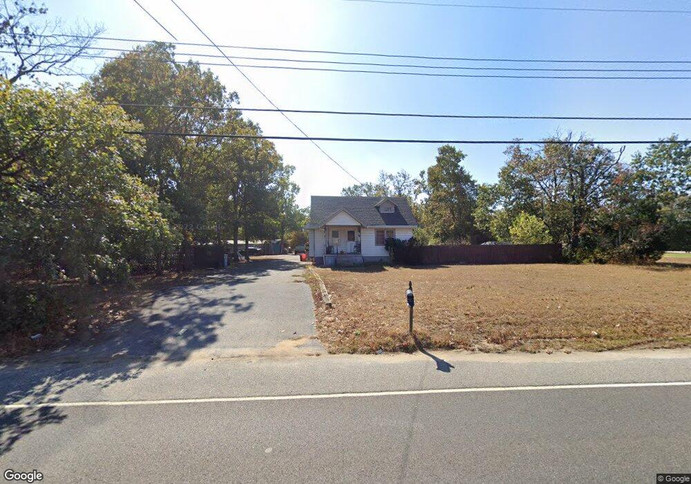
2209 Almond Rd Vineland, NJ 08360
Estimated Value: $269,000 - $296,000
3
Beds
1
Bath
1,277
Sq Ft
$220/Sq Ft
Est. Value
About This Home
This home is located at 2209 Almond Rd, Vineland, NJ 08360 and is currently estimated at $281,356, approximately $220 per square foot. 2209 Almond Rd is a home located in Cumberland County with nearby schools including Marie D. Durand Elementary School, T.W. Wallace Middle School, and Vineland Senior High School.
Ownership History
Date
Name
Owned For
Owner Type
Purchase Details
Closed on
Oct 29, 2011
Sold by
Leadbeater William and Leadbeater Cindy
Bought by
Leadbeater William
Current Estimated Value
Purchase Details
Closed on
Dec 19, 1997
Sold by
Mendez Rogelio
Bought by
Leadbeater William and Leadbeater Cindy
Home Financials for this Owner
Home Financials are based on the most recent Mortgage that was taken out on this home.
Original Mortgage
$56,000
Interest Rate
7.15%
Create a Home Valuation Report for This Property
The Home Valuation Report is an in-depth analysis detailing your home's value as well as a comparison with similar homes in the area
Home Values in the Area
Average Home Value in this Area
Purchase History
| Date | Buyer | Sale Price | Title Company |
|---|---|---|---|
| Leadbeater William | -- | -- | |
| Leadbeater William | $75,000 | -- |
Source: Public Records
Mortgage History
| Date | Status | Borrower | Loan Amount |
|---|---|---|---|
| Previous Owner | Leadbeater William | $56,000 |
Source: Public Records
Tax History Compared to Growth
Tax History
| Year | Tax Paid | Tax Assessment Tax Assessment Total Assessment is a certain percentage of the fair market value that is determined by local assessors to be the total taxable value of land and additions on the property. | Land | Improvement |
|---|---|---|---|---|
| 2025 | $4,082 | $128,200 | $49,800 | $78,400 |
| 2024 | $4,082 | $128,200 | $49,800 | $78,400 |
| 2023 | $4,055 | $128,200 | $49,800 | $78,400 |
| 2022 | $3,934 | $128,200 | $49,800 | $78,400 |
| 2021 | $3,863 | $128,200 | $49,800 | $78,400 |
| 2020 | $3,752 | $128,200 | $49,800 | $78,400 |
| 2019 | $3,701 | $128,200 | $49,800 | $78,400 |
| 2018 | $3,604 | $128,200 | $49,800 | $78,400 |
| 2017 | $3,423 | $128,200 | $49,800 | $78,400 |
| 2016 | $3,302 | $128,200 | $49,800 | $78,400 |
| 2015 | $3,181 | $128,200 | $49,800 | $78,400 |
| 2014 | $3,008 | $128,200 | $49,800 | $78,400 |
Source: Public Records
Map
Nearby Homes
- 1799 W Landis Ave
- 1535 W Landis Ave
- 1457 W Landis Ave
- 127 Doren Terrace
- 58 Wallace St
- 14 Harrison St
- 834 Gershal Ave
- 1252 W Oak Rd
- 765 Gershal Ave
- 656 Nottingham Dr
- 0 W Landis Ave
- 0 Levishohn St
- L:39 S Mill Rd
- 559 Chestnut Terrace
- 1208 E Crescent Dr
- 1170 Chimes Terrace
- 558 Gershal Ave
- 1489 N Delsea Dr
- 550 Northwest Ave
- 108 W Park Ave