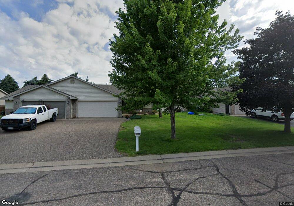
2209 Cattail Way Hudson, WI 54016
Estimated Value: $290,457 - $305,000
2
Beds
2
Baths
1,288
Sq Ft
$231/Sq Ft
Est. Value
About This Home
This home is located at 2209 Cattail Way, Hudson, WI 54016 and is currently estimated at $297,114, approximately $230 per square foot. 2209 Cattail Way is a home located in St. Croix County with nearby schools including River Crest Elementary School, Hudson Middle School, and Hudson High School.
Ownership History
Date
Name
Owned For
Owner Type
Purchase Details
Closed on
May 31, 2022
Sold by
Paul K Martinson Revocable Trust and Ann L Martinson Revocable Trust
Bought by
Martinson Dean O and Wilson Nancy L
Current Estimated Value
Purchase Details
Closed on
Jan 13, 2011
Sold by
Martinson Paul K and Martinson Ann L
Bought by
Paul K Martinson Revocable Trust and Ann L Martinson Revocable Trust
Purchase Details
Closed on
Apr 7, 2010
Sold by
Fannie Mae
Bought by
Martinson Paul K and Revoc Ann
Purchase Details
Closed on
Dec 8, 2009
Sold by
Fata Brian A
Bought by
Federal National Mortgage Association
Purchase Details
Closed on
May 24, 2005
Sold by
Estate Of Brad A Carufel
Bought by
Fata Brian A
Home Financials for this Owner
Home Financials are based on the most recent Mortgage that was taken out on this home.
Original Mortgage
$35,000
Interest Rate
5.82%
Mortgage Type
Credit Line Revolving
Create a Home Valuation Report for This Property
The Home Valuation Report is an in-depth analysis detailing your home's value as well as a comparison with similar homes in the area
Home Values in the Area
Average Home Value in this Area
Purchase History
| Date | Buyer | Sale Price | Title Company |
|---|---|---|---|
| Martinson Dean O | -- | None Listed On Document | |
| Paul K Martinson Revocable Trust | -- | None Available | |
| Martinson Paul K | -- | None Available | |
| Federal National Mortgage Association | -- | None Available | |
| Fata Brian A | -- | Land Title Inc |
Source: Public Records
Mortgage History
| Date | Status | Borrower | Loan Amount |
|---|---|---|---|
| Previous Owner | Fata Brian A | $35,000 |
Source: Public Records
Tax History
| Year | Tax Paid | Tax Assessment Tax Assessment Total Assessment is a certain percentage of the fair market value that is determined by local assessors to be the total taxable value of land and additions on the property. | Land | Improvement |
|---|---|---|---|---|
| 2025 | $4,002 | $305,200 | $71,100 | $234,100 |
| 2024 | $38 | $214,200 | $43,700 | $170,500 |
| 2023 | $3,626 | $214,200 | $43,700 | $170,500 |
| 2022 | $3,403 | $214,200 | $43,700 | $170,500 |
| 2021 | $3,410 | $214,200 | $43,700 | $170,500 |
| 2020 | $2,746 | $214,200 | $43,700 | $170,500 |
| 2019 | $2,585 | $132,800 | $27,600 | $105,200 |
| 2018 | $2,539 | $132,800 | $27,600 | $105,200 |
| 2017 | $2,422 | $132,800 | $27,600 | $105,200 |
| 2016 | $2,422 | $132,800 | $27,600 | $105,200 |
| 2015 | $2,252 | $132,800 | $27,600 | $105,200 |
| 2014 | $2,215 | $132,800 | $27,600 | $105,200 |
| 2013 | $2,298 | $132,800 | $27,600 | $105,200 |
Source: Public Records
Map
Nearby Homes
- 2208 Cattail Way
- 2213 Holly Curve
- 2226 Salvia Ln
- 1900 Magnolia Place
- 2300 Rosemary Curve Curve
- 2305 Rosemary Curve
- 1324 Carriage Dr Unit A
- 2110 Amanda Way
- 1720 Southpoint Ln
- 2363 Sydney Ln
- 2356 Sydney Ln
- 2359 Sydney Ln
- 2475 Sydney Ln
- 1512 Southpoint Dr
- 2236 Aftonn Cir
- 1522 Southpoint Dr
- 2233 Sharon Ln
- 2461 Sharon Ln
- 2477 Sharon Ln
- 2357 Sharon Ln
- 2207 Cattail Way
- 2213 Cattail Way
- 2203 Cattail Way
- 2215 Cattail Way
- 2201 Cattail Way
- 2217 Cattail Way
- 2212 Cattail Way
- 2219 Cattail Way
- 2206 Cattail Way
- 2153 Cattail Way
- 2202 Cattail Way
- 2214 Cattail Way
- 1626 1626 Namekagon-Street-
- 2200 Cattail Way
- 2223 Cattail Way
- 2216 Cattail Way
- 2147 Cattail Way
- 2225 Cattail Way
- 2218 Cattail Way
- 2148 Cattail Way
Your Personal Tour Guide
Ask me questions while you tour the home.