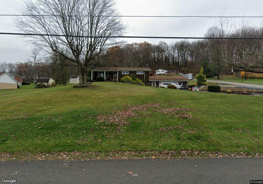
221 Bashforth Dr Jeannette, PA 15644
Estimated Value: $255,000 - $334,776
Studio
--
Bath
1,200
Sq Ft
$238/Sq Ft
Est. Value
About This Home
This home is located at 221 Bashforth Dr, Jeannette, PA 15644 and is currently estimated at $285,444, approximately $237 per square foot. 221 Bashforth Dr is a home located in Westmoreland County with nearby schools including Maxwell Elementary School, Harrold Middle School, and Hempfield Area Senior High School.
Ownership History
Date
Name
Owned For
Owner Type
Purchase Details
Closed on
Oct 27, 2017
Sold by
Moore Margaret E
Bought by
Thomas Robert G and Thomas Susette M
Current Estimated Value
Home Financials for this Owner
Home Financials are based on the most recent Mortgage that was taken out on this home.
Original Mortgage
$150,000
Outstanding Balance
$123,633
Interest Rate
3.78%
Mortgage Type
New Conventional
Estimated Equity
$161,811
Purchase Details
Closed on
Jan 20, 2012
Sold by
Moore Frank L and Moore Margaret E
Bought by
Moore Frank L and Moore Margaret E
Create a Home Valuation Report for This Property
The Home Valuation Report is an in-depth analysis detailing your home's value as well as a comparison with similar homes in the area
Home Values in the Area
Average Home Value in this Area
Purchase History
| Date | Buyer | Sale Price | Title Company |
|---|---|---|---|
| Thomas Robert G | $200,000 | None Available | |
| Moore Frank L | -- | None Available |
Source: Public Records
Mortgage History
| Date | Status | Borrower | Loan Amount |
|---|---|---|---|
| Open | Thomas Robert G | $150,000 |
Source: Public Records
Tax History
| Year | Tax Paid | Tax Assessment Tax Assessment Total Assessment is a certain percentage of the fair market value that is determined by local assessors to be the total taxable value of land and additions on the property. | Land | Improvement |
|---|---|---|---|---|
| 2026 | $3,160 | $24,960 | $5,540 | $19,420 |
| 2025 | $3,051 | $24,960 | $5,540 | $19,420 |
| 2024 | $2,926 | $24,960 | $5,540 | $19,420 |
| 2023 | $2,694 | $24,960 | $5,540 | $19,420 |
| 2022 | $2,694 | $24,960 | $5,540 | $19,420 |
| 2021 | $2,694 | $24,960 | $5,540 | $19,420 |
| 2020 | $2,694 | $24,960 | $5,540 | $19,420 |
| 2019 | $2,682 | $24,960 | $5,540 | $19,420 |
| 2018 | $2,651 | $24,960 | $5,540 | $19,420 |
| 2017 | $2,589 | $24,960 | $5,540 | $19,420 |
| 2016 | $2,461 | $24,960 | $5,540 | $19,420 |
| 2015 | $2,461 | $24,960 | $5,540 | $19,420 |
| 2014 | $2,424 | $24,960 | $5,540 | $19,420 |
Source: Public Records
Map
Nearby Homes
- 107 Rockwell Dr
- 127 Woodhaven Dr
- 531 Reed Ct
- 30 Moore Ave
- 122 Saint Peter Way
- 4055 Briarwood Dr
- 154 Ashbaugh Rd
- 303 Lentz St
- 4053 Briarwood Dr
- 225 Harrison Ave
- 304 Reed St
- 1002 N 3rd St
- 819 N 2nd St
- 406 Harrison Ave
- 324 Lafferty St
- 802 Harrison Ave
- 312 Lafferty St
- 414 Guy St
- 2651 Radebaugh Rd
- 910 Harrison Ave
- 219 Bashforth Dr
- 223 Bashforth Dr
- 216 Bashforth Dr
- 200 Hill Point Rd
- 207 Hill Point Rd
- 207 Hill Point Rd
- 218 Bashforth Dr
- 220 Bashforth Dr
- 211 Bashforth Dr
- 229 Bashforth Dr
- 224 Bashforth Dr
- 210 Hill Point Rd
- 207 Bashforth Dr
- 213 Hill Point Rd
- 231 Bashforth Dr
- 208 Bashforth Dr
- 203 Bashforth Dr
- 130 N Locust Dr
- 219 Mary Ln
- 126 N Locust Dr
Your Personal Tour Guide
Ask me questions while you tour the home.