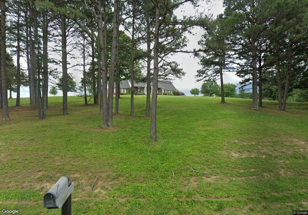
221 Buzzard Rock Rd Farmington, MO 63640
Estimated Value: $739,787 - $851,000
3
Beds
3
Baths
3,636
Sq Ft
$219/Sq Ft
Est. Value
About This Home
This home is located at 221 Buzzard Rock Rd, Farmington, MO 63640 and is currently estimated at $795,394, approximately $218 per square foot. 221 Buzzard Rock Rd is a home located in St. Francois County with nearby schools including Farmington Senior High School.
Ownership History
Date
Name
Owned For
Owner Type
Purchase Details
Closed on
Sep 16, 2020
Sold by
Stamm Catherine A and Stamm Brian A
Bought by
Poore Deena M
Current Estimated Value
Home Financials for this Owner
Home Financials are based on the most recent Mortgage that was taken out on this home.
Original Mortgage
$380,000
Outstanding Balance
$336,599
Interest Rate
2.8%
Mortgage Type
Construction
Estimated Equity
$458,795
Purchase Details
Closed on
Aug 20, 2002
Sold by
Brockmire Lonnie L and Brockmire Sharon A
Bought by
Stamm Brian A and Stamm Catherine A
Create a Home Valuation Report for This Property
The Home Valuation Report is an in-depth analysis detailing your home's value as well as a comparison with similar homes in the area
Home Values in the Area
Average Home Value in this Area
Purchase History
| Date | Buyer | Sale Price | Title Company |
|---|---|---|---|
| Poore Deena M | $475,000 | -- | |
| Stamm Brian A | -- | -- |
Source: Public Records
Mortgage History
| Date | Status | Borrower | Loan Amount |
|---|---|---|---|
| Open | Poore Deena M | $380,000 |
Source: Public Records
Tax History Compared to Growth
Tax History
| Year | Tax Paid | Tax Assessment Tax Assessment Total Assessment is a certain percentage of the fair market value that is determined by local assessors to be the total taxable value of land and additions on the property. | Land | Improvement |
|---|---|---|---|---|
| 2024 | $3,539 | $72,190 | $8,400 | $63,790 |
| 2023 | $3,539 | $72,190 | $8,400 | $63,790 |
| 2022 | $3,550 | $72,190 | $8,400 | $63,790 |
| 2021 | $3,539 | $72,190 | $8,400 | $63,790 |
| 2020 | $3,564 | $72,190 | $8,400 | $63,790 |
| 2019 | $3,567 | $72,190 | $8,400 | $63,790 |
| 2018 | -- | $58,560 | $5,770 | $52,790 |
| 2017 | $2,992 | $58,560 | $5,770 | $52,790 |
| 2016 | $2,979 | $58,560 | $0 | $0 |
| 2015 | -- | $58,560 | $0 | $0 |
| 2014 | -- | $58,560 | $0 | $0 |
| 2013 | -- | $58,560 | $0 | $0 |
Source: Public Records
Map
Nearby Homes
- 107 Wildhorse Rd
- 1733 Highway Aa
- 350 Autumn Chase
- 2168 Pendleton Rd
- 0 Perrine Rd
- 1535 Highway H
- 9995 State Route Aa
- 1141 Bell Mountain Dr
- 113 Shepherd Mountain Rd
- 105 Shepherd Mountain Rd
- 1145 Bell Mountain Dr
- 620 Braning Dr
- 107 Railroad Ln
- 1521 Pendleton Rd
- 506 Aldergate St
- 1013 Stone Creek Rd
- 1006 Stone Creek Rd
- 200 Lisa Dr
- 805 S A St
- 4 Mileva Ct
- 222 Buzzard Rock Rd
- 14 Buzzard Rock Rd
- 0Lot 5 Buzzard Rock Rd
- 2Lot Buzzard Rock Rd
- 1Lot Buzzard Rock Rd
- 3Lot Buzzard Rock Rd
- 223 Buzzard Rock Rd
- 219 Buzzard Rock Rd
- 224 Buzzard Rock Rd
- 220 Buzzard Rock Rd
- 225 Buzzard Rock Rd
- 228 Buzzard Rock Rd
- 227 Buzzard Rock Rd
- 218 Buzzard Rock Rd
- 217 Buzzard Rock Rd
- 229 Buzzard Rock Rd
- 230 Buzzard Rock Rd
- 226 Buzzard Rock Rd
- 411 Silver Creek Rd