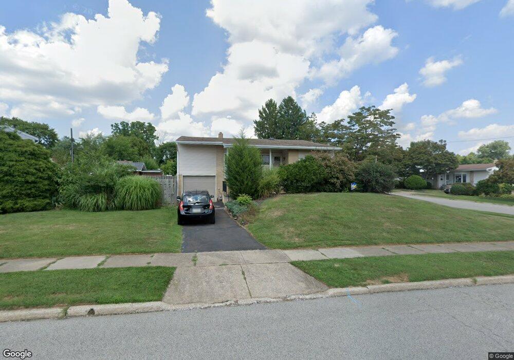
221 Candy Ln Ambler, PA 19002
Estimated Value: $457,531 - $501,000
3
Beds
2
Baths
1,279
Sq Ft
$378/Sq Ft
Est. Value
About This Home
This home is located at 221 Candy Ln, Ambler, PA 19002 and is currently estimated at $482,883, approximately $377 per square foot. 221 Candy Ln is a home located in Montgomery County with nearby schools including Lower Gwynedd El School, Wissahickon Middle School, and Wissahickon Senior High School.
Ownership History
Date
Name
Owned For
Owner Type
Purchase Details
Closed on
Oct 20, 2003
Sold by
Orsini Richard and Orsini Gail
Bought by
Harrington Michael P
Current Estimated Value
Create a Home Valuation Report for This Property
The Home Valuation Report is an in-depth analysis detailing your home's value as well as a comparison with similar homes in the area
Home Values in the Area
Average Home Value in this Area
Purchase History
| Date | Buyer | Sale Price | Title Company |
|---|---|---|---|
| Harrington Michael P | $223,750 | -- |
Source: Public Records
Tax History Compared to Growth
Tax History
| Year | Tax Paid | Tax Assessment Tax Assessment Total Assessment is a certain percentage of the fair market value that is determined by local assessors to be the total taxable value of land and additions on the property. | Land | Improvement |
|---|---|---|---|---|
| 2025 | $4,243 | $114,110 | -- | -- |
| 2024 | $4,243 | $114,110 | -- | -- |
| 2023 | $3,987 | $114,110 | $0 | $0 |
| 2022 | $3,868 | $114,110 | $0 | $0 |
| 2021 | $3,766 | $114,110 | $0 | $0 |
| 2020 | $3,629 | $114,110 | $0 | $0 |
| 2019 | $3,564 | $114,110 | $0 | $0 |
| 2018 | $1,280 | $114,110 | $0 | $0 |
| 2017 | $3,423 | $114,110 | $0 | $0 |
| 2016 | $3,379 | $114,110 | $0 | $0 |
| 2015 | $3,271 | $114,110 | $0 | $0 |
| 2014 | $3,180 | $114,110 | $0 | $0 |
Source: Public Records
Map
Nearby Homes
- 157 Edgewood Dr
- 221 Belmont Ave
- 459 Edgewood Dr
- 414 Brookside Ave
- 280 N Main St
- 25 N Ridge Ave Unit A
- 25 N Ridge Ave Unit B
- 0 Johns Ln Unit BROOKSIDE ELITE
- 0 Johns Ln Unit EMERSON ELITE
- 501 N Bethlehem Pike Unit 14P
- 501 N Bethlehem Pike Unit 13B
- 501 N Bethlehem Pike Unit 12F
- 1000 Quinard Ct
- 528 Argyle Ave
- 49 Cavendish Dr
- 770 Johns Ln
- 88 Hampstead Dr
- 90 Hampstead Dr Unit 90
- 119 Hampstead Dr Unit 119
- 620 Meadowbrook Ave