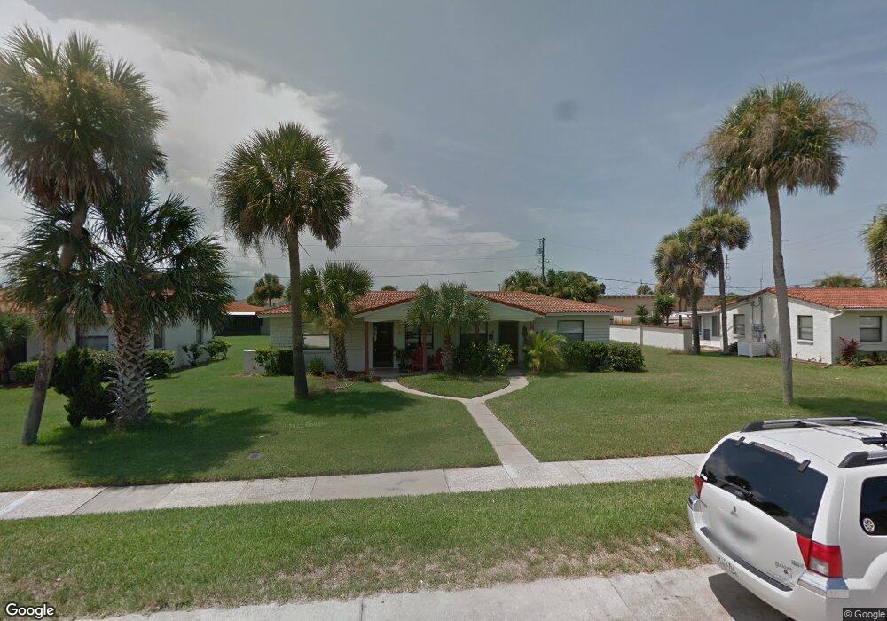
221 Cardinal Dr Unit A Ormond Beach, FL 32176
Estimated Value: $200,000 - $214,568
2
Beds
1
Bath
675
Sq Ft
$310/Sq Ft
Est. Value
About This Home
This home is located at 221 Cardinal Dr Unit A, Ormond Beach, FL 32176 and is currently estimated at $209,142, approximately $309 per square foot. 221 Cardinal Dr Unit A is a home located in Volusia County with nearby schools including Ormond Beach Middle School, Seabreeze High School, and Lourdes Academy.
Ownership History
Date
Name
Owned For
Owner Type
Purchase Details
Closed on
Jan 24, 2005
Sold by
Hedgepeth Peggy Lee
Bought by
Taylor Richad H and Taylor Christina M
Current Estimated Value
Home Financials for this Owner
Home Financials are based on the most recent Mortgage that was taken out on this home.
Original Mortgage
$79,200
Outstanding Balance
$38,829
Interest Rate
5.62%
Mortgage Type
Purchase Money Mortgage
Estimated Equity
$170,313
Purchase Details
Closed on
Oct 13, 1998
Sold by
Ortoma Rosario and Ortoma Gianna
Bought by
Latman William and Peggy Lee
Purchase Details
Closed on
Jul 15, 1991
Bought by
Taylor Richard H and Taylor Christina
Purchase Details
Closed on
Jun 15, 1990
Bought by
Taylor Richard H and Taylor Christina
Create a Home Valuation Report for This Property
The Home Valuation Report is an in-depth analysis detailing your home's value as well as a comparison with similar homes in the area
Home Values in the Area
Average Home Value in this Area
Purchase History
| Date | Buyer | Sale Price | Title Company |
|---|---|---|---|
| Taylor Richad H | $99,000 | Parker Rose Title Agency Inc | |
| Latman William | $58,500 | -- | |
| Taylor Richard H | $66,400 | -- | |
| Taylor Richard H | $99,800 | -- |
Source: Public Records
Mortgage History
| Date | Status | Borrower | Loan Amount |
|---|---|---|---|
| Open | Taylor Richad H | $79,200 |
Source: Public Records
Tax History
| Year | Tax Paid | Tax Assessment Tax Assessment Total Assessment is a certain percentage of the fair market value that is determined by local assessors to be the total taxable value of land and additions on the property. | Land | Improvement |
|---|---|---|---|---|
| 2026 | $3,102 | $189,339 | $86,000 | $103,339 |
| 2025 | $3,102 | $189,544 | $86,000 | $103,544 |
| 2024 | $2,723 | $189,024 | $86,000 | $103,024 |
| 2023 | $2,723 | $183,017 | $70,000 | $113,017 |
| 2022 | $2,396 | $150,171 | $51,000 | $99,171 |
| 2021 | $2,308 | $131,155 | $41,500 | $89,655 |
| 2020 | $2,110 | $119,842 | $40,000 | $79,842 |
| 2019 | $2,075 | $116,863 | $43,500 | $73,363 |
| 2018 | $2,021 | $113,487 | $45,000 | $68,487 |
| 2017 | $1,961 | $109,375 | $45,000 | $64,375 |
| 2016 | $1,828 | $96,090 | $0 | $0 |
| 2015 | $1,724 | $86,508 | $0 | $0 |
| 2014 | $1,648 | $89,122 | $0 | $0 |
Source: Public Records
Map
Nearby Homes
- 11 Oriole Cir Unit A
- 3 Oriole Cir Unit B
- 47 Chippingwood Ln
- 46 Chippingwood Ln
- 150 Benjamin Dr
- 601 Robin Rd Unit A
- 106 Cardinal Dr Unit B
- 159 Ponce de Leon Dr
- 246 Ponce de Leon Dr
- 497 Grandview Ave
- 792 Marvin Rd
- 67 Ormond Shores Dr
- 46 Marvin Rd
- 45 Loyola Dr
- 2 Cypress Cir
- 395 S Atlantic Ave Unit 305
- 395 S Atlantic Ave Unit 701
- 395 S Atlantic Ave Unit 301
- 395 S Atlantic Ave Unit 102
- 395 S Atlantic Ave Unit 501
- 221 Cardinal Dr Unit B
- 213 Cardinal Dr Unit A
- 213 Cardinal Dr Unit B
- 213 Cardinal Dr
- 24 Oriole Cir
- 24 Oriole Cir Unit B
- 24 Oriole Cir Unit A
- 26 Oriole Cir
- 26 Oriole Cir Unit A
- 26 Oriole Cir Unit B
- 26 Oriole Cir
- 205 Cardinal Dr Unit A
- 205 Cardinal Dr Unit B
- 231 Cardinal Dr Unit 10
- 22 Oriole Cir Unit A
- 22 Oriole Cir Unit B
- 206 Cardinal Dr
- 196 Cardinal Dr Unit A
- 196 Cardinal Dr Unit C
- 196 Cardinal Dr Unit B
Your Personal Tour Guide
Ask me questions while you tour the home.