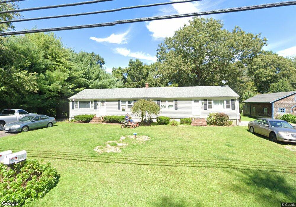
221 Charlotte White Rd Westport, MA 02790
Brownell/Giffords Corner NeighborhoodEstimated Value: $289,000 - $371,000
4
Beds
2
Baths
1,680
Sq Ft
$190/Sq Ft
Est. Value
About This Home
This home is located at 221 Charlotte White Rd, Westport, MA 02790 and is currently estimated at $318,839, approximately $189 per square foot. 221 Charlotte White Rd is a home located in Bristol County with nearby schools including Alice A. Macomber Primary School, Westport Elementary School, and Westport Middle-High School.
Ownership History
Date
Name
Owned For
Owner Type
Purchase Details
Closed on
Feb 18, 2016
Sold by
Isabel Russell H and Isabel Tina M
Bought by
Isabel Family Holdings
Current Estimated Value
Purchase Details
Closed on
Sep 20, 2005
Sold by
Whit 221-223 Charlotte and Furrh Everlyn D
Bought by
Isabel Russell H and Isabel Tina M
Purchase Details
Closed on
Jun 27, 2005
Sold by
Sousa Patricia
Bought by
Furrh Everlyn D and Furrh James E
Home Financials for this Owner
Home Financials are based on the most recent Mortgage that was taken out on this home.
Original Mortgage
$310,500
Interest Rate
5.82%
Mortgage Type
Purchase Money Mortgage
Create a Home Valuation Report for This Property
The Home Valuation Report is an in-depth analysis detailing your home's value as well as a comparison with similar homes in the area
Home Values in the Area
Average Home Value in this Area
Purchase History
| Date | Buyer | Sale Price | Title Company |
|---|---|---|---|
| Isabel Family Holdings | -- | -- | |
| Isabel Russell H | $460,000 | -- | |
| Furrh Everlyn D | $345,000 | -- |
Source: Public Records
Mortgage History
| Date | Status | Borrower | Loan Amount |
|---|---|---|---|
| Previous Owner | Furrh Everlyn D | $310,500 | |
| Previous Owner | Furrh Everlyn D | $97,000 | |
| Previous Owner | Furrh Everlyn D | $20,000 |
Source: Public Records
Tax History Compared to Growth
Tax History
| Year | Tax Paid | Tax Assessment Tax Assessment Total Assessment is a certain percentage of the fair market value that is determined by local assessors to be the total taxable value of land and additions on the property. | Land | Improvement |
|---|---|---|---|---|
| 2025 | $1,502 | $201,600 | $0 | $201,600 |
| 2024 | $1,540 | $199,200 | $0 | $199,200 |
| 2023 | $1,558 | $190,900 | $0 | $190,900 |
| 2022 | $1,390 | $163,900 | $0 | $163,900 |
| 2021 | $1,262 | $146,400 | $0 | $146,400 |
| 2020 | $1,234 | $146,400 | $0 | $146,400 |
| 2019 | $1,265 | $153,000 | $0 | $153,000 |
| 2018 | $1,273 | $155,800 | $0 | $155,800 |
| 2017 | $1,242 | $155,800 | $0 | $155,800 |
| 2016 | $1,232 | $155,800 | $0 | $155,800 |
| 2015 | $1,289 | $162,600 | $0 | $162,600 |
Source: Public Records
Map
Nearby Homes
- 118 Charlotte White Rd
- 978 Sodom Rd
- 8 Strawberry Ln
- 118 Charlotte White Rd Extension
- 0 Hidden Glen Ln
- Lot 0 Marcotte
- 4 Main Rd
- 218 American Legion Hwy
- 308 Robert St
- 47 Robert St
- 15 Village Way
- 7 Village Way
- 8 Village Way
- 47 Fallon Dr
- 33 Moniz Dr
- 771 Sanford Rd
- 47 Devol Ave
- 837 Main Rd
- 837 Main Road & Lot 2
- 374 Crandall Rd
- 223 Charlotte White Rd
- 159 Charlotte White Rd
- 215 Charlotte White Rd
- 229 Charlotte White Rd
- 227 Charlotte White Rd
- 235 Charlotte White Rd Unit 237
- 238 -4 Charlotte White
- 238 - 3 Charlotte White
- 238 -2 Charlotte White
- 238 -1 Charlotte White
- 238 -6 Charlotte White
- 238 -5 Charlotte White
- 238 - 7 Charlotte White
- 239-241 Charlotte White Rd Unit 241
- 239-241 Charlotte White Rd Unit 239
- 239 Charlotte White Rd Unit 241
- 7 Shannon Dr
- 210 Charlotte White Rd
- 3 Maya Way
- 251 Charlotte White Rd