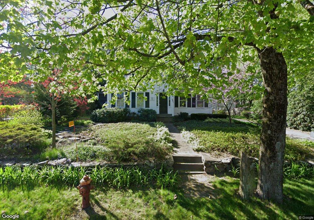
221 Commonwealth Rd Wayland, MA 01778
Estimated Value: $763,232 - $829,000
3
Beds
3
Baths
1,577
Sq Ft
$500/Sq Ft
Est. Value
About This Home
This home is located at 221 Commonwealth Rd, Wayland, MA 01778 and is currently estimated at $788,558, approximately $500 per square foot. 221 Commonwealth Rd is a home located in Middlesex County with nearby schools including Wayland High School, Christa McAuliffe Charter School, and Veritas Christian Academy.
Ownership History
Date
Name
Owned For
Owner Type
Purchase Details
Closed on
Jul 16, 1991
Sold by
Fidelity Prop Inc
Bought by
Cartwright Stuart A
Current Estimated Value
Home Financials for this Owner
Home Financials are based on the most recent Mortgage that was taken out on this home.
Original Mortgage
$100,000
Interest Rate
9.35%
Mortgage Type
Purchase Money Mortgage
Purchase Details
Closed on
Jun 12, 1991
Sold by
Warren Tom H and Warren Carolyn R
Bought by
Fidelity Properties
Home Financials for this Owner
Home Financials are based on the most recent Mortgage that was taken out on this home.
Original Mortgage
$100,000
Interest Rate
9.35%
Mortgage Type
Purchase Money Mortgage
Purchase Details
Closed on
Feb 23, 1990
Sold by
Downer Brett A
Bought by
Warren Tom H
Purchase Details
Closed on
Aug 11, 1987
Sold by
Hoar Gerard R
Bought by
Downer Brett A
Create a Home Valuation Report for This Property
The Home Valuation Report is an in-depth analysis detailing your home's value as well as a comparison with similar homes in the area
Home Values in the Area
Average Home Value in this Area
Purchase History
| Date | Buyer | Sale Price | Title Company |
|---|---|---|---|
| Cartwright Stuart A | $174,500 | -- | |
| Fidelity Properties | $232,500 | -- | |
| Cartwright Stuart A | $174,500 | -- | |
| Fidelity Properties | $232,500 | -- | |
| Warren Tom H | $227,000 | -- | |
| Downer Brett A | $229,100 | -- |
Source: Public Records
Mortgage History
| Date | Status | Borrower | Loan Amount |
|---|---|---|---|
| Closed | Downer Brett A | $100,000 | |
| Closed | Downer Brett A | $100,000 |
Source: Public Records
Tax History Compared to Growth
Tax History
| Year | Tax Paid | Tax Assessment Tax Assessment Total Assessment is a certain percentage of the fair market value that is determined by local assessors to be the total taxable value of land and additions on the property. | Land | Improvement |
|---|---|---|---|---|
| 2025 | $9,855 | $630,500 | $355,800 | $274,700 |
| 2024 | $9,335 | $601,500 | $338,800 | $262,700 |
| 2023 | $8,921 | $535,800 | $308,000 | $227,800 |
| 2022 | $8,764 | $477,600 | $255,100 | $222,500 |
| 2021 | $8,488 | $458,300 | $237,100 | $221,200 |
| 2020 | $8,022 | $451,700 | $237,200 | $214,500 |
| 2019 | $8,147 | $445,700 | $225,900 | $219,800 |
| 2018 | $7,432 | $412,200 | $225,900 | $186,300 |
| 2017 | $7,136 | $393,400 | $215,100 | $178,300 |
| 2016 | $6,704 | $386,600 | $210,900 | $175,700 |
| 2015 | $6,909 | $375,700 | $210,900 | $164,800 |
Source: Public Records
Map
Nearby Homes
- 14 French Ave
- 18 French Ave
- 215 Commonwealth Rd
- 215 Commonwealth Rd
- 217 Commonwealth Rd
- 217 Commonwealth Rd Unit 217
- 217 Commonwealth Rd Unit 2nd floor
- 10 French Ave
- 24 French Ave
- 227 Commonwealth Rd
- 211 Commonwealth Rd
- 226 Commonwealth Rd
- 15 French Ave
- 214 Commonwealth Rd
- 19 French Ave
- 228 Commonwealth Rd
- 21 French Ave
- 21 French Ave Unit 1
- 21 French Ave Unit 21
- 28 French Ave